- National Register of Historic Places listings in Codington County, South Dakota
-
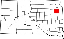 Location of Codington County in South Dakota
This is a list of the National Register of Historic Places listings in Codington County, South Dakota.
This is intended to be a complete list of the properties and districts on the National Register of Historic Places in Codington County, South Dakota, United States. The locations of National Register properties and districts for which the latitude and longitude coordinates are included below, may be seen in a Google map.[1]
There are 44 properties and districts listed on the National Register in the county.
-
- This National Park Service list is complete through NPS recent listings posted November 10, 2011.[2]
Current listings
[3] Landmark name [4] Image Date listed Location City or town Summary 1 E.C. Adams House January 3, 1989 604 N. Maple
44°54′30″N 97°06′39″W / 44.908333°N 97.110833°WWatertown 2 Appleby Atlas Elevator June 21, 1990 6 miles south of the junction of Interstate 29 and U.S. Route 212
44°48′56″N 97°02′59″W / 44.815556°N 97.049722°WWatertown 3 Barr Farmstead August 4, 2005 15539 444th Ave.
45°08′00″N 97°19′55″W / 45.133333°N 97.331944°WFlorence 4 Beskow Barn October 24, 2003 15689 456th Ave.
45°06′33″N 97°05′13″W / 45.109167°N 97.086944°WSouth Shore 5 Carnegie Free Public Library June 18, 1976 27 1st Ave., SE.
44°53′57″N 97°06′47″W / 44.899167°N 97.113056°WWatertown 6 Benjamin H. Cartford House January 3, 1989 803 N. Maple
44°54′37″N 97°06′40″W / 44.910278°N 97.111111°WWatertown 7 Citizens State Bank of Henry November 7, 1997 Junction of Main and 2nd Sts.
44°52′41″N 97°28′06″W / 44.878056°N 97.468333°WHenry 8 Codington County Courthouse July 24, 1978 1st Ave., SE.
44°53′55″N 97°06′51″W / 44.898611°N 97.114167°WWatertown 9 Amy A. Davis House January 3, 1989 20 4th Ave., NW.
44°54′21″N 97°06′55″W / 44.905833°N 97.115278°WWatertown 10 Curt E. DeGraff House January 3, 1989 603 N. Park
44°54′30″N 97°06′52″W / 44.908333°N 97.114444°WWatertown 11 Corson Emminger Round Barn March 30, 1978 South of Watertown on U.S. Route 81
44°51′40″N 97°06′33″W / 44.861111°N 97.109167°WWatertown 12 Evangelical United Brethren Church January 3, 1989 409 N. Maple
44°54′22″N 97°06′41″W / 44.906111°N 97.111389°WWatertown 13 James W. Ferris House January 3, 1989 619 N. Park
44°54′31″N 97°06′52″W / 44.908611°N 97.114444°WWatertown 14 Florence Methodist Church June 28, 1991 Junction of 5th St. and Dolly Ave.
45°03′20″N 97°19′46″W / 45.055556°N 97.329444°WFlorence 15 C.E. and Bertha Fowler House February 9, 2001 316 1st Ave., SE.
44°53′53″N 97°06′34″W / 44.898056°N 97.109444°WWatertown 16 Dr. H.M. Freeburg House January 3, 1989 501 N. Park
44°54′26″N 97°06′52″W / 44.907222°N 97.114444°WWatertown 17 A.C. Gilruth House January 3, 1989 218 2nd Ave., NE.
44°54′14″N 97°06′31″W / 44.903889°N 97.108611°WWatertown 18 Goodhue Lutheran Church July 17, 1996 15555 441st Ave.
45°07′47″N 97°23′33″W / 45.129722°N 97.3925°WFlorence 19 Nels M. Hanson Farmstead July 13, 1989 4 miles north of Henry
44°57′20″N 97°27′06″W / 44.955556°N 97.451667°WHenry 20 John B. Hanten House January 26, 1990 518 E. Kemp Ave.
44°53′54″N 97°06′19″W / 44.898333°N 97.105278°WWatertown 21 Dr. Harry Henningson House January 3, 1989 802 1st St., NW.
44°54′37″N 97°06′55″W / 44.910278°N 97.115278°WWatertown 22 Holy Rosary Church June 6, 1986 Minnesota Ave.
44°53′35″N 96°55′01″W / 44.893056°N 96.916944°WKranzburg 23 A. Einar Johnson House January 3, 1989 803 1st St., NW.
44°54′37″N 97°06′57″W / 44.910278°N 97.115833°WWatertown 24 Mabel and David Jones House November 8, 2001 425 N. Park
44°54′23″N 97°06′51″W / 44.906389°N 97.114167°WWatertown 25 Kemp Avenue Bridge December 9, 1993 Kemp Ave. over the Big Sioux River
44°54′11″N 97°09′01″W / 44.903056°N 97.150278°WWatertown 26 Kranzburg School District No. 5 June 28, 1991 Hasting St.
44°53′33″N 96°55′07″W / 44.8925°N 96.918611°WKranzburg 27 Mathiesen House February 1, 1982 914 N. Maple
44°54′42″N 97°06′38″W / 44.911667°N 97.110556°WWatertown 28 Peter Mauseth House January 3, 1989 703 N. Maple
44°54′32″N 97°06′41″W / 44.908889°N 97.111389°WWatertown 29 Andrew and Lulu Melham House July 28, 2011 721 1st. St., NW
44°54′33″N 97°06′56″W / 44.909167°N 97.115556°WWatertown North End Neighborhood MPS 30 Mellette House August 13, 1976 421 5th Ave., NW.
44°54′26″N 97°07′16″W / 44.907222°N 97.121111°WWatertown 31 Minneapolis and St. Louis Railroad Depot October 31, 1985 168 N. Broadway
44°54′12″N 97°06′43″W / 44.903333°N 97.111944°WWatertown 32 Mount Hope Cemetery Mausoleum August 13, 1986 Mt. Hope Cemetery off U.S. Route 81
44°54′59″N 97°06′13″W / 44.916389°N 97.103611°WWatertown 33 Olive Place May 23, 1978 North of Watertown off U.S. Route 81
44°56′00″N 97°06′28″W / 44.933333°N 97.107778°WWatertown 34 Puhlman Farm October 24, 2003 44350 176th St.
44°50′08″N 97°20′28″W / 44.835556°N 97.341111°WHazel 35 Reeve's Resort October 19, 1989 6 miles south of Florence
44°58′41″N 97°21′18″W / 44.978056°N 97.355°WFlorence 36 Nicholas T. Ries Farmstead February 11, 1988 Off Codington County Highway 3
44°51′43″N 96°55′35″W / 44.861944°N 96.926389°WKranzburg 37 Gen. Mark W. Sheafe House February 26, 1987 57 4th Ave., NW.
44°54′24″N 97°06′51″W / 44.906667°N 97.114167°WWatertown 38 South Dakota Dept. of Transportation Bridge No. 15-210-136 December 9, 1993 Local road over an unnamed creek
44°57′11″N 97°03′55″W / 44.953056°N 97.065278°WWatertown 39 Dr. Tarbell House June 6, 2001 304 2nd Ave., SE.
44°53′49″N 97°06′36″W / 44.896944°N 97.11°WWatertown 40 Watertown Commercial Historic District July 13, 1989 Roughly bounded by 1st Ave., N., 3rd St., E., 2nd Ave., S., and 1st St., W.
44°54′00″N 97°06′49″W / 44.9°N 97.113611°WJefferson 41 Watertown Post Office December 12, 1976 26 S. Broadway
44°53′58″N 97°06′51″W / 44.899444°N 97.114167°WWatertown 42 Watertown Stadium July 5, 2000 1600 W. Kemp Ave.
44°54′16″N 97°08′21″W / 44.904444°N 97.139167°WWatertown 43 Walter Willson House January 3, 1989 702 2nd St., NE.
44°54′33″N 97°06′33″W / 44.909167°N 97.109167°WWatertown 44 Zech Farmstead March 31, 2005 16676 456th Ave.
44°58′04″N 97°05′05″W / 44.967778°N 97.084722°WWatertown See also
- List of National Historic Landmarks in South Dakota
- National Register of Historic Places listings in South Dakota
References
- ^ The latitude and longitude information provided in this table was derived originally from the National Register Information System, which has been found to be fairly accurate for about 99% of listings. For about 1% of NRIS original coordinates, experience has shown that one or both coordinates are typos or otherwise extremely far off; some corrections may have been made. A more subtle problem causes many locations to be off by up to 150 yards, depending on location in the country: most NRIS coordinates were derived from tracing out latitude and longitudes off of USGS topographical quadrant maps created under North American Datum of 1927, which differs from the current, highly accurate GPS system used by Google maps. Chicago is about right, but NRIS longitudes in Washington are higher by about 4.5 seconds, and are lower by about 2.0 seconds in Maine. Latitudes differ by about 1.0 second in Florida. Some locations in this table may have been corrected to current GPS standards.
- ^ "National Register of Historic Places: Weekly List Actions". National Park Service, United States Department of the Interior. Retrieved on November 10, 2011.
- ^ Numbers represent an ordering by significant words. Various colorings, defined here, differentiate National Historic Landmark sites and National Register of Historic Places Districts from other NRHP buildings, structures, sites or objects.
- ^ "National Register Information System". National Register of Historic Places. National Park Service. . http://nrhp.focus.nps.gov/natreg/docs/All_Data.html.
U.S. National Register of Historic Places Topics Lists by states Alabama • Alaska • Arizona • Arkansas • California • Colorado • Connecticut • Delaware • Florida • Georgia • Hawaii • Idaho • Illinois • Indiana • Iowa • Kansas • Kentucky • Louisiana • Maine • Maryland • Massachusetts • Michigan • Minnesota • Mississippi • Missouri • Montana • Nebraska • Nevada • New Hampshire • New Jersey • New Mexico • New York • North Carolina • North Dakota • Ohio • Oklahoma • Oregon • Pennsylvania • Rhode Island • South Carolina • South Dakota • Tennessee • Texas • Utah • Vermont • Virginia • Washington • West Virginia • Wisconsin • WyomingLists by territories Lists by associated states Other Municipalities and communities of Codington County, South Dakota City 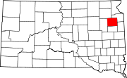
Towns Florence | Henry | Kranzburg | South Shore | Wallace
Indian reservation Footnotes ‡This populated place also has portions in an adjacent county or counties
Categories:- Codington County, South Dakota
- National Register of Historic Places in South Dakota by county
- Buildings and structures in Codington County, South Dakota
-

Wikimedia Foundation. 2010.