- Dry Sandford
-
Coordinates: 51°41′49″N 1°19′59″W / 51.697°N 1.333°W
Dry Sandford 
 Dry Sandford
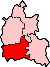
Dry Sandford shown within OxfordshireOS grid reference SP4600 Parish St Helen Without District Vale of White Horse Shire county Oxfordshire Region South East Country England Sovereign state United Kingdom Post town Oxford Postcode district OX13 Dialling code 01865 Police Thames Valley Fire Oxfordshire Ambulance South Central EU Parliament South East England UK Parliament Oxford West and Abingdon Website Wootton and Dry Sandford List of places: UK • England • Oxfordshire Dry Sandford is a village and civil parish in the Vale of White Horse about 3 miles (5 km) north-west of Abingdon. It is one of two villages in the civil parish of St Helen Without. It was part of Berkshire until the 1974 boundary changes transferred it to Oxfordshire.
Contents
Manor
The Domesday Book of 1086 records the place as Sandford.[citation needed] The "sandy ford" must have been across the stream now known as Sandford Brook, a tributary of the River Ock, once known as the Lucringe.[1] The village became known as Dry Sandford by the 18th century.[2]
Dry Sandford was a manor in the parish of St Helen's, Abingdon, and was held by Abingdon Abbey until the Dissolution in 1538.[2]
Parish church
The Church of England parish church of Saint Helen is a 13th century style Gothic Revival building designed by J.B. Clacy[3] of Reading[4] and built in 1855.[2][5] St. Helen's has lancet windows, a nave, chancel, rib-vaulted apse[3] and a bellcote on the gable above the chancel arch.[5] St. Helen's was made a separate ecclesiastical parish in 1867,[citation needed] but was united in a single benefice with St. Peter's, Wootton in 2000.[6]
Amenities
Dry Sandford Pit is a nature reserve just south of the village managed by the Berks, Bucks and Oxon Wildlife Trust.[7] The site is of geological importance for its exposure of Corallian beds, and is designated a Site of Special Scientific Interest.[8]
References
- ^ Grundy, G.B. (1927-28). "Berkshire Charters". Berks, Bucks and Oxon Archaeological Journal 27: 198. http://ads.ahds.ac.uk/catalogue/adsdata/arch-787-1/dissemination/pdf/BAJ027_PDFs/BAJ027_A15_grundy.pdf. Retrieved 10 July 2011.
- ^ a b c Page & Ditchfield, 1924, pages 416–421
- ^ a b Pevsner, 1966, page 130
- ^ Brodie, Felstead, Franklin & Pinfield, 2001, page 375
- ^ a b Brighton, Stuart (18 March 2003). "Church of St Helen, St Helen Without, Vale of White Horse, Oxfordshire". Images of England. English Heritage. http://www.imagesofengland.org.uk/Details/Default.aspx?id=249809. Retrieved 20 October 2011.
- ^ "The Parish Churches of The Villages of Wootton and Dry Sandford, Abingdon, Oxfordshire, UK". Wootton and Dry Sandford. The Benefice of Wootton and Dry Sandford. http://woottonanddrysandford.co.uk/index.htm. Retrieved 20 October 2011.
- ^ "Dry Sandford Pit Nature Reserve". Reserves. Berks, Bucks and Oxon Wildlife Trust. 2011. http://www.bbowt.org.uk/content.asp?did=23585. Retrieved 20 October 2011.
- ^ "Dry Sandford Pit (SSSI)". England's Geology. Natural England. http://www.naturalengland.org.uk/ourwork/conservation/geodiversity/englands/sites/local_ID71.aspx. Retrieved 20 October 2011.
Sources
- Brodie, Antonia; Felstead, Alison; Franklin, Jonathan et al., eds (2001). Directory of British Architects 1834–1914, A–K. London & New York: Continuum. p. 375. ISBN 0826455131.
- Page, W.H.; Ditchfield, P.H., eds (1924). "St. Helen's". A History of the County of Berkshire, Volume 4. Victoria County History. London: Institute of Historical Research. pp. 416–421. http://www.british-history.ac.uk/report.aspx?compid=62741. Retrieved 10 July 2011.
- Pevsner, Nikolaus (1966). Berkshire. The Buildings of England. Harmondsworth: Penguin Books. p. 130.
Towns 
Large Villages Blewbury • Cumnor (Chilswell, Cumnor Hill, Dean Court, Farmoor, Swinford) • Drayton • East Challow • East Hendred • Grove • Harwell • Kennington • Kingston Bagpuize with Southmoor (Kingston Bagpuize, Southmoor) • Marcham (Cothill) • Milton • North Hinksey (Botley, Harcourt Hill) • Radley • St. Helen Without (Dry Sandford, Shippon) • Shrivenham • Stanford in the Vale (Bow) • Steventon • Sunningwell (Bayworth, Boars Hill, Foxcombe Hill) • Sutton Courtenay • Watchfield • Wootton (Boars Hill, Henwood, Lamborough Hill)Other Civil
Parishes
(Component
Villages
and Hamlets)Appleford-on-Thames • Appleton-with-Eaton (Appleton, Eaton) • Ardington (Ardington Wick, West Ginge) • Ashbury (Idstone, Kingstone Winslow) • Baulking • Besselsleigh • Bourton • Buckland (Gainfield) • Buscot • Charney Bassett • Childrey • Chilton • Coleshill • Compton Beauchamp (Knighton) • Denchworth • East Hanney • Eaton Hastings • Fernham • Frilford • Fyfield and Tubney (Fyfield, Tubney, Netherton) • Garford • Goosey • Great Coxwell • Hatford (Little Hatford) • Hinton Waldrist (Duxford) • Kingston Lisle • Letcombe Bassett • Letcombe Regis • Little Coxwell • Littleworth • Lockinge (East Lockinge, West Lockinge) • Longcot • Longworth • Lyford • Pusey • Shellingford • South Hinksey (Hinksey Hill)• Sparsholt • Uffington • Upton • West Challow • West Hanney • West Hendred (East Ginge) • Woolstone • Wytham (Seacourt)Former Districts
and BoroughsMunicipal Borough of Abingdon • Abingdon Rural District • Faringdon Rural District • Wantage Urban District • Wantage Rural DistrictFormer
ConstituenciesCategories:- Villages in Oxfordshire

Wikimedia Foundation. 2010.