- Netherton, Oxfordshire
-
Coordinates: 51°41′49″N 1°23′49″W / 51.697°N 1.397°W
Netherton 
 Netherton
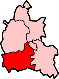
Netherton shown within OxfordshireOS grid reference SU4198 Parish Fyfield and Tubney District Vale of White Horse Shire county Oxfordshire Region South East Country England Sovereign state United Kingdom Post town Abingdon Postcode district OX13 Dialling code 01865 Police Thames Valley Fire Oxfordshire Ambulance South Central EU Parliament South East England UK Parliament Wantage List of places: UK • England • Oxfordshire Netherton is a hamlet in Fyfield and Tubney civil parish about 4.5 miles (7 km) west of Abingdon. It was part of Berkshire until the 1974 boundary changes transferred it to Oxfordshire.
The toponym is derived from the Old English neotherra meaning "lower, nether" and dun meaning "hill".[citation needed] It was recorded as Netendon in 1193.[citation needed]
Netherton is primarily residential. Netherton is linked with Oxford by Whites Coaches route 63 bus that runs on Tuesdays, Wednesdays, Fridays and Saturdays.
Towns 
Large Villages Blewbury • Cumnor (Chilswell, Cumnor Hill, Dean Court, Farmoor, Swinford) • Drayton • East Challow • East Hendred • Grove • Harwell • Kennington • Kingston Bagpuize with Southmoor (Kingston Bagpuize, Southmoor) • Marcham (Cothill) • Milton • North Hinksey (Botley, Harcourt Hill) • Radley • St. Helen Without (Dry Sandford, Shippon) • Shrivenham • Stanford in the Vale (Bow) • Steventon • Sunningwell (Bayworth, Boars Hill, Foxcombe Hill) • Sutton Courtenay • Watchfield • Wootton (Boars Hill, Henwood, Lamborough Hill)Other Civil
Parishes
(Component
Villages
and Hamlets)Appleford-on-Thames • Appleton-with-Eaton (Appleton, Eaton) • Ardington (Ardington Wick, West Ginge) • Ashbury (Idstone, Kingstone Winslow) • Baulking • Besselsleigh • Bourton • Buckland (Gainfield) • Buscot • Charney Bassett • Childrey • Chilton • Coleshill • Compton Beauchamp (Knighton) • Denchworth • East Hanney • Eaton Hastings • Fernham • Frilford • Fyfield and Tubney (Fyfield, Tubney, Netherton) • Garford • Goosey • Great Coxwell • Hatford (Little Hatford) • Hinton Waldrist (Duxford) • Kingston Lisle • Letcombe Bassett • Letcombe Regis • Little Coxwell • Littleworth • Lockinge (East Lockinge, West Lockinge) • Longcot • Longworth • Lyford • Pusey • Shellingford • South Hinksey (Hinksey Hill)• Sparsholt • Uffington • Upton • West Challow • West Hanney • West Hendred (East Ginge) • Woolstone • Wytham (Seacourt)Former Districts
and BoroughsMunicipal Borough of Abingdon • Abingdon Rural District • Faringdon Rural District • Wantage Urban District • Wantage Rural DistrictFormer
ConstituenciesCategories:- Hamlets in Oxfordshire

Wikimedia Foundation. 2010.