- Drayton, Vale of White Horse
-
Coordinates: 51°38′49″N 1°18′47″W / 51.647°N 1.313°W
Drayton 

 Drayton
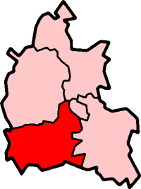
Drayton shown within OxfordshirePopulation 2,218 (2001 census)[1] OS grid reference SU4794 Parish Drayton District Vale of White Horse Shire county Oxfordshire Region South East Country England Sovereign state United Kingdom Post town Abingdon Postcode district OX14 Dialling code 01235 Police Thames Valley Fire Oxfordshire Ambulance South Central EU Parliament South East England UK Parliament Wantage (UK Parliament constituency) Website Drayton-near-Abingdon List of places: UK • England • Oxfordshire Drayton is a village and civil parish about 2 miles (3.2 km) south of Abingdon, Oxfordshire. It was part of Berkshire until the 1974 boundary changes transferred to Oxfordshire.
Contents
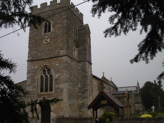
Parish church
The Church of England parish church of Saint Peter was built in the Norman style about 1200.[2] The Perpendicular Gothic bell tower was added later.[2] The chancel was rebuilt in 1872 and the Gothic Revival architect Edwin Dolby restored the church and added the south porch in 1879.[2]
Twinning
Since 2000 Drayton has been twinned with Lesparre-Médoc, a commune in the French département of Gironde.[3]
References
- ^ "Area selected: Vale of White Horse (Non-Metropolitan District)". Neighbourhood Statistics: Full Dataset View. Office for National Statistics. http://neighbourhood.statistics.gov.uk/dissemination/viewFullDataset.do?instanceSelection=03070&productId=779&$ph=60_61&datasetInstanceId=3070&startColumn=1&numberOfColumns=4&containerAreaId=790499. Retrieved 2 January 2011.
- ^ a b c Pevsner, 1966, page 130
- ^ Propos Georges Regal (27 April 2010). "Subventions à la baisse, la grogne des associations". Journal Sud Ouest. http://www.sudouest.fr/2010/04/27/subventions-a-la-baisse-la-grogne-des-associations-76887-2964.php. Retrieved 29 December 2010.
Sources and further reading
- Page, William; Ditchfield, P.H., eds (1924). A History of the County of Berkshire, Volume 4. Victoria County History. pp. 341–344.
- Pevsner, Nikolaus (1966). Berkshire. The Buildings of England. Harmondsworth: Penguin Books. p. 130.
External links
 Media related to Drayton, Vale of White Horse at Wikimedia CommonsCategories:
- Villages in Oxfordshire
- Civil parishes in Oxfordshire
- Oxfordshire geography stubs

Wikimedia Foundation. 2010.