- Chilswell
-
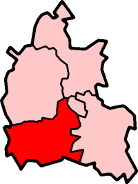
Coordinates: 51°43′34″N 1°17′7″W / 51.72611°N 1.28528°W Chilswell is a small settlement in the parish of Cumnor, Oxfordshire. It lies between the village of South Hinksey and Boars Hill. In 1974 it was transferred from Berkshire.
The place was first mentioned in 1180 as Chiefleswelle. The name is of Old English origin, and appears to mean 'the stream of a man called Cifel'[1]. An older form of the name is Childsworth, and the place is mentioned by that name in the poem Thyrsis by Matthew Arnold. Arnold's "signal elm" is in a field nearby, bought by the Oxford Preservation Trust from All Souls College, Oxford in 2009[2].
The remains of a Roman villa have been found nearby.[3]
Chilswell House, on the edge of Boars Hill, was once the home of the poet Robert Bridges[4].
Chilswell Valley (also known as Happy Valley), between Chilswell and South Hinksey, is the site of a Local Nature Reserve managed by Oxford City Council[5].
References
- ^ Gelling, M. (1974) Place-Names of Berkshire p.446
- ^ Oxford Preservation Trust website
- ^ Oxoniensia Vol.51 (1986) p.186
- ^ Poetry Landmarks website
- ^ Oxford City Council website
Towns 
Large Villages Blewbury • Cumnor (Chilswell, Cumnor Hill, Dean Court, Farmoor, Swinford) • Drayton • East Challow • East Hendred • Grove • Harwell • Kennington • Kingston Bagpuize with Southmoor (Kingston Bagpuize, Southmoor) • Marcham (Cothill) • Milton • North Hinksey (Botley, Harcourt Hill) • Radley • St. Helen Without (Dry Sandford, Shippon) • Shrivenham • Stanford in the Vale (Bow) • Steventon • Sunningwell (Bayworth, Boars Hill, Foxcombe Hill) • Sutton Courtenay • Watchfield • Wootton (Boars Hill, Henwood, Lamborough Hill)Other Civil
Parishes
(Component
Villages
and Hamlets)Appleford-on-Thames • Appleton-with-Eaton (Appleton, Eaton) • Ardington (Ardington Wick, West Ginge) • Ashbury (Idstone, Kingstone Winslow) • Baulking • Besselsleigh • Bourton • Buckland (Gainfield) • Buscot • Charney Bassett • Childrey • Chilton • Coleshill • Compton Beauchamp (Knighton) • Denchworth • East Hanney • Eaton Hastings • Fernham • Frilford • Fyfield and Tubney (Fyfield, Tubney, Netherton) • Garford • Goosey • Great Coxwell • Hatford (Little Hatford) • Hinton Waldrist (Duxford) • Kingston Lisle • Letcombe Bassett • Letcombe Regis • Little Coxwell • Littleworth • Lockinge (East Lockinge, West Lockinge) • Longcot • Longworth • Lyford • Pusey • Shellingford • South Hinksey (Hinksey Hill)• Sparsholt • Uffington • Upton • West Challow • West Hanney • West Hendred (East Ginge) • Woolstone • Wytham (Seacourt)Former Districts
and BoroughsMunicipal Borough of Abingdon • Abingdon Rural District • Faringdon Rural District • Wantage Urban District • Wantage Rural DistrictFormer
ConstituenciesCategories:- Villages in Oxfordshire
Wikimedia Foundation. 2010.