Municipal Borough of Abingdon
- Municipal Borough of Abingdon
-
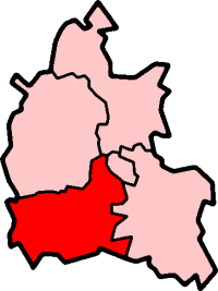
Abingdon was a municipal borough in the county of Berkshire from 1835 to 1974. From 1894 it was nearly entirely surrounded by Abingdon Rural District. It was abolished in 1974 under the Local Government Act 1972, and merged with other districts to form the new Vale of White Horse district of Oxfordshire.
References
| v · Vale of White Horse |
|
| Oxfordshire • County Council elections • District Council elections • Wantage County Constituency • Oxford West and Abingdon County Constituency |
|
| Towns |
|
 |
|
| Large Villages |
Blewbury • Cumnor ( Chilswell, Cumnor Hill, Dean Court, Farmoor, Swinford) • Drayton • East Challow • East Hendred • Grove • Harwell • Kennington • Kingston Bagpuize with Southmoor ( Kingston Bagpuize, Southmoor) • Marcham (Cothill) • Milton • North Hinksey ( Botley, Harcourt Hill) • Radley • St. Helen Without ( Dry Sandford, Shippon) • Shrivenham • Stanford in the Vale ( Bow) • Steventon • Sunningwell ( Bayworth, Boars Hill, Foxcombe Hill) • Sutton Courtenay • Watchfield • Wootton ( Boars Hill, Henwood, Lamborough Hill)
|
|
Other Civil
Parishes
(Component
Villages
and Hamlets) |
|
|
Former Districts
and Boroughs |
|
|
Former
Constituencies |
|
|
| List of Parliamentary constituencies in Oxfordshire • List of places in Oxfordshire • List of civil parishes in Oxfordshire |
|
Coordinates: 51°40′N 1°17′W / 51.667°N 1.283°W / 51.667; -1.283
Categories:
- Abingdon, Oxfordshire
- Districts of England abolished by the Local Government Act 1972
- Former districts of Berkshire
- Municipal boroughs of England
- Oxfordshire geography stubs
Wikimedia Foundation.
2010.
Look at other dictionaries:
Municipal Borough of Wallingford — Wallingford Geography Status Municipal borough History Created 1834 Abolished 31 March 1974 … Wikipedia
Abingdon Rural District — Abingdon was a rural district in the administrative county of Berkshire from 1894 to 1974.It was formed under the Local Government Act 1894 based on that part of the Abingdon rural sanitary district which was in Berkshire (the Oxfordshire part… … Wikipedia
Abingdon — (spr. äbbingd n), Stadt (municipal borough) in Berkshire (England), 7 km von Oxford, bei der Mündung des Ock und des Berk und Wiltshirekanals in die Themse, hat mehrere Kirchen (St. Nicholas und St. Helen), eine Lateinschule, Markthalle,… … Meyers Großes Konversations-Lexikon
Municipal Corporations Act 1835 — The Municipal Corporations Act 1835 Parliament of the United Kingdom Long title An Act to provide for the Regulation of Municipal Corporations in England and Wales Statute book chapter … Wikipedia
Abingdon (UK Parliament constituency) — UK former constituency infobox Name = Abingdon division of Berkshire Type = County Year = 1885 Abolition = 1983 members = oneUK former constituency infobox Name = Abingdon Type = Borough Year = 1558 Abolition = 1885 members = oneAbingdon was a… … Wikipedia
Oxford West and Abingdon (UK Parliament constituency) — Oxford West and Abingdon County constituency for the House of Commons Boundary of Oxford West and Abingdon in … Wikipedia
Ancient borough — An early historical analysis of cities and boroughs by Robert Brady (1704) … Wikipedia
Oxfordshire (UK Parliament constituency) — Oxfordshire Former County constituency for the House of Commons County Oxfordshire 1290 (1290)–1885 … Wikipedia
Milton, Vale of White Horse — Coordinates: 51°37′37″N 1°17′53″W / 51.627°N 1.298°W / 51.627; 1.298 … Wikipedia
Sutton Courtenay — Coordinates: 51°38′31″N 1°16′34″W / 51.642°N 1.276°W / 51.642; 1.276 … Wikipedia