- Coral Harbour
-
Coral Harbour
ᓴᓪᓕᖅ/ᓴᓪᓖᑦ
Salliq/Salliit— Hamlet — Coral Harbour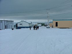
 Coral Harbour
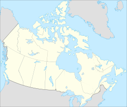
Coordinates: 64°08′13″N 083°09′51″W / 64.13694°N 83.16417°WCoordinates: 64°08′13″N 083°09′51″W / 64.13694°N 83.16417°W Country  Canada
Territory  Nunavut
Region Kivalliq Region Electoral district Nanulik Government[1][2] – Mayor Jerry Paniyuk – MLA Johnny Ningeongan Area[3] – Total 137.83 km2 (53.2 sq mi) Elevation[4] 64 m (210 ft) Population (2006)[3] – Total 769 – Density 5.6/km2 (14.5/sq mi) Time zone EST (UTC-5) Canadian Postal code X0C 0C0 Area code(s) 867 For the place in Vancouver, see Coal Harbour.Coral Harbour (Inuktitut: Salliq/Salliit, Syllabics: ᓴᓪᓕᖅ/ᓴᓪᓖᑦ),[5][6][7][8] is a small Inuit community that is located on Southampton Island, Kivalliq Region, in the Canadian territory of Nunavut. Its name is derived from the fossilized coral that can be found around the waters of the community which is situated at the head of South Bay. The name of the settlement in Inuktitut is Salliq, sometimes used to refer to all of Southampton Island.[9] The plural Salliit, means large flat island(s) in front of the mainland.[5][10]
Contents
History
The Sadlermiut ("inhabitants of Salliq") whose name is derived from Salliq[11] previously occupied the area. The Sadlermiut are thought to be the last vestige of the Tuniit. The Tuniit, a pre-Inuit culture, officially went ethnically and culturally extinct in 1902-03[12] when a Western illness killed all of the Sallirmiut in a matter of weeks. However, others believe that the Sadlermiut were in fact descendants of the Thule, whose geographically isolated culture would have developed idiosyncratically from the mainland Thule culture. A third theory indicates that the Sadlermiut did not necessarily belong to either group, but because of intermarriage, their roots may have in fact been part of both Dorset and Thule cultures.[12][13]
At the beginning of the 20th century, the area was repopulated by Aivilingmiut, whose name was to be later adapted for the Aivilik electoral district, from the Repulse Bay and Chesterfield Inlet areas, influenced to do so by whaler Capt. George Comer and others. Baffin Islanders arrived 25 years later. John Ell, who as a young child travelled with his mother Shoofly on Comer's schooners, eventually became the most famous of Southampton Island's re-settled population.[14]
Demographics
As of the 2006 census the population was 769, an increase of 8.0% from the 2001 census.[3] Coral Harbour is the only Nunavut community that does not observe daylight saving time, remaining on Eastern Standard Time year-round.
Transportation
The only way to reach this community is by plane at Coral Harbour Airport and the main transportation on the island itself (nearly the same size as Switzerland) is by snowmobile and dog sleigh in the winter and all-terrain vehicle in the summer. Despite the harsh climate there is plentiful wildlife around the island. Among some of the species found there are Walruses, Polar bears, Barren-ground Caribou, Ringed Seals, Gyrfalcons, and (rarely) Peregrine Falcons.
Notable residents
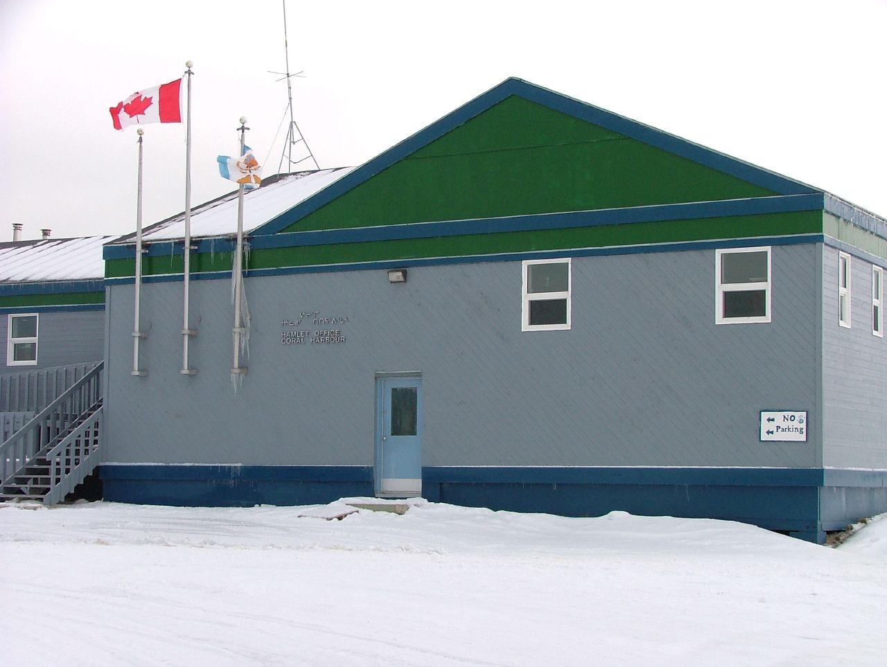
 The Hamlet Office in Coral Harbour
- James Arvaluk, Nunavut's first Minister of Education and current member of the Legislative Assembly of Nunavut for Tunnuniq,[15] representing Pond Inlet. Arvaluk had previously been elected in Nanulik representing the hamlets of Chesterfield Inlet and Coral Harbour.[16] Prior to the 1 April 1999 division of the Northwest Territories he served as a member of the Legislative Assembly of the Northwest Territories for the Aivilik (now split between Rankin Inlet North, Akulliq and Nanulik[16]) electoral district.
- Tagak Curley, founder and first president Inuit Tapiriit Kanatami (Inuit Tapirisat of Canada). Curley is currently a member of the Legislative Assembly of Nunavut for Rankin Inlet North. Prior to division he represented Keewatin South and Aivilik and also stood as the Liberal candidate in the 1979 election for the Nunatsiaq (now Nunavut) riding.
- Patterk Netser, former member of the Legislative Assembly of Nunavut for Nanulik.
- Pudlo Pudlat, notable artist who was born on Baffin Island but lived in the Coral Harbour area until the age of six.
- Manitok Thompson, former member of the Legislative Assembly of Nunavut for Rankin Inlet South/Whale Cove, and prior to division, of the Legislative Assembly of the Northwest Territories for Aivilik. She was Nunavut's first female cabinet minister.
Climate
Climate data for Coral Harbour Airport Month Jan Feb Mar Apr May Jun Jul Aug Sep Oct Nov Dec Year Humidex -0.6 -2.2 -0.5 4.4 8.9 22.8 32.8 30.1 19.9 7.6 1.1 0.6 32.8 Record high °C (°F) 0.6
(33.1)−1.1
(30.0)0.0
(32.0)5.0
(41.0)9.4
(48.9)23.3
(73.9)28.0
(82.4)26.1
(79.0)20.6
(69.1)7.6
(45.7)1.1
(34.0)3.3
(37.9)28.0
(82.4)Average high °C (°F) −25.8
(−14.4)−25.9
(−14.6)−20.8
(−5.4)−11.3
(11.7)−2.6
(27.3)6.3
(43.3)13.9
(57.0)11.4
(52.5)4.1
(39.4)−3.9
(25.0)−12.8
(9.0)−21.6
(−6.9)−7.4 Daily mean °C (°F) −30
(−22.0)−30
(−22.0)−25.7
(−14.3)−16.7
(1.9)−6.8
(19.8)2.8
(37.0)9.3
(48.7)7.3
(45.1)1.1
(34.0)−7.3
(18.9)−17.1
(1.2)−25.8
(−14.4)−11.6 Average low °C (°F) −34.1
(−29.4)−34.1
(−29.4)−30.5
(−22.9)−22
(−7.6)−10.9
(12.4)−0.8
(30.6)4.6
(40.3)3.1
(37.6)−2
(28.4)−10.7
(12.7)−21.4
(−6.5)−29.9
(−21.8)−15.7 Record low °C (°F) −52.8
(−63.0)−51.4
(−60.5)−49.4
(−56.9)−39.4
(−38.9)−31.1
(−24.0)−15.6
(3.9)−1.1
(30.0)−3.3
(26.1)−17.2
(1.0)−34.4
(−29.9)−40.6
(−41.1)−48.9
(−56.0)−52.8
(−63.0)Wind chill −69.5 −69.3 −64.3 −55.1 −39.7 −23.2 −8.2 −11.8 −23.7 −43.7 −54.8 −64.2 −69.5 Precipitation mm (inches) 7.6
(0.299)6.6
(0.26)10.3
(0.406)17.3
(0.681)16.6
(0.654)28.0
(1.102)38.4
(1.512)51.3
(2.02)41.4
(1.63)36.0
(1.417)19.5
(0.768)12.7
(0.5)285.7
(11.248)Rainfall mm (inches) 0.0
(0)0.0
(0)0.0
(0)0.1
(0.004)2.5
(0.098)20.7
(0.815)38.4
(1.512)50.5
(1.988)31.3
(1.232)11.3
(0.445)0.4
(0.016)0.0
(0)155.2
(6.11)Snowfall cm (inches) 7.8
(3.07)6.9
(2.72)10.6
(4.17)17.6
(6.93)14.4
(5.67)7.4
(2.91)0.0
(0)0.8
(0.31)9.7
(3.82)25.5
(10.04)19.9
(7.83)12.9
(5.08)133.5
(52.56)Avg. precipitation days 7.4 6.1 8.2 9.0 8.9 8.7 11.0 11.9 10.3 13.3 11.6 9.2 115.7 Avg. rainy days 0.0 0.0 0.0 0.14 1.5 6.4 11.0 11.8 7.0 2.6 0.41 0.03 40.8 Avg. snowy days 7.5 6.1 8.3 9.0 8.2 3.1 0.0 0.38 4.5 12.3 11.6 9.3 80.1 Sunshine hours 41.1 110.6 187.7 248.3 262.4 272.7 294.2 227.0 110.3 79.8 52.8 19.6 1,906.5 Source: 1971-2000 Environment Canada[17] Throughout December 2010 and early January 2011, Nunavut, northern Quebec and western Greenland set many high temperature records. In Coral Harbour, a high of 3.3°C in mid-December broke the old record of 1.7°C set in 1963.[18] The daily minimum temperature on January 6, 2011, was about 30°C warmer than normal.[19][20] The unusual warmth was due largely to an unseasonal area of high pressure over Greenland, and very negative values of the Arctic oscillation and North Atlantic oscillation. Mostly in the 21st century, the conditions have combined to produce an Arctic dipole anomaly that brings warm air to the Arctic regions and cold air to the continents.
References
- ^ Hamlets elect new councils
- ^ Election Results - 2008 General Election
- ^ a b c 2006 census
- ^ Elevation at airport. Canada Flight Supplement. Effective 0901Z 20 October 2011 to 0901Z 15 December 2011
- ^ a b Nunavut Communities
- ^ TRPS 2008 December Innuinaqtun
- ^ Nunavummi Nangminiqaqtunik Ikajuuti · Qiniqhiajun Nunaliktigun
- ^ Nunavummi Nangminiqaqtunik Ikajuuti · ᕿᓂᕈᑦ ᓄᓇᓕᒃᑎᒍᑦ
- ^ Mourir et renaître: la réception du christianisme par les Inuit de l'Arctique de l'Est canadien (1890-1940)
- ^ Tusaalanga
- ^ Petrone, Penny (1988). Northern Voices: Inuit Writing in English. University of Toronto Press. pp. 12–14. ISBN 080207717X.
- ^ a b Briggs, Jean L.; J. Garth Taylor. "The Canadian Encyclopedia: Sadlermiut Inuit". Historica Foundation of Canada. http://www.encyclopediecanadienne.ca/index.cfm?PgNm=TCE&Params=A1ARTA0007041. Retrieved 2008-03-21.
- ^ "Canadian Arctic historical archaeology in review". Revista de Arqueología Americana. 2004-01-01. http://www.accessmylibrary.com/coms2/summary_0286-32018819_ITM. Retrieved 2008-03-21.
- ^ Rowley, Graham. Cold comfort : my love affair with the Arctic. Montreal: McGill-Queen's University Press. pp. 38. ISBN 0773513930. http://books.google.com/books?id=2k_ZPx76uPQC&pg=PA40&lpg=PA40&dq=%22duke+of+york+bay%22+inuit&source=web&ots=fCfD3iRa_D&sig=5ZCzRLLwsr6sAwDQEPd51_oEfbo&hl=en#PPA38,M1. Retrieved 2008-04-04.
- ^ Arvaluk victorious in Nunavut byelection
- ^ a b Nanulik
- ^ Environment Canada—Canadian Climate Normals 1971–2000. Retrieved 22 June 2011.
- ^ Colton, Jill (December 22, 2010). "Jet stream causing abnormal weather pattern". The Weather Network news. http://www.theweathernetwork.com/news/storm_watch_stories3&stormfile=jet_stream_causing_abnormal__181210. Retrieved 9 February 2011.
- ^ Freedman, Andrew (February 7, 2011). "The winter the Arctic shifted south". The Washington Post - Capital Weather Gang. http://voices.washingtonpost.com/capitalweathergang/2011/02/the_winter_the_arctic_shifted.html. Retrieved 9 February 2011.
- ^ Henson, Bob. "Cold comfort: Canada's record-smashing mildness". NCAR & UCAR. Currents. http://www2.ucar.edu/currents/cold-comfort-canadas-record-smashing-mildness. Retrieved 9 February 2011.
Further reading
- Bower, Margaret E. Aeromagnetic Surveys Across Hudson Bay from Churchill to Coral Harbour and Churchill to Great Whale River. Dept. of Mines and Technical Surveys, Canada, 1960.
- Feheley Fine Arts (Toronto). Contemporary Coral Harbour. Toronto, Ont: Feheley Fine Arts, 2002.
External links
 Subdivisions of Nunavut
Regions Communities Arctic Bay · Arviat · Baker Lake · Bathurst Inlet · Cambridge Bay · Cape Dorset · Chesterfield Inlet · Clyde River · Coral Harbour · Gjoa Haven · Grise Fiord · Hall Beach · Igloolik · Iqaluit Apex · Kimmirut · Kugaaruk · Kugluktuk · Pangnirtung · Pond Inlet · Qikiqtarjuaq · Rankin Inlet · Repulse Bay · Resolute · Sanikiluaq · Taloyoak · Whale CoveWeather stations
and Canadian Forces basesMine sites Proposed Baffinland Iron MineUnder construction Defunct Bent Horn Mine · Cullaton Lake/Shear Lake Mine · Jericho Diamond Mine · Lupin Mine · Nanisivik Mine · Polaris mine · Rankin Inlet MineDEW line and NWS sites Bernard Harbour · Bray Island · Brevoort Island · Broughton Island · Byron Bay · Cambridge Bay · Cape Dyer · Cape Hooper · Cape Mcloughlin · Cape Mercy · Cape Peel West · Cape Young · Clifton Point · Clinton Point · Croker River · Dewar Lakes · Durban Island · Edinburgh Island · Ekalugad · Gjoa Haven · Gladman Point · Hall Beach · Harding River · Hat Island · Jenny Lind Island · Kangok Fjord · Keats Point · Keith Bay · Kivitoo · Lady Franklin Point · Lailor River · Loks Land · Longstaff Bluff · Mackar Inlet · Matheson Point · Nudluardjuk Lake · Pelly Bay · Resolution Island · Ross Point · Rowley Island · Scarpa Lake · Shepherd Bay · Simpson Lake · Sturt PointFormer Amadjuak · Brooman Point Village · Craig Harbour · Dundas Harbour · Iglunga · Killiniq · Native Point · Nuwata · Padlei · Port Leopold · TavaniHudson's Bay Company
trading postsAmadjuak · Apex · Arctic Bay · Baker Lake · Bathurst Inlet · Bay Chimo · Belcher Islands · Blacklead Island · Cambridge Bay · Cape Dorset · Charlton Island Depot · Chesterfield Inlet · Clyde River · Coats Island · Dundas Harbour · Eskimo Point · Fort Hearne · Fort Ross · Frobisher Bay · Gjoa Haven · Igloolik · Kent Peninsula · King William Island · Kugaryuak · Lake Harbour · Mansel Island · Nueltin House · Padley · Pangnirtung · Pangnirtung Fox Farm · Perry River · Ponds Inlet · Port Leopold · Port Burwell · Repulse Bay · Southampton Island · Tavane · Tree River · Wager InletCategories:- Ports and harbours of Nunavut
- Populated places on Hudson Bay
- Hamlets in the Kivalliq Region


Wikimedia Foundation. 2010.