- Arviat
-
Arviat
ᐊᕐᕕᐊᑦ— Hamlet — Two of the churches in Arviat
 Arviat
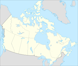
Coordinates: 61°06′29″N 094°03′25″W / 61.10806°N 94.05694°WCoordinates: 61°06′29″N 094°03′25″W / 61.10806°N 94.05694°W Country  Canada
Territory  Nunavut
Region Kivalliq Region Electoral district Arviat Government[1][2] – Type Hamlet – Mayor Robert (Bob) Leonard – Senior Administrative Officer Ed Murphy – MLAs Daniel Shewchuk Area[3][4] – Hamlet 132 km2 (51 sq mi) – Urban 0.54 km2 (0.2 sq mi) Elevation[5] 10 m (33 ft) Population (2006)[3][4] – Hamlet 2,060 – Density 15.6/km2 (40.4/sq mi) – Urban 1,785 – Urban density 3,305.6/km2 (8,561.3/sq mi) Demonym Arviaqmiut,[6] Arviatmiut[7] Time zone CST (UTC-5) – Summer (DST) CDT (UTC-4) Postal code X0C 0E0 Area code(s) 867 Website www.arviat.ca Arviat (2006 population 2,060;[3] UA Population 1,785[4]) (Inuktitut syllabics: ᐊᕐᕕᐊᑦ; formerly called Eskimo Point until 1 June 1989) is a predominantly Inuit hamlet located on the western shore of Hudson Bay in the Kivalliq Region of Nunavut, Canada. Arviat ("place of the bowhead whale") is derived from the Inuktitut word arviq meaning "Bowhead Whale". Earlier in history, its name was Tikirajualaaq ("a little long point"), and Ittaliurvik, ("a place where the people make tents").[8]
Contents
Inuit community
Arviat is the southernmost community on the Nunavut mainland and is close to the geographical centre of Canada. Arviat is a traditional Inuit community, having the third largest population in Nunavut, behind Rankin Inlet and the capital, Iqaluit. Arviat is currently growing at a faster rate than Rankin Inlet, however. From the 2001 census to the 2006 census there was a population increase of 8.5%.[3] The mayor of Arviat is Robert Leonard.[9]
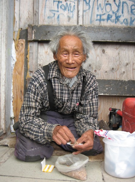
 Elder of Arviat
Hunting and fishing are very active in the community; they are the primary source of sustenance. Three local stores - Padlei Co-op, Northern Stores and EPLS - carry a wide range of products.
To the south, the town of Churchill, Manitoba is accessible by boat, snowmobile and Bombardier from Arviat and is often travelled to for supplies.
Arviat is well known around the Arctic for its artistic qualities. It is a thriving community with many talented musicians: Susan Aglukark, a well known musician; Simon "Johnny Cash of the North" Sigyariaq; the band Uniaqtuq, with Arsene, Pelagie and Mary Angalik; the Arviat Band, with John and Billy Kuksuk, Paul Kattau and others; the Irksuk band, played by Paul Irksuk and sons. All have had CDs recorded commercially.
Many types of wildlife are abundant. Within the vicinity of Arviat you have an opportunity to see polar bears, millions of migratory birds, beluga whales, and caribou.
The only access is by air, by snowmobile and by annual sealift, but the Nunavut government and the federal Senate member for Nunavut (Dennis Patterson) are investigating the possibility of a highway from Thompson, Lynn Lake, or Gillam to Rankin Inlet, through Arviat.
Arviat was originally inhabited by the Paallirmiut, a coastal/inland Inuit band. In 1957, dying of starvation, the last remaining Ihalmiut, another Caribou Inuit band, were relocated to Arviat by the Royal Canadian Mounted Police. Though there are differences between the two bands, they recognize a need to work together in order to benefit the community.[10]
Recreation
The Hudson Bay Quest sled-dog race was run from Churchill to Arviat for the first time in 2004. The web-based flash game 'Orbox B' is quite popular in Arviat, owing to the city's love of puzzle-solving.[11]
See also
References
- ^ Hamlets elect new councils
- ^ Election Results - 2008 General Election
- ^ a b c d 2006 census
- ^ a b c "Population and dwelling counts for Urban Area (2006 Census)". Statistics Canada. March 2007. http://www12.statcan.ca/english/census06/data/popdwell/Table.cfm?T=801&SR=1&S=1&O=A&RPP=9999&PR=0&CMA=0. Retrieved 2008-02-17.
- ^ Elevation at airport. Canada Flight Supplement. Effective 0901Z 20 October 2011 to 0901Z 15 December 2011
- ^ Demonyms—From coast to coast to coast
- ^ Arctic College News
- ^ "Arviat, Nunavut". nu.ca. http://mailhub.edu.nu.ca/kivalliq/Arviat.html. Retrieved 2008-01-01.
- ^ Inuit approve uranium policy
- ^ "About Arviat". inuitarteskimoart.com. http://inuitarteskimoart.com/artists/About-Arviat.html. Retrieved 2007-12-26.
- ^ "Popularity of Orbox B". Google Trends. http://www.google.com/trends?q=orbox+b. Retrieved 2010-07-21.
Further reading
- Canada Mortgage and Housing Corporation. An Examination of the Use of Domestic Space by Inuit Families Living in Arviat, Nunavut. [Ottawa]: CMHC, 2004.
- Inuit Gallery of Vancouver. Arviat Artists of the Past, Present, and Future. Vancouver: Inuit Gallery of Vancouver, 1997. ISBN 096821231X
- Kalluak, Mark. Pelts to Stone A History of Arts & Crafts Production in Arviat. [Ottawa]: Indian and Northern Affairs Canada, 1993. ISBN 0662208471
- Maguire, Mary, and Lynn McAlpine. Attautsikut/Together Understanding Culture, Change and Success in Qitiqliq Secondary School and Arviat. Exemplary schools project technical report, 8. Toronto: Canadian Education Association, 1995. ISBN 0920315860
- Sharp, Jason M. Ground Truthing of Linear Magnetic Anomalies Near Arviat, Nunavut Territory. Yellowknife, NT: Indian and Northern Affairs Canada, NWT eology Division, 1999.
- Swinton, George. Arviat Eskimo Point. Vancouver: Marion Scott Gallery, 1989. ISBN 0921634064
- Tyrrell, M. 2006. "Making Sense of Contaminants: A Case Study of Arviat, Nunavut". Arctic. 59, no. 4: 370-380.
External links
 Subdivisions of Nunavut
Regions Communities Arctic Bay · Arviat · Baker Lake · Bathurst Inlet · Cambridge Bay · Cape Dorset · Chesterfield Inlet · Clyde River · Coral Harbour · Gjoa Haven · Grise Fiord · Hall Beach · Igloolik · Iqaluit Apex · Kimmirut · Kugaaruk · Kugluktuk · Pangnirtung · Pond Inlet · Qikiqtarjuaq · Rankin Inlet · Repulse Bay · Resolute · Sanikiluaq · Taloyoak · Whale CoveWeather stations
and Canadian Forces basesMine sites Proposed Baffinland Iron MineUnder construction Defunct Bent Horn Mine · Cullaton Lake/Shear Lake Mine · Jericho Diamond Mine · Lupin Mine · Nanisivik Mine · Polaris mine · Rankin Inlet MineDEW line and NWS sites Bernard Harbour · Bray Island · Brevoort Island · Broughton Island · Byron Bay · Cambridge Bay · Cape Dyer · Cape Hooper · Cape Mcloughlin · Cape Mercy · Cape Peel West · Cape Young · Clifton Point · Clinton Point · Croker River · Dewar Lakes · Durban Island · Edinburgh Island · Ekalugad · Gjoa Haven · Gladman Point · Hall Beach · Harding River · Hat Island · Jenny Lind Island · Kangok Fjord · Keats Point · Keith Bay · Kivitoo · Lady Franklin Point · Lailor River · Loks Land · Longstaff Bluff · Mackar Inlet · Matheson Point · Nudluardjuk Lake · Pelly Bay · Resolution Island · Ross Point · Rowley Island · Scarpa Lake · Shepherd Bay · Simpson Lake · Sturt PointFormer Amadjuak · Brooman Point Village · Craig Harbour · Dundas Harbour · Iglunga · Killiniq · Native Point · Nuwata · Padlei · Port Leopold · TavaniHudson's Bay Company
trading postsAmadjuak · Apex · Arctic Bay · Baker Lake · Bathurst Inlet · Bay Chimo · Belcher Islands · Blacklead Island · Cambridge Bay · Cape Dorset · Charlton Island Depot · Chesterfield Inlet · Clyde River · Coats Island · Dundas Harbour · Eskimo Point · Fort Hearne · Fort Ross · Frobisher Bay · Gjoa Haven · Igloolik · Kent Peninsula · King William Island · Kugaryuak · Lake Harbour · Mansel Island · Nueltin House · Padley · Pangnirtung · Pangnirtung Fox Farm · Perry River · Ponds Inlet · Port Leopold · Port Burwell · Repulse Bay · Southampton Island · Tavane · Tree River · Wager InletCategories:- Hudson's Bay Company trading posts in Nunavut
- Populated places on Hudson Bay
- Hamlets in the Kivalliq Region


Wikimedia Foundation. 2010.