- Damxung County
-
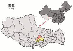
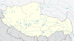
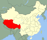
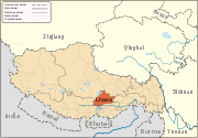
Damxung County — County — Tibetan transcription(s) - Tibetan འདམ་གཞུང་རྫོང། - Wylie transliteration ’dam gzhung rdzong - [] tamɕuŋ tsoŋ - official transcription (PRC) Damxung - THDL Damzhung - other transcriptions Damshung, Dhamshung Chinese transcription(s) - Traditional 當雄縣 - Simplified 当雄县 - Pinyin Dāngxióng Xiàn Nam Tso Location of Damxung County within Tibet Location in Tibet Coordinates: 30°31′04″N 90°45′46″E / 30.51778°N 90.76278°E Country China Province Tibet Prefecture Lhasa Prefecture Capital Damquka or Damxung Town? Area - Total 10,036 km2 (3,874.9 sq mi) Population (1999) - Total 38,473 Time zone China Standard (UTC+8) Damxung is a county far north of the main centre of Lhasa in the Tibet Autonomous Region of China. Its administrative seat is Damquka.
Damxung means "selected pasture" in Tibetan language.
Contents
Geography
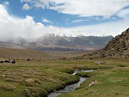
Damxung County is located in the middle of the Tibet Autonomous Region and by the side of the Lhamo Namco Holy Lake. It covers an area of 10,036 square kilometres with a population of 38,473 (1999).
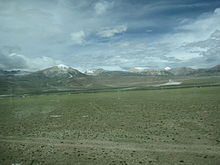
Damxung County is at the area of Gangdisê and Nyainqêntanglha Mountains. The Nyainqêntanglha range crosses through the whole county.
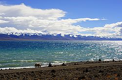
The biggest lake in Tibet - Lhamo Nam Co is in Damxung County. The lake covers an area of 1920 square kilometres. It's a famous tourism attraction of Tibet.
Administrative divisions
Name Tibetan Wylie Chinese Pinyin Damquka འདམ་ཆུ་ཁ། ’dam chu kha 当曲卡镇 Dāngqǔkǎ Zhèn Yangbajain ཡངས་པ་ཅན།། yangs pa can 羊八井镇 Yángbājǐng Zhèn Gyaidar རྒྱས་དར།། rgyas dar 格达乡 Gédá Xiāng Nyingzhung སྙིང་དྲུང། snying drung 宁中乡 Níngzhōng Xiāng Gongtang ཀོང་ཐང། kong thang 公塘乡 Gōngtáng Xiāng Lungring ལུང་རིང། lung ring 龙仁乡 Lóngrén Xiāng Wumatang དབུ་མ་ཐང། dbu ma thang 乌玛塘乡 Wūmǎtáng Xiāng Namco གནམ་མཚོ། gnam mtsho 纳木错乡 Nàmùcuò Xiāng Economy
The main mine resources are sulfur, kaolin, pozzolana, plaster and turf, etc.
Animal husbandry is booming in the area. The herdsmen raise yaks, sheep, goats and horses.
Qinghai-Tibet Highway (part of G219) goes through the whole county and Damxung railway station links the city from the north to Lhasa.
The mileage opened to traffic has reached 1625 kilometres.
See also
Lhünzhub · Damxung · Nyêmo · Qüxü · Doilungdêqên · Dagzê · Maizhokunggar · Chengguan District
Towns and villages Monasteries
and palacesArchitecture of Lhasa · Lingkhor · Potala Palace · Norbulingka · Jokhang Temple · Tsomon Ling · Ganden Monastery · · Kundeling Monastery · Nechung · Nyethang Drolma Lhakhang Temple · Yangpachen Monastery · · Drepung Monastery · Ramoche Temple · Reting Monastery · Sanga Monastery · Yerpa
Sera Monastery: · Chupzang Nunnery · Drakri Hermitage · Garu Nunnery · Jokpo Hermitage · Keutsang Hermitage · Keutsang East Hermitage · Keutsang West Hermitage · Khardo Hermitage · Negodong Nunnery · Nenang Nunnery · Pabongkha Hermitage · Panglung Hermitage · Purbuchok Hermitage · Rakhadrak Hermitage · Sera Chöding Hermitage · Sera Gönpasar Hermitage · Sera Utsé Hermitage · Takten Hermitage · Trashi Chöling HermitageOther landmarks Banak Shöl Hotel · Barkhor · Chokpori · Drapchi Prison · Lhasa Brewery · Lhasa Hotel · Lhasa Zhol Pillar · Tibet Museum · Tibet University · Tromzikhang · Nyang bran · Hutoushan ReservoirTransport Lhasa Airport · Damxung Railway Station · Lhasa Railway Station · Lhasa West Railway Station · Wumatang railway station · Yangbajain Railway Station · G109 · G318 · North Linkor RoadGovernment Doje Cezhug · Jigme Namgyal
Coordinates: 30°31′04″N 90°45′46″E / 30.51778°N 90.76278°E
Categories:- Counties of Tibet
- Lhasa Prefecture
- Lhasa Prefecture geography stubs
Wikimedia Foundation. 2010.

