- Chokpori
-
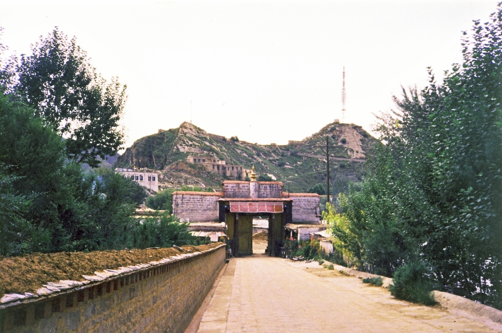
 Chokpori 1993
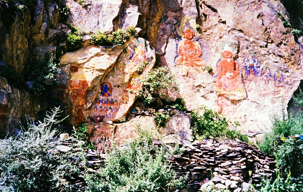
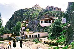 Below Chokpori 1993
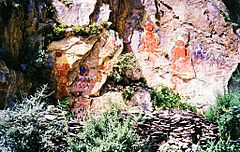 Painted rock carvings at base of Chokpori 1993
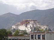
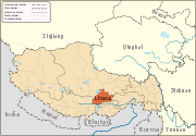
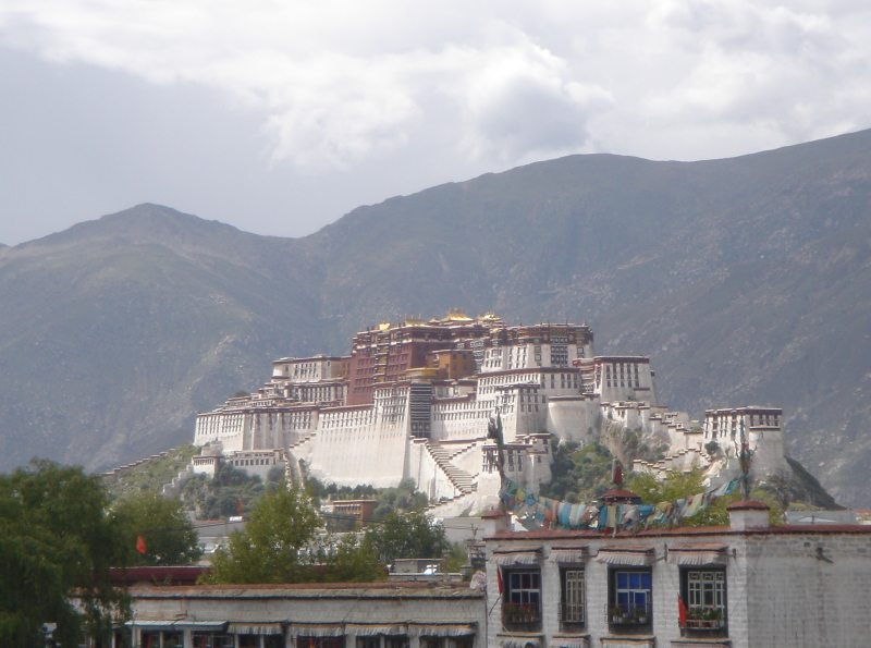
Chokpori, Chagpori, Chagpo Ri (Wylie: lCags po ri, literally "Iron Mountain"; simplified Chinese: 药王山; traditional Chinese: 藥王山; pinyin: Yàowáng shān) is a sacred hill in the city of Lhasa in Tibet. It south of the Potala and just to the left when one is facing the Potala. It is considered to be one of the four holy mountains of central Tibet.
It was the site of the most famous medical school Tibet, known as the Mentsikhang, which was founded in 1413. It was conceived of by Lobsang Gyatso, the "Great" 5th Dalai Lama, and completed by the Regent Sangye Gyatso[1] shortly before 1697.
During the March 1959 Lhasa uprising, the medical school and a temple housing statutes of coral (Tsepame), mother-of-pearl (of Tujechempo) and turquoise (of Drolma) were demolished by PLA artillery as the Tibetans had placed their cannons up there.[2][3] It is now crowned by radio antennas.[4][5] A road has been constructed through the spur that used to connect Chokpori with the Marpo Ri ('Red Hill') on which the Potala is built.
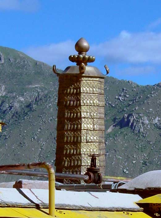
Some rebuilding has since taken place a number of old rock carvings have survived through damage. Some of them are thought to have been carved during the reign of king Songtsän Gampo (605 or 617? - 649 CE) and painted by Nepalese artists.[6] Some buildings have been rebuilt near the base of the hill and there is now again a small temple with prayer wheels.[7]
Tradition has it that the three main hills of Lhasa represent the "Three Protectors of Tibet." Chokpori is the soul-mountain (bla-ri) of Vajrapani, Pongwari that of Manjushri, and Marpori, the hill on which the Potala stands, represents Chenresig or Avalokiteshvara.[8]
Footnotes
- ^ Dowman, Keith. (1988). The Power-Places of Central Tibet: The Pilgrim's Guide, p. 49. Routledge & Kegan Paul Ltd., London. ISBN 0-7102-1370-0.
- ^ Travelin Tibet, Going in circles: "The Tibetans placed their few cannon up there and the Chinese destroyed the place."
- ^ Dowman, Keith. (1988). The Power-Places of Central Tibet: The Pilgrim's Guide, p. 49. Routledge & Kegan Paul Ltd., London. ISBN 0-7102-1370-0.
- ^ Mayhew, Bradley and Kohn, Michael. Tibet. 6th Edition (2005), p. 103. Lonely Planet. ISBN 1-74059-523-8.
- ^ French, Patrick. Tibet, Tibet: A Personal History of a Lost Land. (2003), p. 143. Alfred A Knopf. New York. ISBN 1-4000-4100-7.
- ^ Mayhew, Bradley and Kohn, Michael. Tibet. 6th Edition (2005), p. 103. Lonely Planet. ISBN 1-74059-523-8.
- ^ Buckley, Michael and Strauss, Robert. (1986). Tibet: a travel survival kit, p. 133. Lonely Planet Publications, South Yarra, Vic., Australia. ISBN 0-9088086-88-1.
- ^ Stein, R. A. (1972). Tibetan Civilization, p. 228. Translated by J. E. Stapleton Driver. Stanford University Press, Stanford, California. ISBN 0-8047-0806-1 (cloth); ISBN 0-8047-0901-7 (paper).
 The Chokburi in the background
Lhünzhub · Damxung · Nyêmo · Qüxü · Doilungdêqên · Dagzê · Maizhokunggar · Chengguan District
Towns and villages Monasteries
and palacesArchitecture of Lhasa · Lingkhor · Potala Palace · Norbulingka · Jokhang Temple · Tsomon Ling · Ganden Monastery · · Kundeling Monastery · Nechung · Nyethang Drolma Lhakhang Temple · Yangpachen Monastery · · Drepung Monastery · Ramoche Temple · Reting Monastery · Sanga Monastery · Yerpa
Sera Monastery: · Chupzang Nunnery · Drakri Hermitage · Garu Nunnery · Jokpo Hermitage · Keutsang Hermitage · Keutsang East Hermitage · Keutsang West Hermitage · Khardo Hermitage · Negodong Nunnery · Nenang Nunnery · Pabongkha Hermitage · Panglung Hermitage · Purbuchok Hermitage · Rakhadrak Hermitage · Sera Chöding Hermitage · Sera Gönpasar Hermitage · Sera Utsé Hermitage · Takten Hermitage · Trashi Chöling HermitageOther landmarks Banak Shöl Hotel · Barkhor · Chokpori · Drapchi Prison · Lhasa Brewery · Lhasa Hotel · Lhasa Zhol Pillar · Tibet Museum · Tibet University · Tromzikhang · Nyang bran · Hutoushan ReservoirTransport Lhasa Airport · Damxung Railway Station · Lhasa Railway Station · Lhasa West Railway Station · Wumatang railway station · Yangbajain Railway Station · G109 · G318 · North Linkor RoadGovernment Doje Cezhug · Jigme Namgyal
Coordinates: 29°39′08″N 91°06′34″E / 29.6522043°N 91.1094743°E
Categories:- Lhasa
- Mountains of Tibet


Wikimedia Foundation. 2010.