- Maizhokunggar County
-
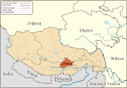
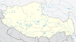
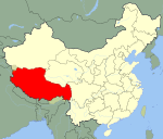
Maizhokunggar County — County — Tibetan transcription(s) - Tibetan མལ་གྲོ་གུང་དཀར་རྫོང་ - Wylie transliteration mal-gro-gung-dkar rdzong - pronunciation in IPA - official transcription (PRC) - THDL - other transcriptions Chinese transcription(s) - Traditional - Simplified 墨竹工卡县 - Pinyin Mòzhúgōngkǎ Xiàn Location of Maizhokunggar County within Tibet Location in Tibet Coordinates: 30°09′36″N 92°09′29″E / 30.16°N 92.15806°E Country China Province Tibet Prefecture Lhasa Prefecture Capital Kunggar Time zone China Standard (UTC+8) Maizhokunggar (Tibetan: མལ་གྲོ་གུང་དཀར་རྫོང་; Wylie: Mal-gro-gung-dkar rdzong; simplified Chinese: 墨竹工卡县; pinyin: Mòzhúgōngkǎ Xiàn) is a county east of the main centre of Lhasa, Tibet.[1] The country is especially noted for its pottery, particularly Kunggar Township. The pottery is non-corrodible, heat retaining and in an ethnic style. It has an over 1000-year-old history.[2]
Geography
Maizhokunggar means "The Place Where Medro King has lived" in the Tibetan language.The county is located in the valley of the middle reaches of the Yarlung Tsangpo River. The average altitude of the county is above 4000 metres and the main natural resources are gold, silver, copper, lead, zinc and marble etc.[3]
There are 34 temples in the county and many hot springs. Main towns and villages include Kunggar and Zaxoi.
Transport
The Sichuan-Tibet Road (China National Highway 318) runs through the county. There are over 70 roads in the county. The total length of the roads are 650 kilometres.
References
- ^ Baike.baidu.com (Chinese)
- ^ China Tibet News
- ^ En.Tibetour
Lhünzhub · Damxung · Nyêmo · Qüxü · Doilungdêqên · Dagzê · Maizhokunggar · Chengguan District


Towns and villages Monasteries
and palacesArchitecture of Lhasa · Lingkhor · Potala Palace · Norbulingka · Jokhang Temple · Tsomon Ling · Ganden Monastery · · Kundeling Monastery · Nechung · Nyethang Drolma Lhakhang Temple · Yangpachen Monastery · · Drepung Monastery · Ramoche Temple · Reting Monastery · Sanga Monastery · Yerpa
Sera Monastery: · Chupzang Nunnery · Drakri Hermitage · Garu Nunnery · Jokpo Hermitage · Keutsang Hermitage · Keutsang East Hermitage · Keutsang West Hermitage · Khardo Hermitage · Negodong Nunnery · Nenang Nunnery · Pabongkha Hermitage · Panglung Hermitage · Purbuchok Hermitage · Rakhadrak Hermitage · Sera Chöding Hermitage · Sera Gönpasar Hermitage · Sera Utsé Hermitage · Takten Hermitage · Trashi Chöling HermitageOther landmarks Banak Shöl Hotel · Barkhor · Chokpori · Drapchi Prison · Lhasa Brewery · Lhasa Hotel · Lhasa Zhol Pillar · Tibet Museum · Tibet University · Tromzikhang · Nyang bran · Hutoushan ReservoirTransport Lhasa Airport · Damxung Railway Station · Lhasa Railway Station · Lhasa West Railway Station · Wumatang railway station · Yangbajain Railway Station · G109 · G318 · North Linkor RoadGovernment Doje Cezhug · Jigme Namgyal
Coordinates: 30°09′36″N 92°09′29″E / 30.16°N 92.15806°E
Categories:- Counties of Tibet
- Lhasa Prefecture
- Lhasa Prefecture geography stubs
Wikimedia Foundation. 2010.


