- Namling County
-
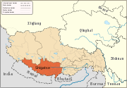
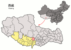
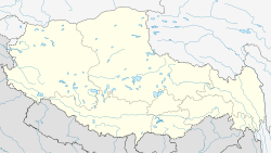
Namling County — County — Tibetan transcription(s) – Tibetan – Wylie transliteration – pronunciation in IPA – official transcription (PRC) – THDL – other transcriptions Chinese transcription(s) – Traditional – Simplified – Pinyin Location of Namling County within Tibet Location in Tibet Coordinates: 29°53′07″N 89°26′10″E / 29.88528°N 89.43611°E Country China Province Tibet Prefecture Xigazê Prefecture Capital [[]] Time zone China Standard (UTC+8) Namling County (Chinese: 南木林县; Pinyin: Nánmùlín Xiàn) is a county of the Xigazê Prefecture in the Tibet Autonomous Region.
Xigazê Prefecture, Tibet County-level divisions 
Settlements Landmarks Changmoche Monastery · Lhatse · Chokorgyel Monastery · Daklha Gampo · Donggar Monastery · Dorje Pakmo · Drongtse Monastery · Garju Monastery · Manmogang Monastery · Menri Monastery · Milarepa's Cave · Narthang Monastery · Ngor · Palcho Monastery · Ralung Monastery · Samding Monastery · Sakya Monastery · Ṣalu Monastery · Samding Monastery · Shelkar · Tashilhunpo · Tsi Nesar ·Coordinates: 29°53′07″N 89°26′10″E / 29.88528°N 89.43611°E
Categories:- Xigazê Prefecture geography stubs
- Counties of Tibet
- Xigazê Prefecture
Wikimedia Foundation. 2010.


