- National Register of Historic Places listings in La Crosse County, Wisconsin
-
Buildings, sites, structures, districts, and objects in La Crosse County listed on the National Register of Historic Places
-
- This National Park Service list is complete through NPS recent listings posted November 10, 2011.[1]
Current listings
[2] Landmark name Image Date listed Location City or town Summary 1 10th and Cass Streets Neighborhood Historic District 
December 13, 2000 Roughly bounded by Main, South 11th Street, Cameron Avenue, and South 8th Street
43°48′43″N 91°14′32″W / 43.811944°N 91.242222°WLa Crosse 2 23rd and 24th Streets Historic District November 5, 2010 Generally bounded by Campbell Rd., Losey Blvd. N., Main St., Vine St., and 23rd St. N.
43°48′52″N 91°13′14″W / 43.814444°N 91.220556°WLa Crosse 3 Agger Rockshelter March 25, 1988 Address Restricted Stevenstown 4 Mons Anderson House 
May 6, 1975 410 Cass Street
43°48′30″N 91°15′05″W / 43.808333°N 91.251389°WLa Crosse 5 E.R. Barron Building 
June 19, 1985 426-430 Main Street
43°48′43″N 91°15′02″W / 43.811944°N 91.250556°WLaCrosse 6 Bell Coulee Shelter July 9, 1997 Address Restricted
44°00′11″N 91°02′10″W / 44.003056°N 91.036111°WMindoro 7 Bridge No. 1 
February 27, 1980 NW of La Crosse
44°01′15″N 91°18′28″W / 44.020833°N 91.307778°WLa Crosse 8 Bridge No. 2 
February 27, 1980 NW of La Crosse
44°01′16″N 91°18′38″W / 44.021111°N 91.310556°WLa Crosse 9 Bridge No. 3 
February 27, 1980 NW of La Crosse
44°01′17″N 91°18′51″W / 44.021389°N 91.314167°WLa Crosse 10 Bridge No. 4 
February 27, 1980 NW of La Crosse
44°01′24″N 91°19′14″W / 44.023333°N 91.320556°WLa Crosse 11 Bridge No. 5 February 27, 1980 NW of La Crosse
44°01′24″N 91°19′44″W / 44.023333°N 91.328889°WLa Crosse 12 Bridge No. 6 
February 27, 1980 NW of La Crosse
44°01′27″N 91°20′08″W / 44.024167°N 91.335556°WLa Crosse 13 John L. Callahan House 
April 14, 1995 933 Rose Street
43°50′16″N 91°14′54″W / 43.837778°N 91.248333°WLa Crosse 14 Cass and King Street Residential Historic District November 7, 1997 Roughly bounded by State, South 21st, and Madison Streets, and West Avenue South
43°48′36″N 91°14′00″W / 43.81°N 91.233333°WLa Crosse 15 Chambers-Markle Farmstead March 22, 1991 6104 WI 35
43°44′57″N 91°12′04″W / 43.749167°N 91.201111°WLa Crosse 16 Dr. H. H. Chase and Henry G. Wohlhuter Bungalows 
June 30, 1983 221 and 223 South 11th Street
43°48′34″N 91°14′25″W / 43.809444°N 91.240278°WLa Crosse 17 Chicago, Milwaukee and Saint Paul Railway Passenger Depot 
December 1, 1997 601 Saint Andrew Road
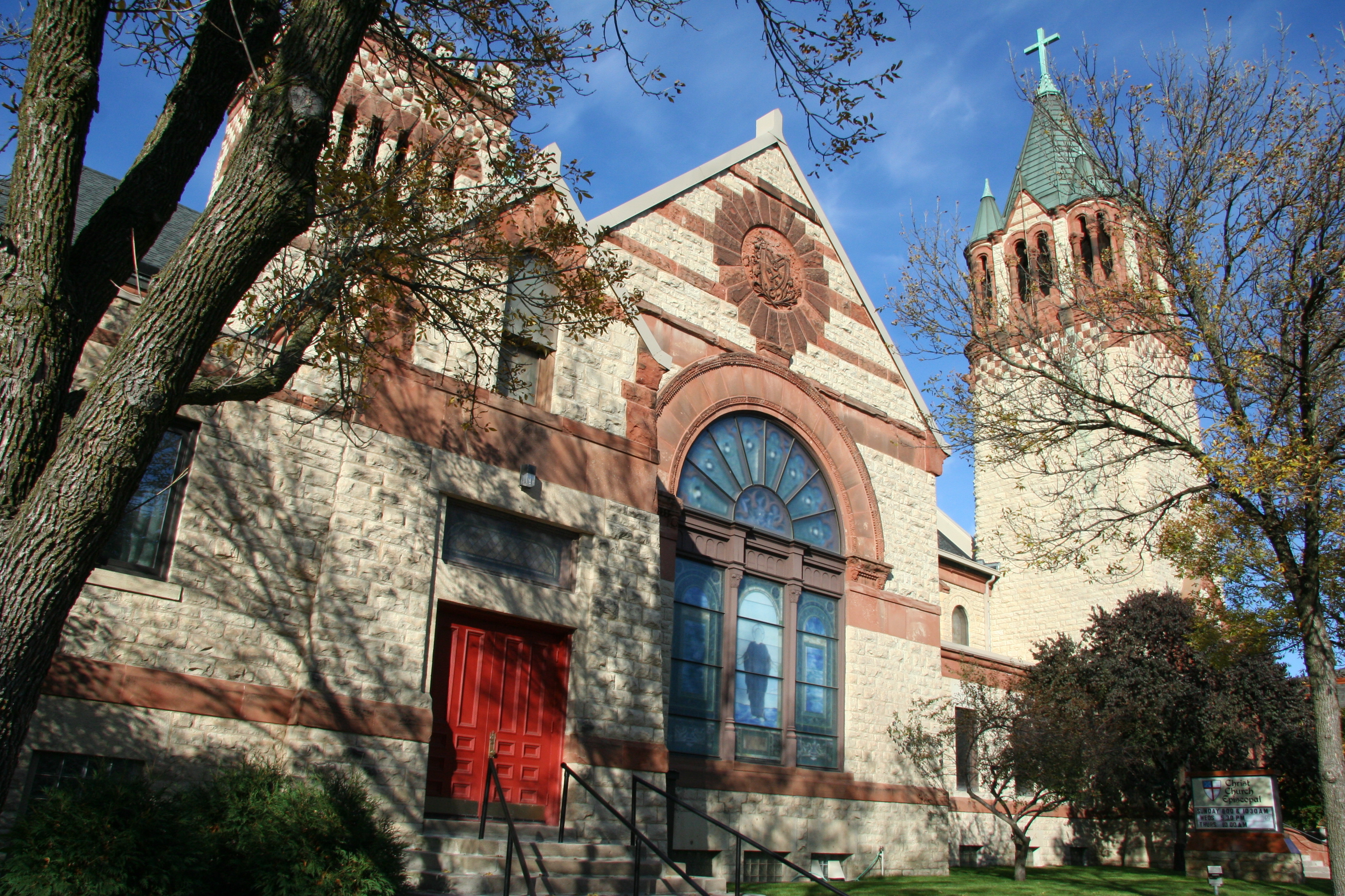
43°49′56″N 91°14′49″W / 43.832222°N 91.246944°WLaCrosse 18 Christ Church of La Crosse 
June 19, 1985 831 Main Street
43°48′43″N 91°14′40″W / 43.811944°N 91.244444°WLaCrosse 19 District School No. 1 March 21, 1996 US 14/61 E of Jct. with WI 35
43°45′31″N 91°11′22″W / 43.758611°N 91.189444°WShelby 20 Edgewood Place Historic District October 28, 2010 2500 block of Edgewood Pl.
43°49′08″N 91°13′09″W / 43.818889°N 91.219167°WLa Crosse 21 Freight House 
March 2, 1982 107-109 Vine Street
43°48′56″N 91°15′11″W / 43.815556°N 91.253056°WLa Crosse 22 Hamlin Garland House 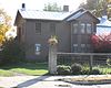
November 11, 1971 357 West Garland Street
43°53′56″N 91°04′51″W / 43.898889°N 91.080833°WWest Salem 23 Gideon C. Hixon House 
December 30, 1974 429 North 7th Street
43°48′58″N 91°14′49″W / 43.816111°N 91.246944°WLa Crosse 24 La Crosse County School of Agriculture and Domestic Economy 
March 13, 1987 700 Wilson Street
43°52′34″N 91°13′42″W / 43.876111°N 91.228333°WOnalaska 25 LaCrosse Commercial Historic District 
September 2, 1994 Roughly bounded by Jay Street, Second Street South, State Street, and Fifth Avenue South
43°48′44″N 91°15′06″W / 43.812222°N 91.251667°WLaCrosse 26 LaCrosse State Teachers College Training School Building July 15, 1999 1615 State Street
43°48′48″N 91°13′55″W / 43.813333°N 91.231944°WLaCrosse 27 Laverty-Martindale House 
November 23, 1977 237 South 10th Street
43°48′33″N 91°14′31″W / 43.809167°N 91.241944°WLa Crosse 28 Losey Memorial Arch 
May 30, 2002 1407 La Crosse Street
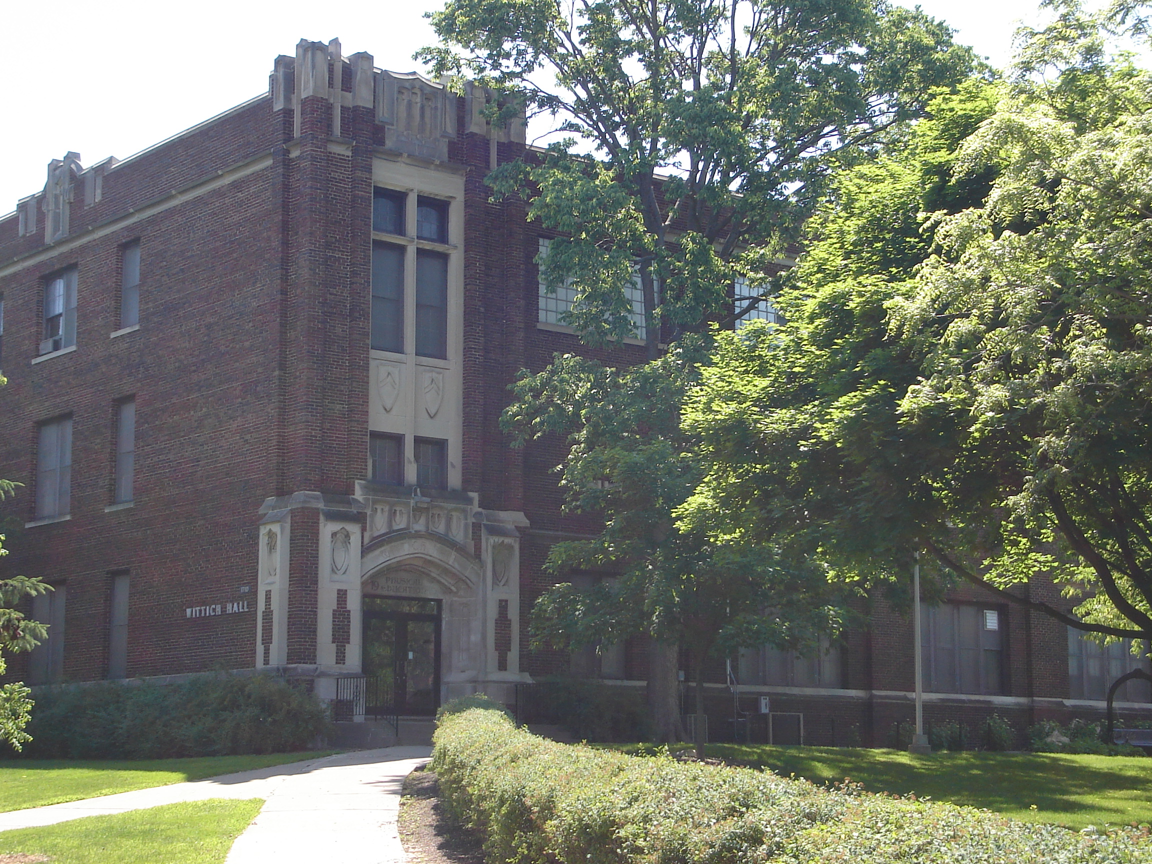
43°49′06″N 91°14′07″W / 43.818333°N 91.235278°WLa Crosse 29 Main Hall/La Crosse State Normal School 
March 14, 1985 1724 State St., Univ. of WI, La Crosse
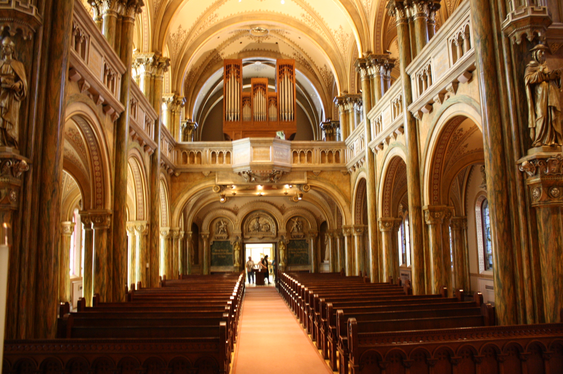
43°48′49″N 91°13′47″W / 43.813611°N 91.229722°WLa Crosse 30 Maria Angelorum Chapel 
March 29, 2006 901 Franciscan Way
43°48′14″N 91°14′37″W / 43.803889°N 91.243611°WLa Crosse 31 Midway Village Site December 18, 1978 West of Holmen Holmen 32 Mindoro Cut May 15, 2007 WI 108, bet. Mindoro and West Salem Hamilton 33 Mundstock, Carl August, Farm November 21, 1994 US 14/61, N side, E of jct. with WI 35
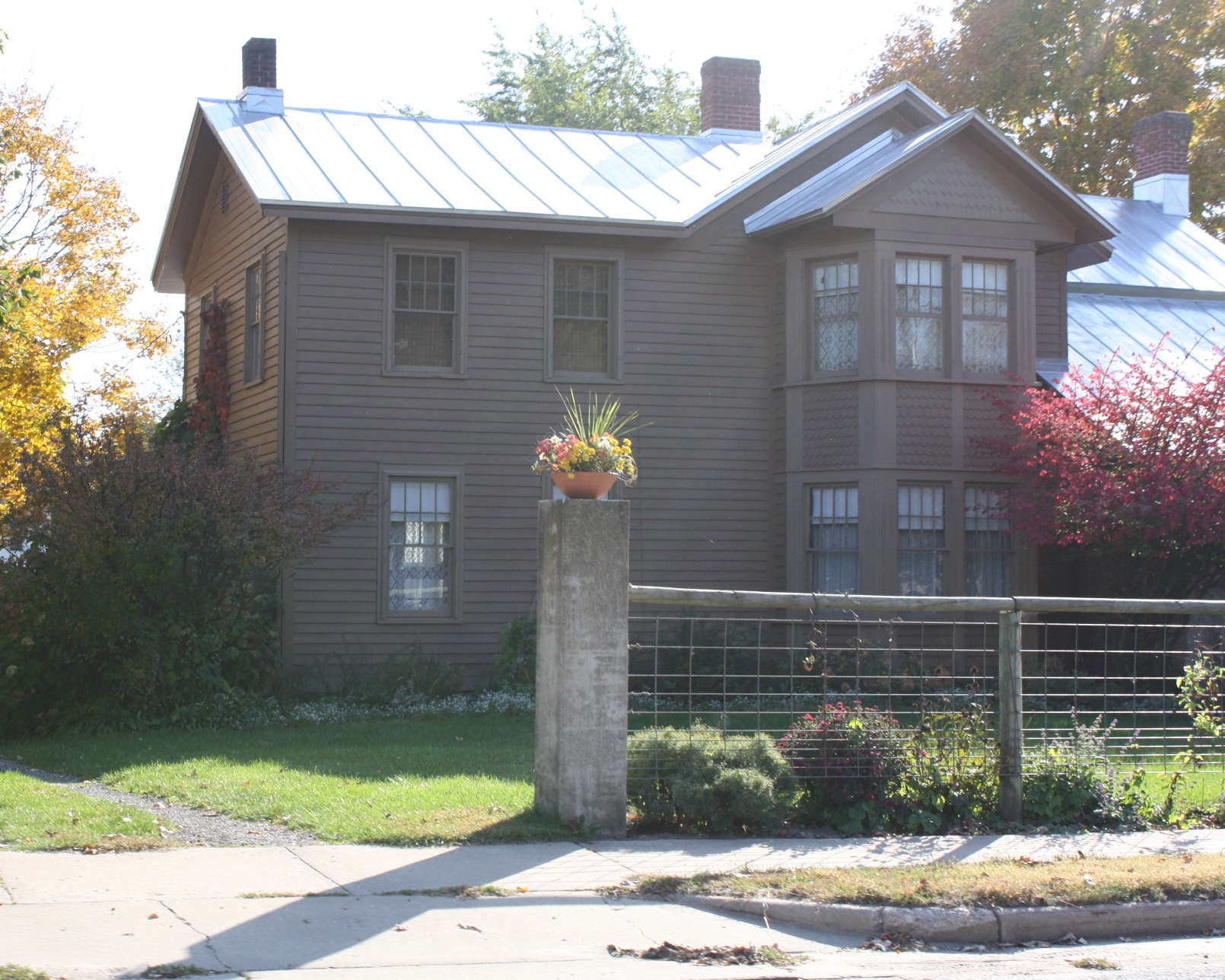
43°45′36″N 91°11′12″W / 43.76°N 91.186667°WShelby 34 Frank Eugene Nichols House 
February 11, 1993 421 North Second Street
43°53′10″N 91°14′10″W / 43.886111°N 91.236111°WOnalaska 35 Will Ott House 
January 15, 1980 1532 Madison Street
43°48′24″N 91°13′58″W / 43.806667°N 91.232778°WLa Crosse 36 Our Lady of Sorrows Chapel 
September 11, 1986 519 Losey Boulevard South
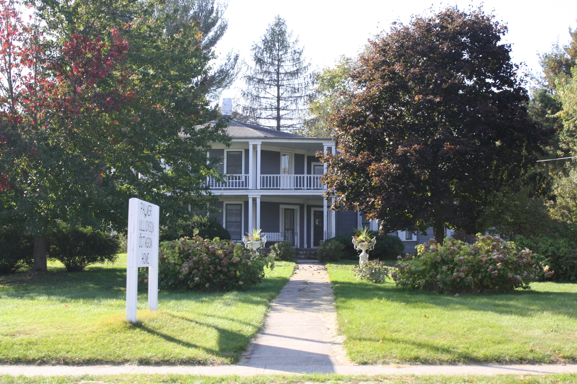
43°48′19″N 91°13′08″W / 43.805278°N 91.218889°WLa Crosse 37 Overhead Site December 18, 1978 South of La Crosse La Crosse 38 Palmer Brother's Octagons 
August 7, 1979 358 North Leonard Street and WI 16
43°54′05″N 91°04′54″W / 43.901389°N 91.081667°WWest Salem, Wisconsin and Vicinity 39 Physical Education Building/La Crosse State Normal School 
April 11, 1985 UW La Crosse Campus off US 16
43°48′52″N 91°13′48″W / 43.814444°N 91.23°WLa Crosse 40 Powell Place 
December 22, 1983 200-212 Main Street
43°48′47″N 91°15′12″W / 43.813056°N 91.253333°WLa Crosse 41 W. A. Roosevelt Company 
February 16, 1984 230 North Front Street
43°48′53″N 91°15′13″W / 43.814722°N 91.253611°WLa Crosse 42 Samuels' Cave June 11, 1991 Address Restricted Barre Mills 43 Sand Lake Archeological District April 20, 1984 Address Restricted Onalaska 44 Sand Lake Site (47Lc44) June 30, 1983 Address Restricted Onalaska 45 Smith Valley School 
July 30, 1981 4130 Smith Valley Road
43°50′40″N 91°10′40″W / 43.844444°N 91.177778°WLa Crosse 46 Swennes Archaeological District July 18, 1985 Address Restricted Onalaska 47 U.S. Fish Control Laboratory 
September 17, 1981 Riverside Park
43°49′06″N 91°15′20″W / 43.818333°N 91.255556°WLa Crosse 48 Valley View Site December 15, 1978 North of Medary Medary 49 James Vincent House 
October 20, 1988 1024 Cass Street
43°48′31″N 91°14′28″W / 43.808611°N 91.241111°WLa Crosse 50 Waterworks Building 
July 27, 1979 119 King Street
43°48′38″N 91°15′11″W / 43.810556°N 91.253056°WLa Crosse 51 Wisconsin Telephone Company Building 
March 7, 1985 125 North 4th Street
43°48′48″N 91°15′03″W / 43.813333°N 91.250833°WLa Crosse 52 George Zeisler Building 
February 25, 1993 201 Pearl Street
43°48′46″N 91°15′15″W / 43.812778°N 91.254167°WLa Crosse See also
- List of National Historic Landmarks in Wisconsin
- National Register of Historic Places listings in Wisconsin
References
- ^ "National Register of Historic Places: Weekly List Actions". National Park Service, United States Department of the Interior. Retrieved on November 10, 2011.
- ^ Numbers represent an ordering by significant words. Various colorings, defined here, differentiate National Historic Landmark sites and National Register of Historic Places Districts from other NRHP buildings, structures, sites or objects.
U.S. National Register of Historic Places Topics Lists by states Alabama • Alaska • Arizona • Arkansas • California • Colorado • Connecticut • Delaware • Florida • Georgia • Hawaii • Idaho • Illinois • Indiana • Iowa • Kansas • Kentucky • Louisiana • Maine • Maryland • Massachusetts • Michigan • Minnesota • Mississippi • Missouri • Montana • Nebraska • Nevada • New Hampshire • New Jersey • New Mexico • New York • North Carolina • North Dakota • Ohio • Oklahoma • Oregon • Pennsylvania • Rhode Island • South Carolina • South Dakota • Tennessee • Texas • Utah • Vermont • Virginia • Washington • West Virginia • Wisconsin • WyomingLists by territories Lists by associated states Other Municipalities and communities of La Crosse County, Wisconsin Cities 
Villages Bangor | Holmen | Rockland | West Salem
Towns Bangor | Barre | Burns | Campbell | Farmington | Greenfield | Hamilton | Holland | Medary | Onalaska | Shelby | Washington
CDPs Brice Prairie | French Island | St. Joseph
Unincorporated
communitiesBarre Mills | Burns | Burns Corners | Burr Oak | Council Bay | Middle Ridge | Mindoro | New Amsterdam | Stevenstown
Categories:- La Crosse County, Wisconsin
- Lists of historic places in Wisconsin
-


Wikimedia Foundation. 2010.