- Claydon, Oxfordshire
-
Coordinates: 52°08′49″N 1°19′59″W / 52.147°N 1.333°W
Claydon 
 Claydon
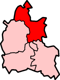
Claydon shown within OxfordshirePopulation 321 (parish) (2001 Census)[1] OS grid reference SP4550 Parish Claydon with Clattercot District Cherwell Shire county Oxfordshire Region South East Country England Sovereign state United Kingdom Post town Banbury Postcode district OX17 Dialling code 01295 Police Thames Valley Fire Oxfordshire Ambulance South Central EU Parliament South East England UK Parliament Banbury Website Claydon village website List of places: UK • England • Oxfordshire Claydon is a village in Claydon with Clattercot civil parish, about 6 miles (10 km) north of Banbury in Oxfordshire. The village is about 417 feet (127 m) above sea level on a hill of Early Jurassic Middle Lias clay.[2] Claydon is the northernmost village in Oxfordshire. The parish is bounded by Warwickshire to the west and Northamptonshire to the east.
Contents
Churches
The Church of England parish church of Saint James the Great was a chapel under the parish of Cropredy until 1851. St. James' was originally Norman, built in about 1100.[3] The arcade between the nave and north aisle survives from this date, as does the south doorway.[3] Slightly later a chapel was added at the east end of the north aisle, linked by Early English Gothic arches to both the aisle and the chancel. There is also a squint from the chapel to the chancel.[3] The bell tower was added in the 14th century, and the chancel was extended eastwards in either the 14th or the 15th century.[3] The south porch is a late Mediaeval Perpendicular Gothic addition, and the ironwork on the south door was added in 1640.[3]
In 1856 the Bishop of Oxford, Samuel Wilberforce, expressed dissatisfaction with the condition of the church building.[2] In 1860 the Gothic Revival architect William White heavily restored the building, including renewal of the foundations.[2] White almost completely rebuilt the north aisle,[3] and so altered the chancel that its original date may not be determined with certainty.[2] The bell tower has three bells: one each from 1609 and 1611 and a tenor of 1756 recast in 1910.[2] St. James' parish is now part of the Benefice of Shire's Edge along with those of Cropredy, Great Bourton, Mollington and Wardington.[4]
A Primitive Methodist congregation developed in Claydon from 1835 and built a chapel in 1846.[2] By 1969 it no longer had its own minister and was served by visiting clergy in the Banbury Methodist Circuit.[2] The chapel has since closed and has been converted into a garage for the house next door.[5]
Secular history
Historic houses in Claydon include Manor Farm built in 1720 and Claydon House built in 1852.[3] In 1867 the vicar, Rev. G.W. Palmer, bought Claydon House to be the vicarage[2] and had it altered by the architect Edwin Dolby.[3] In 1958 Claydon House was sold and returned to being a private house.[2]
Between 1753 and 1763 Claydon had three public houses.[2] By 1781 this had fallen to two, and from 1841 the number of pubs in the village fluctuated between one and two until the latter part of the 20th century.[2] The New Inn had closed by 1969[2] and the Sunrising Inn closed January 1990.
Construction of the Oxford Canal began north of Coventry in 1769. In May 1776 it reached Fenny Compton in Warwickshire, 2.5 miles (4.0 km) northwest of Claydon.[6] and by November 1777 the canal had been extended to Cropredy in Oxfordshire,[7] passing through Claydon parish by skirting the north and east sides of the hill on which Claydon stands. On the east side of the hill the canal's engineer Samuel Simcock built Claydon Locks, a flight of five locks that begins the canal's southward descent from its 11-mile long summit pound. Between them the five locks achieve a total rise (i.e. change in water level) of 30.5 feet (9.3 m).[8]
Villagers farmed under the open field system until 1776 when an Act of Parliament enclosed the common lands of the parish.[2]
In 1852 the Great Western Railway extended its Oxford and Rugby Railway through the western edge of Claydon parish to a new railway station at Fenny Compton. In 1872-73 the East and West Junction Railway built a line from its Fenny Compton West railway station to Towcester through glebe land in the north of Claydon parish.[2] Claydon's nearest station was 2.5 miles (4.0 km) to the south at Cropredy, until British Railways closed it in 1956.
Claydon and Clattercote School Board was established in 1875 and opened Claydon village school in 1877.[2] The school closed in 1948.[2]
In 1932 the hamlet of Clattercote, 0.5 miles (800 m) south of Claydon, was added to the civil parish to form the present parish of Claydon with Clattercote.[9]
Amenities
The Bygones Museum at Butlin Farm in Claydon was founded in 1972.[10] This privately-owned museum includes a collection of steam-powered stationary engines.[11]
References
- ^ "Area: Claydon-with-Clattercot CP (Parish): Parish Headcounts". Neighbourhood Statistics. Office for National Statistics. http://neighbourhood.statistics.gov.uk/dissemination/LeadTableView.do?a=7&b=798555&c=Claydon&d=16&e=15&g=480133&i=1001x1003x1004&o=1&m=0&r=1&s=1267790168292&enc=1&dsFamilyId=779. Retrieved 5 March 2010.
- ^ a b c d e f g h i j k l m n o p Crossley et al., 1972, pages 184–194
- ^ a b c d e f g h Sherwood & Pevsner, 1974, page 548
- ^ Archbishops' Council (2010). "Benefice of Shire's Edge". A Church Near You. Church of England. http://www.achurchnearyou.com/benefice.php?B=27/139CW. Retrieved 5 August 2011.
- ^ Oxfordshire Churches website: Claydon
- ^ Compton, 1976, page 22
- ^ Compton, 1976, page 25
- ^ British Waterways, 1965, page 11
- ^ Claydon with Clattercote Parish Council
- ^ AboutBritain.com: Bygones Museum
- ^ Stationary Steam Engines: The Bygones Museum Claydon
Sources
- British Waterways Board (1965). British Waterways Inland Cruising Booklet 6, Cruising on The Oxford Canal, Napton Junction to Oxford. London: British Waterways Board.
- Crossley, Alan (ed.); Colvin, Christina; Cooper, Janet; Cooper, N.H.; Harvey, P.D.A.; Hollings, Marjory; Hook, Judith; Jessup, Mary et al. (1972). A History of the County of Oxford, Volume 10. Victoria County History. pp. 184–194.
- Compton, Hugh J (1976). The Oxford Canal. Newton Abbot: David & Charles. ISBN 0 7153 7238 6.
- Sherwood, Jennifer; Pevsner, Nikolaus (1974). Oxfordshire. The Buildings of England. Harmondsworth: Penguin Books. p. 548. ISBN 0 14 071045 0.
External links
 Media related to Claydon, Oxfordshire at Wikimedia CommonsCategories:
- Villages in Oxfordshire

Wikimedia Foundation. 2010.