- Mollington, Oxfordshire
-
Coordinates: 52°07′26″N 1°21′40″W / 52.124°N 1.361°W
Mollington 
 Mollington
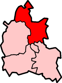
Mollington shown within OxfordshirePopulation 469 (2001 Census)[1] OS grid reference SP4447 Parish Mollington District Cherwell Shire county Oxfordshire Region South East Country England Sovereign state United Kingdom Post town Banbury Postcode district OX16 Dialling code 01295 Police Thames Valley Fire Oxfordshire Ambulance South Central EU Parliament South East England UK Parliament Banbury List of places: UK • England • Oxfordshire Mollington is a village and civil parish about 4 miles (6.4 km) north of Banbury in Oxfordshire, England. It has an area of about 2 square miles (5.2 km2).
Contents
History
Æthelstan Ætheling, eldest son of Æthelred the Unready willed an estate at Mollington to his father in 1014 or 1015.[2] The Domesday Book records that by 1086 the manor had passed to William d'Évreux, a kinsman of William the Conqueror.[2]
In 1086 Mollington was partly in three counties: Oxfordshire, Warwickshire and Northamptonshire. Later the village was only in Oxfordshire and Warwickshire, and in 1895 the Warwickshire part was transferred to Oxfordshire by the Local Government Act 1894.[2]
The earliest parts of the Church of England parish church of All Saints date from the 14th century, but the font is 13th century so there may have been an earlier church building on the site.[2][3][4] The Gothic Revival architect William White restored All Saints in 1856.[5] All Saints' parish is now part of the Benefice of Shire's Edge along with those of Claydon, Cropredy, Great Bourton and Wardington.[6]
In 1872 a National School was built in the village. It was a Church of England school and was still open in 1996,[7] but has since been closed.
Mollington used to have a post office.[2]
A Point to point racing racing ground opened at Mollington in 1972 and was home to a number of hunt groups until its closure in 2007.[8]
Amenities
Mollington has one public house, The Green Man, a village hall and two children's playgrounds.
References
- ^ "Parish Headcounts". Neighbourhood Statistics: Mollington CP. Office of National Statistics. 2001. http://neighbourhood.statistics.gov.uk/dissemination/LeadTableView.do?a=3&b=798587&c=OX17+1AZ&d=16&e=15&g=480137&i=1001x1003x1004&m=0&r=0&s=1192710730316&enc=1&dsFamilyID=779. Retrieved 2007-10-16.
- ^ a b c d e Crossley, 1972, pages 197–206
- ^ "Mollington: All Saints, Mollington". A Church Near You. Church of England. http://www.acny.org.uk/venue.php?V=5948. Retrieved 2007-10-18.
- ^ Oxfordshire Churches website: Mollington
- ^ Sherwood & Pevsner, 1974, page 711
- ^ Archbishops' Council (2010). "Benefice of Shire's Edge". A Church Near You. Church of England. http://www.achurchnearyou.com/benefice.php?B=27/139CW. Retrieved 2011-08-05.
- ^ "Mollington CofE School". Department for Children, Schools and Families. 1997-06-30. http://www.dcsf.gov.uk/cgi-bin/performancetables/archives/shschoolp_96?School=9313006. Retrieved 2007-10-18.
- ^ Smith, Russell (2007-07-19). "POINT TO POINT: Mollington set to close". Oxford Mail (Newsquest Media Group). http://www.oxfordmail.net/search/display.var.1556106.0.point_to_point_mollington_set_to_close.php. Retrieved 2007-10-18.
Sources
- Crossley, Alan (ed.); Colvin, Christina; Cooper, Janet; Cooper, N.H.; Harvey, P.D.A.; Hollings, Marjory; Hook, Judith; Jessup, Mary et al. (1972). A History of the County of Oxford, Volume 10. Victoria County History. pp. 197–206.
- Sherwood, Jennifer; Pevsner, Nikolaus (1974). Oxfordshire. The Buildings of England. Harmondsworth: Penguin Books. pp. 710–711. ISBN 0 14 071045 0.
External links
 Media related to Mollington, Oxfordshire at Wikimedia CommonsCategories:
- Oxfordshire geography stubs
- Villages in Oxfordshire
- Civil parishes in Oxfordshire

Wikimedia Foundation. 2010.