- Clifton, Oxfordshire
-
Not to be confused with Clifton Hampden, a village near Abingdon.
Coordinates: 51°58′59″N 1°17′20″W / 51.983°N 1.289°W
Clifton 
 Clifton
Clifton shown within OxfordshireOS grid reference SP4831 Parish Deddington District Cherwell Shire county Oxfordshire Region South East Country England Sovereign state United Kingdom Post town Banbury Postcode district OX15 Dialling code 01295 Police Thames Valley Fire Oxfordshire Ambulance South Central EU Parliament South East England UK Parliament Banbury Website Deddington Online List of places: UK • England • Oxfordshire Clifton is a hamlet by the River Cherwell in Deddington civil parish about 6 miles (9.7 km) south of Banbury, Oxfordshire, England. Clifton is on the B4031 road between Deddington and Croughton, Northamptonshire.
Contents
Chapels
A dependent chapel of Deddington parish church still existed in Hempton in 1523 but seems to have disappeared by the 17th century.[1]
A Methodist chapel was built in Clifton in about 1815.[1] It was a small brick building and has since been demolished.[1] The Methodists replaced it in 1869 with a new brick and stucco chapel[1] with plain lancet windows. It was still in use for worship in the 1950s but was disused by 1983[1] and is now a private house.
A new Church of England chapel of Saint James the Great was completed in 1853.[1] The Diocese of Oxford declared the chapel redundant in and sold it for secular commercial use in 1974.[1]
Amenities
Clifton has a public house, the Duke of Cumberland's Head.
References
Sources
- Crossley, Alan (ed.); Baggs, A.P.; Colvin, Christina; Colvin, H.M.; Cooper, Janet; Day, C.J.; Selwyn, Nesta; Tomkinson, A. (1983). A History of the County of Oxford, Volume 11: Wootton Hundred (northern part). Victoria County History. pp. 81–120.
Towns 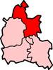
Large Villages Adderbury • Ambrosden • Arncott (Upper Arncott) • Bloxham • Bodicote • Caversfield • Deddington (Clifton, Hempton) • Hook Norton • Kidlington • Launton • Upper Heyford • YarntonOther Civil
Parishes
(Component
Villages
and Hamlets)Ardley with Fewcott (Ardley, Fewcott) • Barford St. John and St. Michael (Barford St. Michael, Barford St. John) • Begbroke • Blackthorn • Bletchingdon (Enslow) • Bourton (Great Bourton, Little Bourton) • Broughton • Bucknell • Charlton-on-Otmoor • Chesterton (Little Chesterton) • Claydon with Clattercot (Claydon, Clattercote) • Cottisford (Juniper Hill) • Cropredy • Drayton • Duns Tew • Epwell • Fencott and Murcott (Fencott, Murcott) • Finmere • Fringford • Fritwell • Godington • Gosford and Water Eaton (Gosford, Water Eaton) • Hampton Gay and Poyle (Hampton Gay, Hampton Poyle) • Hanwell • Hardwick with Tusmore (Hardwick, Tusmore) • Hethe (Willaston) • Horley • Hornton • Horton-cum-Studley • Islip • Kirtlington (Northbrook) • Lower Heyford (Caulcott) • Merton • Middle Aston • Middleton Stoney • Milcombe • Milton • Mixbury • Mollington • Newton Purcell with Shelswell (Newton Purcell, Shelswell) • Noke • North Aston • North Newington • Oddington • Piddington • Prescote • Shenington with Alkerton (Shenington, Alkerton) • Shipton-on-Cherwell and Thrupp (Shipton-on-Cherwell, Thrupp) • Shutford • Sibford Ferris • Sibford Gower (Burdrop) • Somerton • Souldern • South Newington • Steeple Aston • Stoke Lyne (Bainton) • Stratton Audley • Swalcliffe • Tadmarton • Wardington (Lower Wardington, Upper Wardington) • Wendlebury • Weston-on-the-Green • Wigginton • Wroxton (Balscote)Former Districts
and BoroughsMunicipal Borough of Banbury • Banbury Rural District • Bicester Urban District • Ploughley Rural District • Bicester Rural DistrictFormer
ConstituenciesCategories:- Oxfordshire geography stubs
- Villages in Oxfordshire


Wikimedia Foundation. 2010.