- Croughton, Northamptonshire
-
Coordinates: 51°59′50″N 1°12′33″W / 51.99729°N 1.20906°W
Croughton 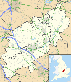
 Croughton
Croughton shown within NorthamptonshirePopulation 998 (2001 Census)[1]
1,020 (2010 est)[2].OS grid reference SP544335 - London 68 miles (109 km) Parish Evenley District South Northamptonshire Shire county Northamptonshire Region East Midlands Country England Sovereign state United Kingdom Post town BRACKLEY Postcode district NN13 5 Police Northamptonshire Fire Northamptonshire Ambulance East Midlands EU Parliament East Midlands UK Parliament South Northamptonshire List of places: UK • England • Northamptonshire Croughton is a small village in the South Northamptonshire district of Northamptonshire, England. It is close to the border with Oxfordshire and Buckinghamshire and is six kilometres southwest of the town of Brackley. Along with Aynho it is one of the county's two southernmost villages.
The village has a cooperative which is available for all daily essentials, only closing on Christmas Day, Boxing Day and New Year's Day, as well as being the home of Croughton All Saints Primary School.
Contents
Name
There is no one predominant pronunciation of the village's name, with residents pronouncing it with its first syllable rhyming with "thou" or with the first syllable rhyming with "crow". The "thou" pronunciation was adopted by the Americans nearby at RAF Croughton when the airbase was in use by the USAF.[dubious ] The origin of the name is thought to mean "town in the fork of a river".
Location
Croughton is situated upon the B4031 road running west from Buckingham, and is close to the Ockley Brook, a minor tributary of the River Cherwell, which it meets southwest of Aynho.
The village is dwarfed by RAF Croughton, a base on long-term lease to the United States Air Force, 2 miles (3.2 km) south-east.
History
The village is best known for its Parish Church, which is of historical significance for its murals, now sadly damaged. An historic elm reputedly stood in the church grounds for 800 years, and although it is believed to have died of Dutch elm disease in the 1970s, its demise dates back to the early 1900s. The remains of an Iron Age fort, Rainsborough Camp, lie to the north-west of the village, and the site of the long-abandoned mediaeval village of Astwick lies to the north-east.
Notable people from Croughton
- Robert Freind
References and notes
- ^ "UK census 2001 - data". http://neighbourhood.statistics.gov.uk/dissemination/LeadTableView.do?a=7&b=797341&c=NN13+5LT&d=16&e=15&g=473857&i=1001x1003x1004&m=0&r=0&s=1293381754033&enc=1&dsFamilyId=779. Retrieved 26 December 2010.
- ^ SNC (2010). South Northamptonshire Council Year Book 2010-2011. Towcester NN12 7FA. pp. 39.
External links
Categories:- Villages in Northamptonshire

Wikimedia Foundation. 2010.