- Cherryville, North Carolina
-
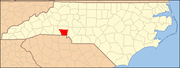
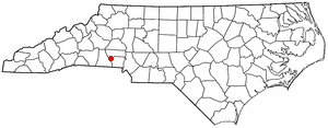
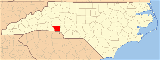
Cherryville, North Carolina — City — Location in the US state of North Carolina
Coordinates: 35°22′52″N 81°22′45″W / 35.38111°N 81.37917°WCoordinates: 35°22′52″N 81°22′45″W / 35.38111°N 81.37917°W Country  United States
State  North Carolina
County Gaston Incorporated 1881 Government – Mayor Bob Austell Area – Total 4.7 sq mi (12.3 km2) – Land 4.7 sq mi (12.3 km2) – Water 0.0 sq mi (0.0 km2) Elevation 1,007 ft (307 m) Population (2000) – Total 5,361 – Density 1,131.3/sq mi (436.8/km2) Time zone Eastern (EST) (UTC-5) – Summer (DST) EDT (UTC-4) ZIP code 28021 Area code(s) 704 FIPS code 37-12340[1] GNIS feature ID 1019622[2] Cherryville is a small city in northwestern Gaston County, North Carolina, United States. The population was 5,361 at the 2000 census. The New Year's Shooters preserve the area's German heritage by honoring the custom of beginning each year with a chant and the shooting of muskets.[3] Cherryville is located approximately 30 miles west of Charlotte and 13 miles northwest of Gastonia.
Contents
Geography
Cherryville (pronounced by many of its residents as "CHUR-uh-vul", though the more proper pronunciation would be just as it is spelled) is located in Cherryville Township at 35°22′52″N 81°22′45″W / 35.38111°N 81.37917°W (35.381169, -81.379168)[4] at an elevation of 1,007 feet (307 m). According to the United States Census Bureau, the city covers a total area of 4.7 square miles (12 km2), all land. The small Cherryville City Reservoir is located just southeast of the city limits.
Cherryville is located along a divide among three watersheds. The western end of Cherryville is in the watershed of Muddy Creek, a right tributary of Buffalo Creek and part of the Broad River catchment basin. The north side of Cherryville is in the Indian Creek watershed, drained by Lick Fork Creek and an unnamed tributary of Indian Creek. The south side Cherryville Township is in the Beaverdam Creek watershed, drained by unnamed right-hand tributaries of Beaverdam Creek. Indian Creek and Beaverdam Creek are tributaries of the South Fork Catawba River.[5]
History
During the last half of the 18th century, German, Dutch, and Scots-Irish families from the Colony of Pennsylvania migrated south and settled in the Cherryville area. Land grants made by King George III of England date back to 1768, and as early as 1792 Governor Samuel Ashe of North Carolina made grants in and around "White Pine", as the settlement was known at the time. A village began to develop at a crossroads of the Morganton-to-Charleston road, closely followed by modern Highway 274 / Mountain Street, and the Old Post Road, a main thoroughfare between Salisbury, North Carolina and Spartanburg, South Carolina.[6]
In 1862, the Wilmington, Charlotte and Rutherford Railroad (later known as Carolina Central Railroad) reached White Pine. Construction of the railroad westward from Cherryville was interrupted by the Civil War, so that throughout the war Cherryville was a western terminus of the railroads in North Carolina. When construction resumed and the railroad extended beyond Cherryville, the town served as a water and coal stop. Along the railroad, a local resident planted cherry trees, and the train engineers soon began calling the settlement "Cherryville". The town was incorporated under this name in 1881.[7]
Agriculture was Cherryville's main economic base for many years. However, during the late 19th century, the textile industry became established in the town. Cherryville's first cotton mill, Cherryville Manufacturing Plant, was incorporated in 1891. It was soon followed by the opening of three other mills. By the turn of the 20th century, the rural village had become an industrial community of a thousand people.[6] Eventually, 13 mills would be opened in Cherryville, including Gaston Manufacturing Company (later operated as Dora Yarn Mills), Vivian Manufacturing Company ("Old Sardine", later operated as Nuway Spinning Company), Melville Manufacturing Company (later Burlington Industries' Pinnacle Plant), Howell Manufacturing Company, Rhyne Houser Manufacturing Company (later part of Burlington Industries' Madision Division), and Carlton Yarn Mills, Inc.[8] All of these plants have since closed.
In 1932, a trucking company began operating in Cherryville with one truck hauling produce from Florida to Cherryville. This company would become one of the largest freight carriers in the nation, known as Carolina Freight Carriers Corporation. After operating for more than sixty years, Carolina Freight was bought by the Arkansas Best Trucking Company in October 1995 and operations moved from Cherryville.[6]
On July 13, 1966 Trains #45 & #46 of The Seaboard Air Line Railroad, hit headon on the SE side of the city, killing one and injuring three.
Demographics
As of the census[1] of 2000, there were 5,361 people, 2,177 households, and 1,480 families residing in the city. The population density was 1,131.3 people per square mile (436.7/km²). There were 2,356 housing units at an average density of 497.2 per square mile (191.9/km²). The racial makeup of the city was 88.81% White, 9.57% African American, 0.13% Native American, 0.62% Asian, 0.52% from other races, and 0.35% from two or more races. Hispanic or Latino of any race were 2.29% of the population.
There were 2,177 households out of which 27.6% had children under the age of 18 living with them, 51.6% were married couples living together, 12.5% had a female householder with no husband present, and 32.0% were non-families. 28.9% of all households were made up of individuals and 15.6% had someone living alone who was 65 years of age or older. The average household size was 2.34 and the average family size was 2.86.
In the city the population was spread out with 21.2% under the age of 18, 6.9% from 18 to 24, 26.6% from 25 to 44, 23.3% from 45 to 64, and 21.9% who were 65 years of age or older. The median age was 41 years. For every 100 females there were 86.1 males. For every 100 females age 18 and over, there were 82.5 males.
The median income for a household in the city was $33,054, and the median income for a family was $45,607. Males had a median income of $38,667 versus $24,828 for females. The per capita income for the city was $19,254. About 6.7% of families and 9.1% of the population were below the poverty line, including 10.5% of those under age 18 and 9.3% of those age 65 or over.
Government
The mayor of Cherryville is elected by popular vote for a two-year term. The City Council is made up of four members with staggered terms. Each member is elected from one of four wards for a four-year term. Candidates are required to reside in the ward they intend to represent; however, the vote is citywide. The council appoints a full-time city manager to serve as executive officer of the city.[9][10]
Economy
Cherryville's largest employers include Keystone Powdered Metal Company, a manufacturer of primarily automotive parts, including bearings, valve seats, and small structural parts, employing 220 people, and Bradington-Young Furniture Company, a manufacturer of sofas, chairs, and recliners employing 187 people. Other manufacturing companies include R-Anell Incorporated, manufacturing pre-fabricated modular homes, and Advanced Urethane Solutions, Inc., manufacturing an assortment of polyurethane products including rollers, bumpers, and gears.
The largest among non-manufacturing employers are in the governmental, institutional, and construction sectors. The Gaston County Public School System employs 200 people locally, while the government offices of the City of Cherryville employ 90 people. Rutherford Electric Membership Cooperative employs 186 people. Beam Construction Company employs 150 people. Carolina Care Center and Century Care, convalescent facilities, employ 120 and 70 people, respectively.[11]
Education
Public schools in Cherryville are part of the Gaston County Schools public school system. They include:
- Cherryville Elementary School, grades K-3,
- William Blaine Beam Intermediate School, grades 4-5, built in 2004 on the site of the former Cherryville High School and named for a former community leader and education advocate.
- John Chavis Middle School, grades 6-8, named for John Chavis (c. 1763-1838), African-American educator and Presbyterian minister
- Cherryville High School, grades 9-12.
Tryon Elementary School, grades K-5, in the unincorporated Tryon community of Cherryville Township also feeds into John Chavis Middle School.
Religious life
The first church organized in Cherryville was Saint John's Evangelical Lutheran Church, established in 1881, the same year in which the town was incorporated. The congregation had the first church building in Cherryville as well, erected soon after the church's organization (it was replaced by the current structure in 1963)[12]
Other churches in Cherryville include First United Methodist Church (organized 1883), Fairview Baptist Church (1884), First Presbyterian Church (1893[13]), First Baptist Church (1893[14]), Rudisill Chapel AME Zion Church (1896[15]), First Wesleyan Church (1907), Second Baptist Church (1940), First Church of the Nazarene (1950), Cherryville Church of God, North Gaston Church of God, Mount Zion Baptist Church, Cherryville Missionary Methodist Church, Iglesia Christian Integral, Victory Life Assembly of God, Macedonia Missionary Baptist Church, Liberty United Glorious Church,Shady Grove Baptist Church, and Oak Grove Baptist Church.[16]
Places of interest
The Cherryville Historical Museum preserves the history of the Cherryville area, and is open to the public each week during specified days. The C. Grier Beam Truck Museum, interpreting the history of freight trucking and Carolina Freight Carriers, is in the former Beam's Shell Service Station and Office, 117 N. Mountain St., listed on the National Register of Historic Places. The 1922 Noah Benjamin Kendrick House at 402 N. Mountain Street is a Designated Gaston County Historic Property. Recreational sites in Cherryville include the semi-private Cherryville Country Club, with a nine-hole golf course, on the northeast side of town.
Rudisill Stadium, completed in 1963 and located on the campus of Beam Intermediate School, is the largest sports venue in Cherryville and is used for several community events throughout the year.
Famous residents
- Tony Cloninger (born in Cherryville, August 13, 1940) - former Major League Baseball starting pitcher with the Milwaukee and Atlanta Braves, Cincinnati Reds and St. Louis Cardinals
- Charlie Justice (American football at University of North Carolina at Chapel Hill) played for the Washington Redskins, born in Asheville, North Carolina; founded Justice & Crews Insurance Agency in Cherryville which he operated until his death.
- Patrick T. McHenry (resident of Cherryville) - Republican United States Representative from North Carolina's 10th congressional district
- Jack Tatum (born in Cherryville, November 18, 1948) - professional American football player with the Oakland Raiders and Houston Oilers of the National Football League, three-time Pro Bowl selection and Super Bowl champion
- George Wilson (born in Cherryville, August 30, 1925) - former Major League Baseball outfielder with the Chicago White Sox, New York Giants and New York Yankees
References
- ^ a b "American FactFinder". United States Census Bureau. http://factfinder.census.gov. Retrieved 2008-01-31.
- ^ "US Board on Geographic Names". United States Geological Survey. 2007-10-25. http://geonames.usgs.gov. Retrieved 2008-01-31.
- ^ Quality of Life, Official City of Cherryville website. Retrieved on 2008-07-14.
- ^ "US Gazetteer files: 2010, 2000, and 1990". United States Census Bureau. 2011-02-12. http://www.census.gov/geo/www/gazetteer/gazette.html. Retrieved 2011-04-23.
- ^ Gaston County Watersheds, Gaston County official government website. Retrieved on 2008-08-05.
- ^ a b c Mary Frances Mauney."Cherryville", Cherryville.com history articles. Retrieved on 2008-07-14.
- ^ Local History, Official City of Cherryville website. Retrieved on 2008-07-14.
- ^ History of the Textile Industry in Cherryville, Cherryville.com history articles. Retrieved on 2008-08-05.
- ^ Election of Municipal Officials, Gaston County government website. Retrieved on 2008-08-06.
- ^ Cherryville Facts. Retrieved on 2008-08-06.
- ^ Commerce and Industry, official City of Cherryville website. Retrieved on 2008-07-14.
- ^ History of St. Johns. Retrieved on 2008-08-05.
- ^ First Presbyterian Church History. Retrieved on 2008-08-05.
- ^ First Baptist Church History. Retrieved on 2008-08-05.
- ^ History of Rudisill Chapel AME Zion Church. Retrieved on 2008-08-05.
- ^ Outline History of Cherryville Churches (source of organization dates if not otherwise referenced). Retrieved on 2008-08-05.
External links
- Official City of Cherryville website
- Cherryville.com, unofficial community website]
- Official Cherryville New Year Shooters website
Charlotte Metropolitan Area Counties 
Major city Cities and towns
20k-99kConcord • Gastonia • Huntersville • Kannapolis • Matthews • Monroe • Hickory • Mooresville • Rock Hill • Salisbury • Shelby • StatesvilleCities and towns
5k-20kAlbemarle • Belmont • Bessemer City • Chester • Cherryville • Conover • Cornelius • Davidson • Fort Mill • Indian Trail • Kings Mountain • Lancaster • Lincolnton • Mint Hill • Mount Holly • South Gastonia • Unionville • Wadesboro • Weddington • YorkFootnotes Bold = principal metro cities • Italic = places and counties part of CSAMunicipalities and communities of Gaston County, North Carolina Cities Belmont | Bessemer City | Cherryville | Gastonia | Kings Mountain‡ | Lowell | Mount Holly
Towns Cramerton | Dallas | Dellview | High Shoals | McAdenville | Ranlo | Spencer Mountain | Stanley
Townships Unincorporated
communitiesAlexis | Ashebrook Park | Brown Town | Crowders | Hardins | Lucia | Mountain Island | South Gastonia | Springdale | Tryon
Footnotes ‡This populated place also has portions in an adjacent county or counties
Categories:- Cities in North Carolina
- Populated places in Gaston County, North Carolina
- Populated places established in 1792

Wikimedia Foundation. 2010.