- McAdenville, North Carolina
-
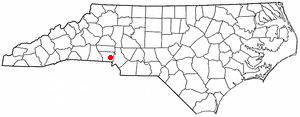
McAdenville, North Carolina — Town — Location of McAdenville, North Carolina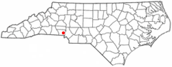
Coordinates: 35°15′50″N 81°4′45″W / 35.26389°N 81.07917°WCoordinates: 35°15′50″N 81°4′45″W / 35.26389°N 81.07917°W Country  United States
State  North Carolina
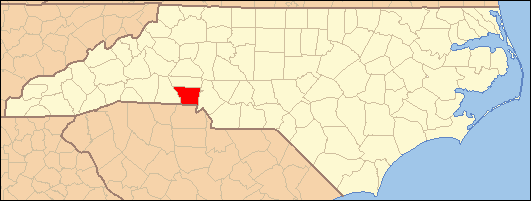
County Gaston Government - Mayor Farrell A. Buchanan Area - Total 1.5 sq mi (3.8 km2) - Land 1.4 sq mi (3.6 km2) - Water 0.1 sq mi (0.3 km2) Elevation 571 ft (174 m) Population (2000) - Total 619 - Density 450.1/sq mi (173.8/km2) Time zone Eastern (EST) (UTC-5) - Summer (DST) EDT (UTC-4) ZIP code 28101 Area code(s) 704 FIPS code 37-39880[1] GNIS feature ID 1021377[2] Website www.mcadenville-christmastown.com McAdenville, also known as Christmastown USA, is a town in Gaston County, North Carolina, United States and is considered to be a suburb of both Charlotte and Gastonia. The population was 619 at the 2000 census.
A Christmas tradition in the town for many years have been the decorating of the entire town in Christmas lights. The event is called Christmas Town USA. The lights attract visitors from all over the country and is one of the biggest light shows in the US. Begun in 1956 with the assistance of Pharr Yarns, the largest employer and land owner in the town, many trees and buildings in the town are covered in Christmas lights and some form of decoration. More than 300,000 vehicles visit each year.[3] The lights are entirely maintained by volunteers from the community and no admission is charged. Pharr Yarns picks up the electric bill for the event.
McAdenville was incorporated in 1881. It was named after Rufus Yancey McAden, president of McAden Mills, the town's textile mill. McAden had served in the North Carolina House of Commons from 1862 to 1867, and was Speaker of the House in 1866. He came to Charlotte in 1867 to become president of the two-year old First National Bank.[4]
Contents
Geography
McAdenville is located on the South Fork Catawba River at 35°15′50″N 81°4′45″W / 35.26389°N 81.07917°W (35.263893, -81.079282)[5]. McAdenville Lake is formed by a dam on the South Fork in central McAdenville.
According to the United States Census Bureau, the town has a total area of 1.5 square miles (3.9 km2), of which, 1.4 square miles (3.6 km2) of it is land and 0.1 square miles (0.26 km2) of it (6.80%) is water. The town lies in the Cramerton Watershed.[6]
Demographics
As of the census[1] of 2000, there were 619 people, 247 households, and 182 families residing in the town. The population density was 450.1 people per square mile (173.2/km²). There were 282 housing units at an average density of 205.1 per square mile (78.9/km²). The racial makeup of the town was 95.80% White, 1.94% African American, 0.97% Native American, 0.97% Asian, and 0.32% from two or more races.
There were 247 households out of which 29.6% had children under the age of 18 living with them, 56.7% were married couples living together, 12.6% had a female householder with no husband present, and 26.3% were non-families. 22.7% of all households were made up of individuals and 7.7% had someone living alone who was 65 years of age or older. The average household size was 2.51 and the average family size was 2.96.
In the town the population was spread out with 24.1% under the age of 18, 6.5% from 18 to 24, 25.8% from 25 to 44, 29.1% from 45 to 64, and 14.5% who were 65 years of age or older. The median age was 41 years. For every 100 females there were 91.6 males. For every 100 females age 18 and over, there were 91.8 males.
The median income for a household in the town was $36,513, and the median income for a family was $40,750. Males had a median income of $30,781 versus $21,481 for females. The per capita income for the town was $18,130. About 6.4% of families and 6.1% of the population were below the poverty line, including 5.9% of those under age 18 and 4.7% of those age 65 or over.
Government
McAdenville is governed by a mayor and a five-member town council. Fire protection is provided by the McAdenville Volunteer Fire Department. McAdenville is in South Point Township.
The town has its own police department, which patrols from 6 AM to 6 PM daily within the McAdenville town limits. From 6 PM until 6 AM daily, patrol duties are handled by officers of the Cramerton Police Department, based on a contract signed in 2006 by the McAdenville and Cramerton Town Councils.[7]
Industry
McAdenville is the headquarters of Pharr Yarns. The company has operated a yarn manufacturing plant in the town since 1939. It is the town's largest employer and the 7th-largest employer in Gaston County.[8]
Transportation
The primary east-west highway passing through McAdenville is Interstate 85. Other important highways include U.S. Route 29/U.S. Route 74 (Wilkinson Blvd.) and North Carolina Highway 7 (Main St./Hickory Grove Rd./Riverside Dr./McAdenville Rd.).
Education
Public education in McAdenville is administered by the Gaston County Schools public school system. The only school in McAdenville is McAdenville Elementary School. Some elementary age children from the northern part of McAdenville attend Lowell Elementary School in Lowell.
Most McAdenville students in grades 6-8 attend Holbrook Middle School in Lowell, except for those in a small section of town who attend Belmont Middle School in Belmont.
High school-age students living south of Interstate 85 attend South Point High School in Belmont, while most of those living north of the interstate attend Ashbrook High School in Gastonia. Students from one small section of town attend East Gaston High School in Mount Holly.
Famous residents
- George Watts (born July 12, 1914 in McAdenville, died July 11, 1990) - American football offensive tackle in the National Football League. He played for the Washington Redskins in the 1942 season. He played college football at Appalachian State University.
References
- ^ a b "American FactFinder". United States Census Bureau. http://factfinder.census.gov. Retrieved 2008-01-31.
- ^ "US Board on Geographic Names". United States Geological Survey. 2007-10-25. http://geonames.usgs.gov. Retrieved 2008-01-31.
- ^ Holiday Light Spectaculars. Retrieved on 2008-07-21
- ^ Henry M. McAden House, Charlotte-Mecklenburg Historic Landmarks Commission. Retrieved on 2008-07-13
- ^ "US Gazetteer files: 2010, 2000, and 1990". United States Census Bureau. 2011-02-12. http://www.census.gov/geo/www/gazetteer/gazette.html. Retrieved 2011-04-23.
- ^ Gaston County Watersheds, Gaston County government website. Retrieved on 2008-07-21.
- ^ Cramerton-McAdenville Contract Police Services, Cramerton Police Department Website. Retrieved on 2008-07-21.
- ^ Gaston County Factbook, retrieved on 2008-07-14.
External links
Municipalities and communities of Gaston County, North Carolina County seat: Gastonia Cities Belmont | Bessemer City | Cherryville | Gastonia | Kings Mountain‡ | Lowell | Mount Holly
Towns Cramerton | Dallas | Dellview | High Shoals | McAdenville | Ranlo | Spencer Mountain | Stanley
Townships Unincorporated
communitiesAlexis | Ashebrook Park | Brown Town | Crowders | Hardins | Lucia | Mountain Island | South Gastonia | Springdale | Tryon
Footnotes ‡This populated place also has portions in an adjacent county or counties
Categories:- Populated places in Gaston County, North Carolina
- Towns in North Carolina
- Populated places established in 1881
Wikimedia Foundation. 2010.