- Crowders, North Carolina
-
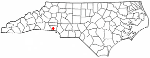
Crowders, North Carolina — Populated place — Location in the U.S. state of North Carolina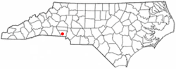
Coordinates: 35°11′10″N 81°12′23″W / 35.18611°N 81.20639°WCoordinates: 35°11′10″N 81°12′23″W / 35.18611°N 81.20639°W Country  United States
State  North Carolina
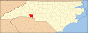
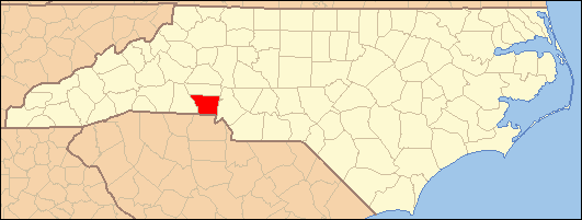
County Gaston Elevation 774 ft (236 m) Time zone Eastern (EST) (UTC-5) - Summer (DST) EDT (UTC-4) Area code(s) 704 FIPS code 37-15660[1] GNIS feature ID 983803[2] Crowders is an unincorporated community in Gaston County, North Carolina, United States. It is located approximately 6.0 miles (9.7 km) south of downtown Gastonia on U.S. Route 321 and 3.8 miles (6.1 km) north of the South Carolina state line.
References
- ^ "American FactFinder". United States Census Bureau. http://factfinder.census.gov. Retrieved 2008-01-31.
- ^ U.S. Geological Survey Geographic Names Information System: Crowders, North Carolina
Municipalities and communities of Gaston County, North Carolina County seat: Gastonia Cities Belmont | Bessemer City | Cherryville | Gastonia | Kings Mountain‡ | Lowell | Mount Holly
Towns Cramerton | Dallas | Dellview | High Shoals | McAdenville | Ranlo | Spencer Mountain | Stanley
Townships Unincorporated
communitiesAlexis | Ashebrook Park | Brown Town | Crowders | Hardins | Lucia | Mountain Island | South Gastonia | Springdale | Tryon
Footnotes ‡This populated place also has portions in an adjacent county or counties
Categories:- Unincorporated communities in North Carolina
- Populated places in Gaston County, North Carolina
- North Carolina geography stubs
Wikimedia Foundation. 2010.