- Mehrauli
-
Mehrauli — neighbourhood — Coordinates 28°30′57″N 77°10′39″E / 28.51583°N 77.1775°ECoordinates: 28°30′57″N 77°10′39″E / 28.51583°N 77.1775°E Country India Territory Delhi District(s) South West district MLA Balrum Tanwar Time zone IST (UTC+05:30) Mehrauli (Hindi: महरौली, Urdu: مہرؤلی, Punjabi: ਮਹਰੌਲੀ) is a neighbourhood in the South West district of Delhi in India. It represents a constituency in the legislative assembly of Delhi. The area is located close to Gurgaon.
Contents
History
Mehrauli, Which was earlier known as Mihirawali means Home of Mihir, was founded by the King Mihir Bhoja of the Gurjara-Pratihara Dynasty.[1]

Mehrauli is one of the seven ancient cities that make up the present state of Delhi. The Lal Kot fort was constructed by the Gurjar[2] Tanwar chief Anangpal I around AD 731 and expanded by AnangPal II in the 11th century, who shifted his capital to Lal Kot from Kannauj. The Gurjar[2] Tanwars were defeated by the Chauhans in the 12th century. Prithviraj Chauhan further expanded the fort and called it Qila Rai Pithora. He was defeated and killed in 1192 by Mohammed Ghori, who put his general Qutb-ud-din Aybak in charge and returned to Afghanistan. Subsequently in 1206, after the death of Mohammed Ghori, Qutubuddin enthroned himself as the first Sultan of Delhi. Thus Delhi became the capital of Mamluk dynasty of Delhi (Slave dynasty), the first dynasty of Muslim sultans to rule over northern India.[3] Mehrauli remained the capital of the Mamluk dynasty which ruled until 1290. During the Khilji dynasty, the capital shifted to Siri.[3]
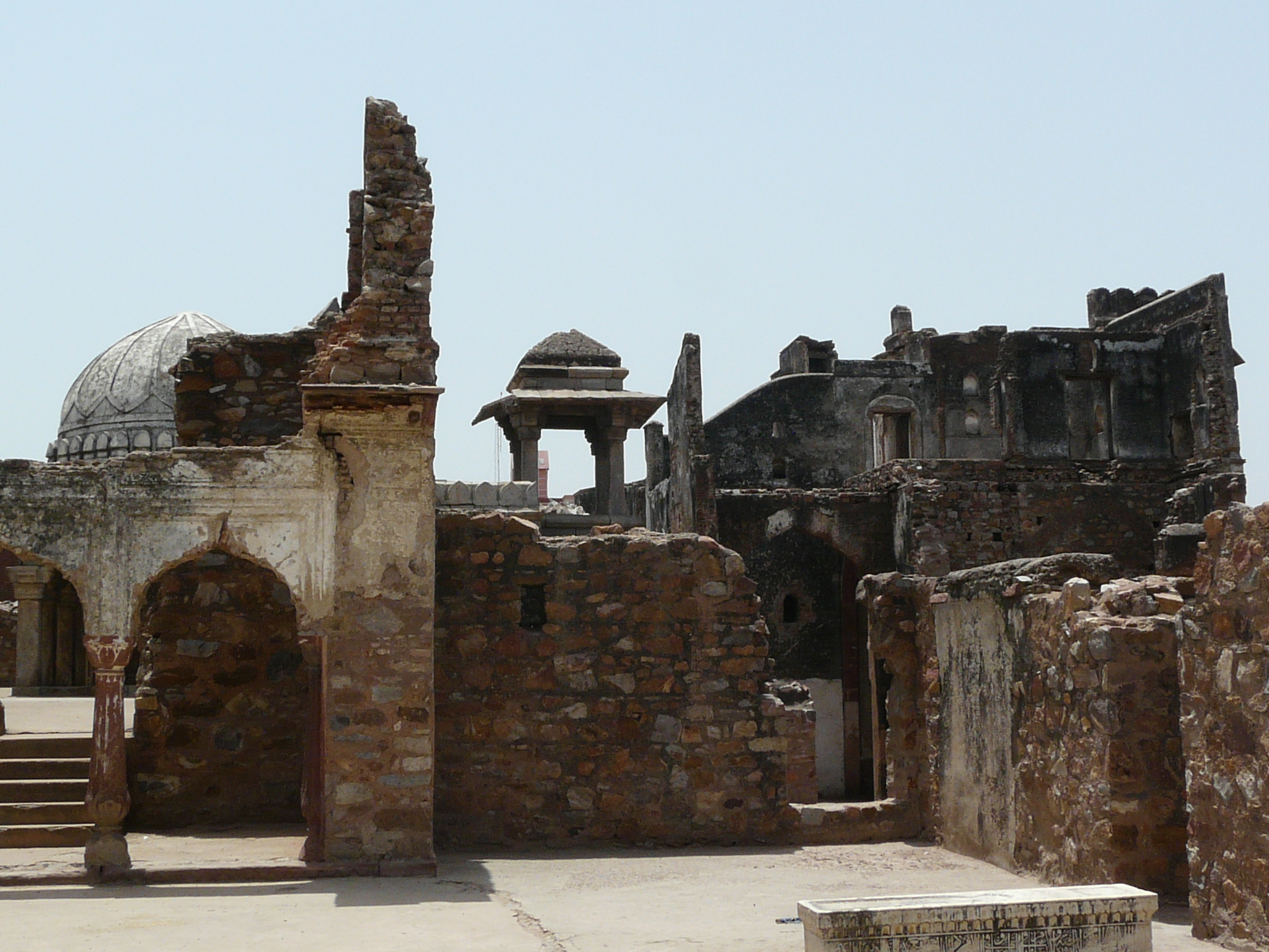
 Balban's tomb, Mehrauli
In 12-century Jain scriptures, the place is also mentioned as Yogninipura, now noticeable by the presence of the famous, "Yogmaya Temple", near the Qutub Minar complex, believed to be built by the Pandavas.[4]
Geography and climate
Mehrauli lies in the South West district of Delhi at 28°30′57″N 77°10′39″E / 28.51583°N 77.1775°E. To its north lies Hauz Khas. Vasant Kunj lies to its West and Tughlakabad to its south.
Like the rest of Delhi, Mehrauli has a semi-arid climate with high variation between summer and winter temperatures. While the summer temperatures may go up to 46 °C, the winters can seem freezing to people used to a warm climate with near 0 °C.
The soil of Mehrauli consists of sandy loam to loam texture. The water level has gone down in the recent past hovering between 45 m to 50 m due to rise in population.[5]
Architecture
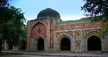 Jamali Kamali Masjid, Mehrauli Archaeological Park
 Qutub Minar
Though Mehrauli is like any ordinary neighbourhood today, its past is what distinguishes it in terms of architecture. Yet the famous conservation architect AGK Menon is doing all he could to displace the indigenous population and return Mehrauli to its past glory, as accorded by the British Colonial norms.
Even though the capital shifted from Mehrauli after the Slave dynasty rule came to an end, many other dynasties contributed significantly to Mehrauli's architecture.
The most visible piece of architecture remains the Qutb complex which was initiated by Qutub ud din Aybak with subsequent additions by Iltutmish and Alauddin Khilji.[6] The Qutb complex is today a UNESCO world heritage site.,[7] and also the venue for the annual Qutub Festival.
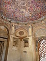
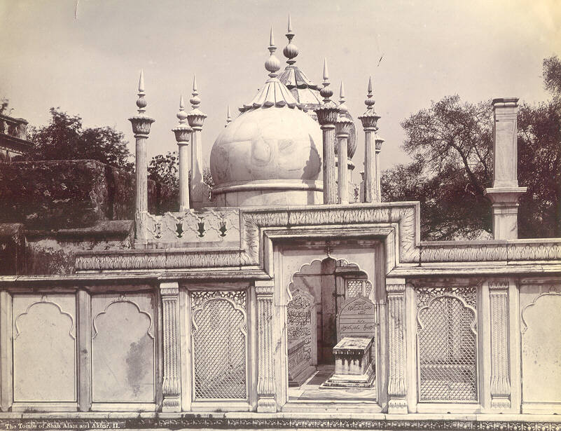
Mausoleum of 13th century, Sufi saint, Khwaja Qutbuddin Bakhtiar Kaki is also situated near the Qutub Minar Complex, and the venue for the annual Phoolwalon-ki-sair Festival. The dargah complex also houses graves of later Mughal emperors, Bahadur Shah I, Shah Alam II, and Akbar II, in an adjacent marble enclosure. To the left of the dargah, lies Moti Masjid, a small mosque, built for private prayer by the son of Aurangzeb, Bahadur Shah I.
Balban's tomb belonging to Balban, Slave dynasty ruler of Delhi Sultanate was constructed here in the 13th century can still be seen though in a dilapidated condition. Architecturally important structure as it is the first true arch in Indo-Islamic architecture, Another tomb, that of Balban's son, Khan Shahid, who died before he could be crowned, is also located nearby in Mehrauli Archeological Park.
A baoli or stepwell known as Rajon ki Bain was constructed in 1506 during Sikandar Lodhi's reign. It was used to store water though it is now completely dried and is now known as Sukhi Baoli (dry well).
The Jamali Kamali mosque was built in 1528,[8] in honour of the Sufi saint Shaikh Hamid bin Fazlullah, also known as Dervish Shaikh Jamali Kamboh Dihlawi or Jalal Khan. The saint's tomb built in 1536 upon his death is adjacent to the mosque.
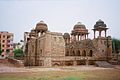
The Adham Khan's Tomb was constructed by Emperor Akbar in memory of his foster brother and general Adham Khan in 1566. The tomb, also known as Bhulbhulaiyan, as one could get lost in the labyrinth of its passages,[9] it was later used by the British as a residence, rest house and even as a police station. Close to Adham Khan's tomb, lies that of another Mughal General, Muhammad Quli Khan,[10] later it served as the residence of Sir Thomas Metcalfe, Governor-General’s Agent at the Mughal court.[9][11]
2008 blasts
Concealed in a black polythene bag, the bomb was dropped by two unidentified persons riding a motorcycle New Delhi, September 27, 2008. Exactly a fortnight after three of the Capital’s top markets were targeted by terrorists, a medium-intensity blast ripped through the congested flower market in South Delhi’s Mehrauli area killing at least two and injuring 22 others.
Accessibility
- I.G. International Airport is approximately 17 km.
- 18 km approximately from New Delhi Railway Stations
Areas under Meharauli
- Saket (Delhi)
- Malviya Nagar
- Khanpur New Delhi
- Ladosarai
Areas in South Delhi
- Greater Kailash
- Chanakyapuri
- Lajpat Nagar
- Mehrauli
- Nehru Place
- Safdarjung New Delhi
- South Extension
- Vasant Kunj
- Shahpur Jat
Historical architecture in Mehrauli
-

Tomb of Qutbuddin Bakhtiar Kaki, Mehrauli.
-

The tombs of Mughal Emperor, Shah Alam II and his son Akbar II within Kaki mausoleum complex
-

Madhi Masjid entrance gateway, Mehrauli.
-

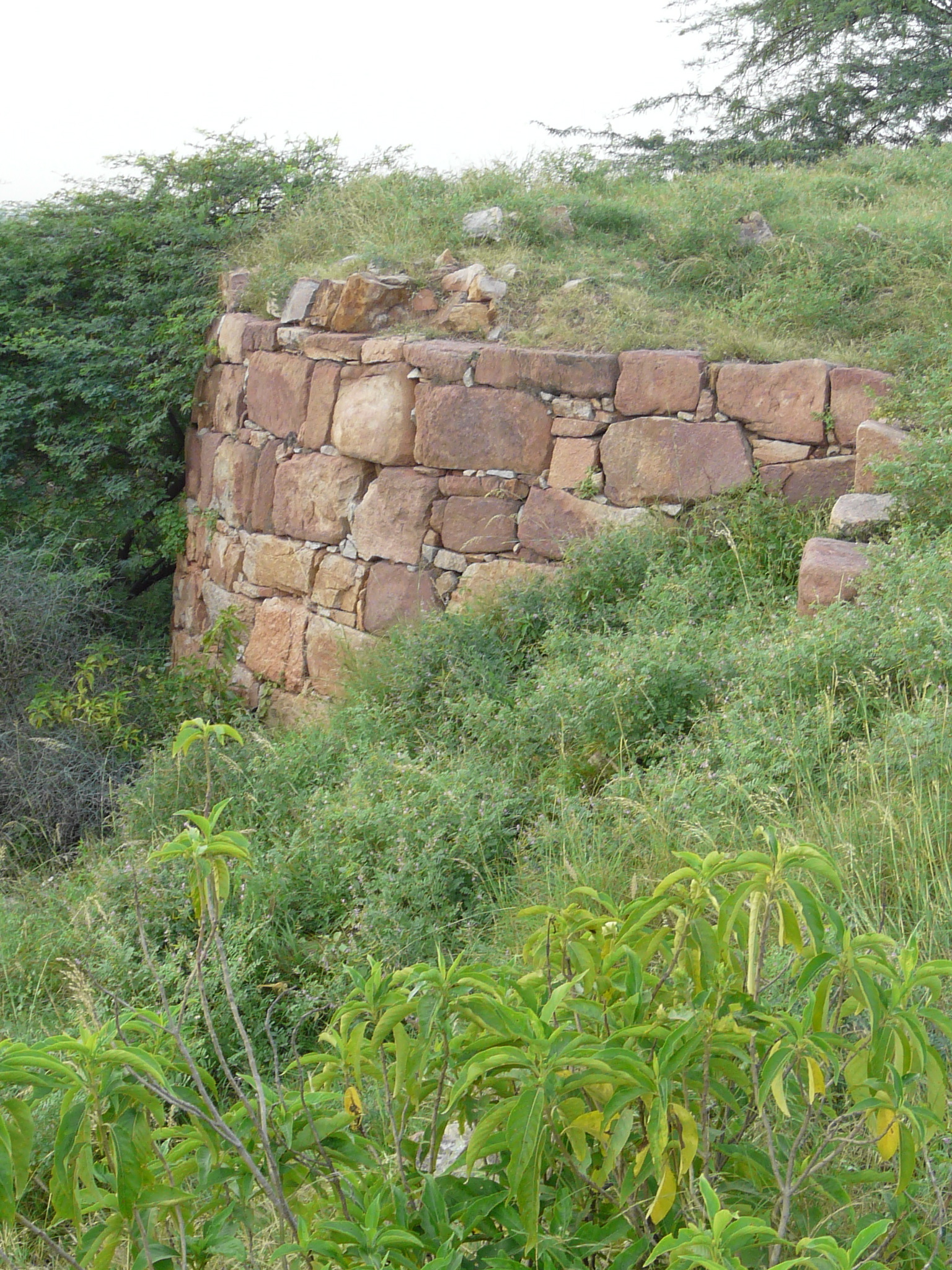
The bastion of Lal Kot fort, Mehrauli
-

Adham Khan's Tomb, Mehrauli.
-
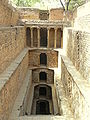
Gandhak ki Baoli, stepwell, Mehrauli.
-

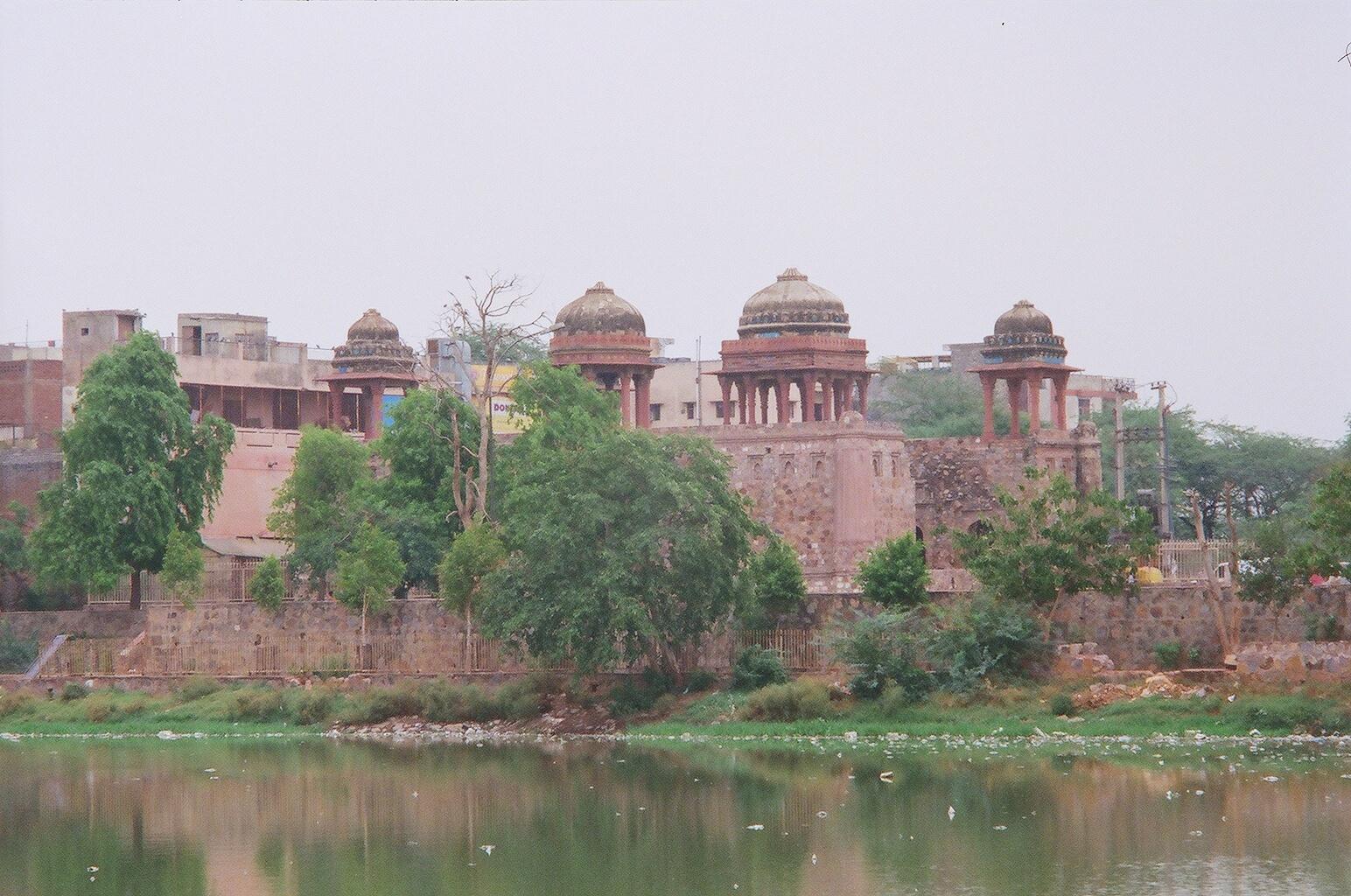
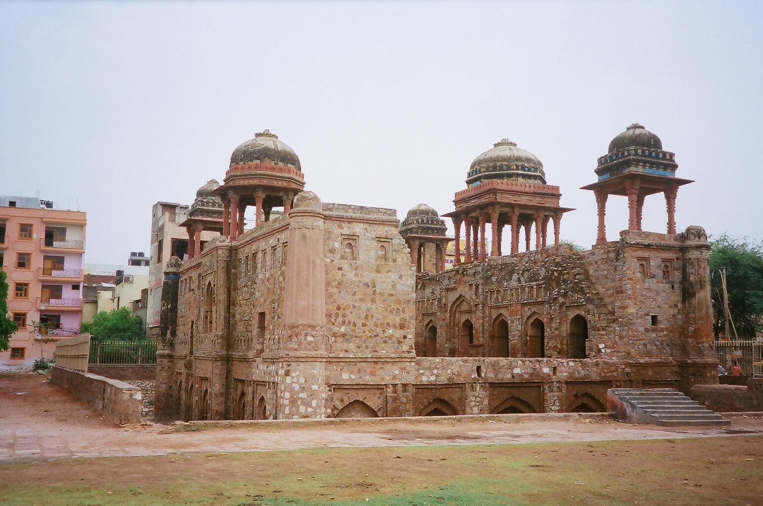
Zafar Mahal built first by Akbar Shah II in the 18th century with addition by Bahadur Shah Zafar II.
-

View of Jahaz Mahal from Hauz-i-Shamsi.
-
Bagichi Ki Masjid, Mehrauli Archeological Park
-

Rajon ki Baoli, stepwell
-
Jahaz Mahal on the bank of Hauz-i-Shamsi
-
Jamali Kamali tomb interior
-

Tomb of Mohammad Quli Khan, brother of Adham Khan, a general of Mughal Emperor, Akbar, later turned into a country house Metcalfe House or Dilkusha by Sir Thomas Metcalfe, near Qutb complex
See also
- Areas And Zones of New Delhi
References
- ^ Singh, Ganpati (1986). Gurjar veer virangnaen. New Embassy Press. p. 216.
- ^ a b A. F. Rudolf Hoernle. Some Problems of Ancient Indian History. No. III: The Gurjara Clans(Concluded from p. 662, October, 1904). Royal Asiatic Society of Great Britain and Ireland. JSTOR 25208724. "Both this "leader" and the "lord" Rudrena must have been chiefs of minor divisions of the imperial Tomara clan of Gurjaras."
- ^ a b "Seven Cities Of Delhi: Mehrauli". Government of Delhi Official website. http://delhigovt.nic.in/dept/prj/visitor/city.asp?opt=2. Retrieved September 16, 2006.
- ^ Yogmaya Temple
- ^ "Rainwater level in Delhi". http://www.rainwaterharvesting.org/index_files/pt_gadipur.htm. Retrieved September 15, 2006.
- ^ "Article on Delhigate.com". http://www.delhigate.com/qt_index.htm. Retrieved September 16, 2006.
- ^ "UNESCO website". http://whc.unesco.org/en/list/233. Retrieved September 16, 2006.
- ^ Jamali Kamali Indira Gandhi National Centre for the Arts.
- ^ a b Qutub Complex www.the-south-asian.com.
- ^ Tomb of Muhammad Quli Khan - Images
- ^ The tomb of Muhammad Quli Khan, brother of Adham Khan,.. British Library.
Further reading
- All About Delhi Delhi, the Capital of India, by Anon. Asian Educational Services, 1997. ISBN 8120612825.
External links
- Collection of Photographs Capturing Mehrauli's Diversity
- Travel Article on Mehrauli Archeological Park
Categories:- Neighbourhoods of Delhi
- Mamluk Sultanate (Delhi)
- Mehrauli
- South West Delhi district


Wikimedia Foundation. 2010.