- Nova Iguaçu
-
- Not to be confused with Nova Iguaçu de Goiás.
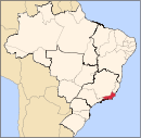
Nova Iguaçu — Municipality — The Municipality of Nova Iguaçu 
FlagLocation of Nova Iguaçu Location of Nova Iguaçu Coordinates: 22°45′32″S 43°27′03″W / 22.75889°S 43.45083°W Country  Brazil
Region Southeast State Rio de Janeiro Founded 15 January 1833 Government - Mayor Sheila Gama (PDT) Elevation 25 m (82 ft) Population (2006)[1][2] - Total 844,583 - Density 1,612.1/km2 (4,175.3/sq mi) Time zone UTC-3 (UTC-3) - Summer (DST) UTC-2 (UTC-2) Postal Code 26000-000 Area code(s) +55 21 Website www.novaiguacu.rj.gov.br Coordinates: 22°45′32″S 43°27′03″W / 22.75889°S 43.45083°W Nova Iguaçu (Portuguese pronunciation: [ˈnɔvɐ iɡwaˈsu], New Iguaçu) is a city in southeast Brazil in the Baixada Fluminense region of Rio de Janeiro state. It was the state's second largest city until Mesquita was split off, and now is the fourth largest after São Gonçalo and Duque de Caxias. It lies northwest of the city of Rio de Janeiro, on the limits of the metropolitan area. The current mayor is Sheila Gama (PDT). The city is the seat of the Roman Catholic Diocese of Nova Iguaçu.
Contents
Rail accidents
- On June 7, 1951 the city was the site of a level crossing disaster in which 54 people were killed when a train struck a gasoline truck.
- On 30 August 2007, two trains collided in the city, killing at least eight people.[3]
Sports
Nova Iguaçu Futebol Clube is an important football club from the city. Its estimated population is around 845,000 people. Nova Iguaçu, as a suburb of Rio, is under the influence of the capital; its people commute daily to Rio.
References
External links
- Via Iguassu - Cultura, laser, entretenimento, informação e Guia da cidade de Nova Iguaçu.
 Brazil
History First inhabitants · Colonization · Empire · Old Republic · Vargas Era · Second Republic · Military rule · ContemporaryGeography Regions · States · Mesoregions · Microregions · Municipalities · Islands · Coastline · Climate · Environment · Extreme points · Protected areas · CapitalsGovernment Constitution · Federal government · President · National Congress · Foreign relations · Law · Law enforcement · MilitaryPolitics Economy Society Demographics · People · Languages · Religion · Immigration · Education · Health · Crime · Social issues · Largest cities · ApartheidCulture  Category ·
  Portal ·
  WikiProject
Demographics of Brazil Economic and social Apartheid · Attractions · Law · Crime · Education · GDP · Health · Human Development · Human Rights (LGBT Rights) · Immigration · Languages · People · Politics · Poverty · Races · Religions · Traditions · Wealth
Ethnic groups BrazilAfricaAmericasNorth AmericaCaribbeanHaitianSouth AmericaBy EthnicityBy Country
or RegionEasternSouthernEast IndianWesternEuropeBy EthnicityBy Country
or RegionNorthernWesternCentralSouthernBalkanEastern50 largest cities of Brazil by population  Municipalities of Rio de Janeiro
Capital: Rio de Janeiro Mesoregion
BaixadasBacia de São JoãoLagos
Mesoregion
Centro FluminenseCantagalo-CordeiroNova FriburgoSanta Maria MadalenaTrês RiosMesoregion
Metropolitana do
Rio de JaneiroItaguaíMacacu-CaceribuMicroregion
Rio de JaneiroBelford Roxo · Duque de Caxias · Guapimirim · Itaboraí · Japeri · Magé · Maricá · Nilópolis · Niterói · Mesquita · Nova Iguaçu · Queimados · Rio de Janeiro · São Gonçalo · São João de Meriti · TanguáSerranaVassourasMesoregion
Noroeste FluminenseItaperunaSanto Antônio de PáduaMesoregion
Norte FluminenseCampos dos GoytacazesMacaéMesoregion
Sul FluminenseBaía da Ilha GrandeBarra do PiraíVale do Paraíba FluminenseBarra Mansa · Itatiaia · Pinheiral · Piraí · Porto Real · Quatis · Resende · Rio Claro · Volta RedondaCategories:- Municipalities of Brazil
- Populated places in Rio de Janeiro (state)
Wikimedia Foundation. 2010.


