- Campos dos Goytacazes
-
Coordinates: 21°45′14″S 41°19′26″W / 21.75389°S 41.32389°W
Campos — Municipality — The Municipality of
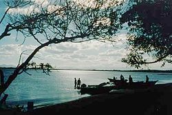
Campos dos GoytacazesLagoon in the city 
Flag
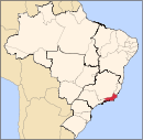
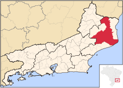
SealNickname(s): "The Capital of Oil and Sugar" Location of Campos in the State of Rio de Janeiro Location of Campos in the State of Rio de Janeiro Coordinates: 21°45′14″S 41°19′26″W / 21.75389°S 41.32389°W Country  Brazil
Region Southeast State  Rio de Janeiro
Founded March 28, 1835 Government – Mayor Rosinha Garotinho (PSB) Area – Total 4,032 km2 (1,556.8 sq mi) Elevation 14 m (46 ft) Population (2008) – Total 431,839 – Density 105/km2 (271.9/sq mi) Time zone UTC-3 Postal Code 28000-000 Area code(s) +55 22 Website Campos, Rio de Janeiro Campos dos Goytacazes (Portuguese pronunciation: [ˈkɐ̃puʒ duʒ gojtaˈkaziʃ]) is a municipality and city located in the northern area of Rio de Janeiro State, Brazil, with a population of 431,839 inhabitants. Its area is 4,031.910 km², which makes it the largest municipality in the state and its elevation is 14 m. Its name comes from the geographical characteristic of the region, very flat with fields (campos in Portuguese) and from the Goytacazes Indians, that inhabited the region. Campos, as the city is usually known, is a macro region of the Northern Fluminense, and is a micro region of Campos dos Goytacazes. The city has a tropical climate.
The colonization of the area started in the 16th century, and on May 29, 1677 was created the São Salvador de Campos de Goytacazes village. On March 28, 1835 the village was promoted to city status.
The city's distance to Rio de Janeiro city, which is the capital of the state, is 286 km, and the BR-101 is the access highway of the city of Campos. Regular air services are operated from its airport Bartolomeu Lysandro. It is the easternmost municipality in Rio de Janeiro.
The Roman Catholic Diocese of Campos was the see of Bishop Antônio de Castro Mayer, nicknamed "The Lion of Campos", who was one of the bishops who opposed the Vatican II reforms and who teamed with Archbishop Marcel Lefebvre of Dakar to consecrate four independent bishops in Econe, Switzerland, 1991. Nowadays there are in Campos two Roman Catholic jurisdictions: a Diocese, whose Bishop is Monsignor Roberto Gomes Guimarães and the Personal Apostolic Administration of Saint John Mary Vianney, whose Apostolic Administrator is Monsignor Fernando Areas Rifan.
Contents
Economy
The GDP for the city was R$ 16,116,180,000 (2005).[1]
The per capita income for the city was R$ 37,813 (2005).[2]
Education
Portuguese language is the official national language, and thus the primary language taught in schools. But English and Spanish are part of the official high school curriculum.
Educational institutions
- Universidade Estadual do Norte Fluminense;
- Universidade Cândido Mendes;
- Universidade Federal Rural do Rio de Janeiro;
- Faculdade de Medicina de Campos;
- Faculdade de Direito de Campos;
- Faculdade de Odontologia Campos;
- IF Fluminense (former CEFET Campos);
- Universidade Federal Fluminense;
- Universidade Salgado de Oliveira;
- Universidade Estácio de Sá;
- Faculdade Batista Fluminense;
- Ise-Censa;
- Unigranrio;
Sports
There are at least three football clubs in the city: Americano Futebol Clube, Goytacaz Futebol Clube and Clube Esportivo Rio Branco. The derby between Americano and Goytacaz is known as Goyta-cano.
External links
References
- ^ (in Portuguese) (PDF) GDP. Campos, Brazil: IBGE. 2005. ISBN 85-240-3919-1. http://www.ibge.gov.br/home/estatistica/economia/pibmunicipios/2005/tab01.pdf. Retrieved 2007-07-18.
- ^ (in Portuguese) (PDF) per capita income. Campos, Brazil: IBGE. 2005. ISBN 85-240-3919-1. http://www.ibge.gov.br/home/estatistica/economia/pibmunicipios/2005/tab01.pdf. Retrieved 2007-07-18.
 Brazil
History First inhabitants · Colonization · Empire · Old Republic · Vargas Era · Second Republic · Military rule · ContemporaryGeography Regions · States · Mesoregions · Microregions · Municipalities · Islands · Coastline · Climate · Environment · Extreme points · Protected areas · CapitalsGovernment Constitution · Federal government · President · National Congress · Foreign relations · Law · Law enforcement · MilitaryPolitics Economy Society Demographics · People · Languages · Religion · Immigration · Education · Health · Crime · Social issues · Largest cities · ApartheidCulture Demographics of Brazil Economic and social Apartheid · Attractions · Law · Crime · Education · GDP · Health · Human Development · Human Rights (LGBT Rights) · Immigration · Languages · People · Politics · Poverty · Races · Religions · Traditions · Wealth
Ethnic groups BrazilAfricaAmericasNorth AmericaCaribbeanHaitianSouth AmericaBy EthnicityBy Country
or RegionEasternSouthernEast IndianWesternEuropeBy EthnicityBy Country
or RegionNorthernWesternCentralSouthernBalkanEastern50 largest cities of Brazil by population - Niterói
- São João de Meriti
- Aparecida de Goiânia
- Campos dos Goytacazes
- Santos
- São José do Rio Preto
- Mauá
- Caxias do Sul
- Betim
- Vila Velha
 Municipalities of Rio de JaneiroCapital: Rio de Janeiro
Mesoregion
BaixadasBacia de São JoãoLagos
Mesoregion
Centro FluminenseCantagalo-CordeiroNova FriburgoSanta Maria MadalenaTrês RiosMesoregion
Metropolitana do
Rio de JaneiroItaguaíMacacu-CaceribuMicroregion
Rio de JaneiroBelford Roxo · Duque de Caxias · Guapimirim · Itaboraí · Japeri · Magé · Maricá · Nilópolis · Niterói · Mesquita · Nova Iguaçu · Queimados · Rio de Janeiro · São Gonçalo · São João de Meriti · TanguáSerranaVassourasMesoregion
Noroeste FluminenseItaperunaSanto Antônio de PáduaMesoregion
Norte FluminenseCampos dos GoytacazesCampos dos Goytacazes · Cardoso Moreira · São Fidélis · São Francisco de Itabapoana · São João da BarraMacaéMesoregion
Sul FluminenseBaía da Ilha GrandeBarra do PiraíVale do Paraíba FluminenseBarra Mansa · Itatiaia · Pinheiral · Piraí · Porto Real · Quatis · Resende · Rio Claro · Volta RedondaCategories:- Municipalities of Brazil
- Populated coastal places in Rio de Janeiro (state)
- Priestly Society of Saint John Mary Vianney
- Populated places established in 1835
Wikimedia Foundation. 2010.


