- Santo André, São Paulo
infobox City
official_name = Santo André
motto = Paulistarum Terra Mater (Latin: Motherland of Paulistians)
image_shield = Brasão_Santo_André.gif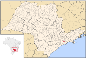
mapsize = 250px
map_caption = Location of Santo André
subdivision_type = Country
subdivision_type1 = Region
subdivision_type2 = State
subdivision_name = flag|Brazil
subdivision_name1 = Southeast
subdivision_name2 = flag|São Paulo
leader_title =Mayor
leader_name = João Avamileno (PT)
area_total_km2 = 175
area_magnitute =
population_as_of = 2007
population_footnotes = cite web|url=http://www.ibge.gov.br/home/estatistica/populacao/contagem2007/popmunic2007layoutTCU14112007.xls|title=Estimativas - Contagem da População 2007|publisher = IBGE|accessdate=2008-07-11]
population_total = 667891
population_density_km2 = 3816.52
elevation_m = 700
timezone =UTC-3
utc_offset = -3
timezone_DST =UTC-2
utc_offset_DST = -2
latd=23 |latm=39 |lats=26 |latNS=S
longd=46 |longm=32 |longs=00 |longEW=WThe city of Santo André (Portuguese for
Saint Andrew ), on theTamanduateí River , is in São Paulo State, 18 km away from the São Paulo city, in the most industrialized region ofBrazil . It is known as a core part of theABC region (A = Santo André, B =São Bernardo do Campo , C =São Caetano do Sul ).The settlement, which became a town in 1553, experienced rapid growth beginning in the 1930s. Industries include chemical engineering, textiles, oil, metal products, metallurgy and printed materials. It is an industrial city, but more than 60% of Santo André's total area are protected by water law.
In 1910 it became accessed with a railway named the
São Paulo Railway Co. or theEstrada de Ferro Santos Jundiaí . In 1954, it became the seat of theRoman Catholic Diocese of Santo André .In 2002 the city shot to national prominence with the assassination of serving mayor
Celso Daniel , the case of which remains unsolved.Districts
* Distrito Sede - Santo André
*Paranapiacaba
* Distrito de Utinga - Santo André
* Distrito de Capuava - Santo Andréports
Soccer
* Soccer Team -Esporte Clube Santo André , the football (soccer ) team of the city.
* City Stadium - Estádio Bruno José Daniel - Capacity: 15.157 Titles:Brazilian National Cup Champion in 2004, beatingFlamengo in final game atMaracana Stadium with more than 80,000 fans against. Paulista 2nd Division Champions in 1967, 1975, 1981 and 2008.Copa Estado de São Paulo 2003Copa São Paulo Under-20 2002* (
Pelé ) scored his first professional goal ever at Corinthians Futebol Clube Satadium in Santo AndreVolleyball
* Men's Volleyball Team - Pirelli Volleyball Club - Men's World Club Champion in 1984. Actually the team's name is Shopping ABC Santo AndréBasketball
* Men's Basketball Team - Pinheiros Santo André - Plays Paulista League of BasketballOther Sports
* Boxing - Hosts national olympic team at Pedro Dell'Antonia Gymnasium facilities.
ister Cities
Santo André has city partnerships with the following cities:
*flagicon|United StatesBattle Creek ,Michigan ,United States
*flagicon|People's Republic of ChinaChengde , thePeople's Republic of China
*flagicon|Czech RepublicPilsen ,Czech Republic
*flagicon|ItalySesto San Giovanni ,Italy
*flagicon|JapanTakasaki ,Japan Famous people from Santo André
*
Lucélia Santos
*Diego Hypólito
*Daniele Hypólito
*Marcelo Takashima References
External links
* [http://www.santoandre.sp.gov.br/ Santo André City Hall]
Geographic Location
Centre = Santo André
North =São Paulo
Northeast =Mauá ,Ribeirão Pires ,Rio Grande da Serra andSuzano
East =Mogi das Cruzes
Southeast =Cubatão and Santos
South = Santos
Southwest =São Bernardo do Campo
West =São Caetano do Sul
Northwest =São Caetano do Sul

Wikimedia Foundation. 2010.