- Mangaratiba
-
Coordinates: 22°57′36″S 44°02′27″W / 22.96°S 44.04083°W
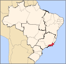
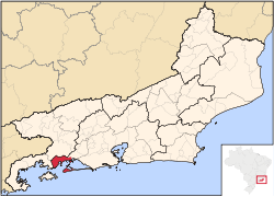
Mangaratiba (Portuguese pronunciation: [mɐ̃ˌgaɾaˈtʃibɐ]) is a municipality located in the Brazilian state of Rio de Janeiro. Its population is 29,272 (2005) and its area is 352 km².[1]
Muddy beaches and the incongruous industrial presence of the Terminal de Sepetiba put off many people stopping at Mangaratiba. The town setting is attractive, with a mountain backdrop, a beautiful bay in front with fishing boats at anchor and a late eighteenth-century church dominating the main square. Its most important boroughs are Muriqui, Ibicuí and Itacuruçá.
Many large bulk carriers enter the port of Mangaratiba, fetching heavy loads of iron ore bound for especially European ports. As such, the port of Mangaratiba is one of the largest in Brazil.
References
 Municipalities of Rio de Janeiro
Capital: Rio de Janeiro Mesoregion
BaixadasBacia de São JoãoLagos
Mesoregion
Centro FluminenseCantagalo-CordeiroNova FriburgoSanta Maria MadalenaTrês RiosMesoregion
Metropolitana do
Rio de JaneiroItaguaíMacacu-CaceribuMicroregion
Rio de JaneiroBelford Roxo · Duque de Caxias · Guapimirim · Itaboraí · Japeri · Magé · Maricá · Nilópolis · Niterói · Mesquita · Nova Iguaçu · Queimados · Rio de Janeiro · São Gonçalo · São João de Meriti · TanguáSerranaVassourasMesoregion
Noroeste FluminenseItaperunaSanto Antônio de PáduaMesoregion
Norte FluminenseCampos dos GoytacazesMacaéMesoregion
Sul FluminenseBaía da Ilha GrandeBarra do PiraíVale do Paraíba FluminenseBarra Mansa · Itatiaia · Pinheiral · Piraí · Porto Real · Quatis · Resende · Rio Claro · Volta RedondaCategories:- Rio de Janeiro (state) geography stubs
- Populated places in Rio de Janeiro (state)
- Municipalities of Brazil
Wikimedia Foundation. 2010.

