- Neder-Betuwe
-
Neder-Betuwe — Municipality — 
Flag
Coat of arms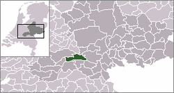
Coordinates: 51°56′N 5°38′E / 51.933°N 5.633°ECoordinates: 51°56′N 5°38′E / 51.933°N 5.633°E Country Netherlands Province Gelderland Area(2006) - Total 68.11 km2 (26.3 sq mi) - Land 61.12 km2 (23.6 sq mi) - Water 6.99 km2 (2.7 sq mi) Population (1 January, 2007) - Total 22,306 - Density 365/km2 (945.3/sq mi) Source: CBS, Statline. Time zone CET (UTC+1) - Summer (DST) CEST (UTC+2)  Neder-Betuwe is a municipality in the eastern Netherlands.
Contents
Geography
The municipal boundaries are for a large part defined by the river Waal to the south, the river Rhine to the North and the Amsterdam-Rhine Canal to the west. Because of the location between the two rivers the area is as narrow as 3 km near Opheusden. The area is basically a polder, dikes protect the former floodplain from flooding. Since it was a floodplain the area is relatively flat and the soil is mainly clay with layers of sand and gravel underneath.
Culture and history
Archaeological excavations have found remains dating back to the stone age and Iron Age although it is not known if the area was permanently inhabited. The Neder-Betuwe area is along the northernmost border or Limes of the Roman empire. Evidence suggests that a Roman fort (Castra) was maintained where the town of Kesteren now is. Around 1300 the first dikes were put up to protect the inhabitants and agricultural lands from flooding.
Most churches are reformed, there are no Catholic churches in the Neder-Betuwe area. The eastern municipal border also marks an invisible religious border, to the east a considerable part of the population is Catholic. This can be explained by the presence of a dike called the Spanjaardsdijk or Spaniards Dike which was built before or during the Eighty Years' War. The local ruler was Protestant, the rulers to the east were Catholic.
During World War II the area saw a lot of fighting. During the German invasion in May 1940 the area was attacked since it was on the southern flank of the attack towards the Grebbeberg. In September 1944 the area again came under fire during and after operation Market Garden. The narrowest part of the Betuwe became the western front of the allied bridgehead in the area. Opheusden was basically ruined because of the constant fighting between the Germans an de 101st Airborne Division and later British forces and the 1st Belgian Infantry Brigade. Ochten was flattened by British forces using artillery and mortars from south of the Waal.
Transport
The highway A15 runs east to west through Neder-Betuwe. A provincial road crosses the Rhine near Kesteren and another provincial road crosses the Waal near Echteld. A railway line through the area was built in 1882, connecting Geldermalsen and Amersfoort to Nijmegen. A new dedicated freight railway line called the Betuweroute was opened on June 16, 2007. This line connects the port of Rotterdam to Germany and beyond. A ferry operates a service across the Rhine between Opheusden and Wageningen. During summer months a small ferry transports people between Dodewaard and Druten, mainly tourists, across the river Waal as part of several recreational bicycle routes.
Economy
The local economy runs mostly on agriculture (fruit plantations and tree nurseries) and some factories. The economy blossomed after the completion of the railway line through the area making it possible to transport fresh fruit. A considerable part of the local population works outside the municipal boundaries.
Disused powerplant
In Dodewaard a nuclear power plant with a boiling water reactor has been decommissioned. It was operational in the period 1968-1997. It had a capacity of 58 MW. In 2003 the last fissionable material was removed. Parts of the plant were demolished, the main building is in a 40-year waiting period of "safe enclosure" from 2005-2045, before being demolished. The main source of radioactivity is cobalt-60 with a half-life of 5.27 years, hence it is reduced by a factor 193 in 40 years. Waiting longer is not as effective, since at that time the main source of radioactivity will become nickel-63 with a half-life of 100.1 years.
The spent uranium and the uranium left when operation was discontinued were transported to BNFL in Sellafield for nuclear reprocessing.
See also nuclear reactors in the Netherlands.
Evacuation
In February 1995 Ochten received international media attention because of a weakened dike after a prolonged period of high waterlevels in the rivers. This situation and the state of other dikes forced 250,000 people in this region to evacuate. The riverlevels had been unusually high for almost two months, reaching record heights during the first days of February. Although the dike started to shift a huge rescue operation managed to stabilise the dike. Several months later the already planned strengthening of the dike started with almost no opposition. Some people who opposed the strengthening before the evacuation, mainly because of NIMBYism, were harassed by some locals.
Population centres
Dodewaard, Echteld, IJzendoorn, Kesteren, Ochten and Opheusden.
External links
- Official Website
- Nuclear power plant (in Dutch)
Aalten · Apeldoorn · Arnhem · Barneveld · Berkelland · Beuningen · Brummen · Bronckhorst · Buren · Culemborg · Doesburg · Doetinchem · Druten · Duiven · Ede · Elburg · Epe · Ermelo · Geldermalsen · Groesbeek · Harderwijk · Hattem · Heerde · Heumen · Lingewaal · Lingewaard · Lochem · Maasdriel · Millingen aan de Rijn · Montferland · Neder-Betuwe · Neerijnen · Nijkerk · Nijmegen · Nunspeet · Oldebroek · Oost Gelre · Oude IJsselstreek · Overbetuwe · Putten · Renkum · Rheden · Rijnwaarden · Rozendaal · Scherpenzeel · Tiel · Ubbergen · Voorst · Wageningen · West Maas en Waal · Westervoort · Wijchen · Winterswijk · Zaltbommel · Zevenaar · Zutphen

See also: Netherlands · Provinces · Municipalities Categories:- Municipalities of Gelderland


Wikimedia Foundation. 2010.