Maasdriel

Maasdriel

Infobox Settlement
official_name = Maasdriel
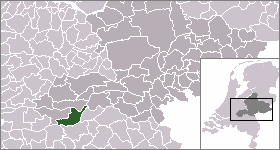


mapsize = 280px
subdivision_type = Country
subdivision_name = Netherlands
subdivision_type1 = Province
subdivision_name1 = Gelderland
area_footnotes = (2006)
area_total_km2 = 75.49
area_land_km2 = 66.27
area_water_km2 = 9.22
population_as_of = 1 January, 2007
population_note = Source: CBS, [http://statline.cbs.nl/ Statline] .
settlement_type = Municipality
population_total = 23502
population_density_km2 = 355
timezone = CET
utc_offset = +1
timezone_DST = CEST
utc_offset_DST = +2

.

Population centres

Alem, Ammerzoden, Hedel, Heerewaarden, Hoenzadriel, Hurwenen, Kerkdriel, Rossum, Velddriel, Well & Wellseind and the small settlement of Wordragen.

Maasdriel was formed on the 1. January, 1999 by the merger of the former municipalities of Ammerzoden (including Well, Wellseind en Wordragen), Hedel, Heerewaarden, Maasdriel (Alem, Hoenzadriel, Kerkdriel and Velddriel) and Rossum (including Hurwenen). The former municipality of Maasdriel was called "Driel" before 1944. [Ad van der Meer and Onno Boonstra, "Repertorium van Nederlandse gemeenten", KNAW, 2006. [http://www.knaw.nl/cfdata/publicaties/detail.cfm?boeken__ordernr=20061061] ]

References

External links

* [http://www.maasdriel.nl Official website municipality]
* [http://www.paardenmarkt.info Horse market Hedel official website]
* [http://www.hedel.info Website of Hedel]
* [http://www.Hedel.nu Website about Hedel]


Wikimedia Foundation. 2010.

Игры ⚽ Нужно сделать НИР?

Look at other dictionaries:

  • Maasdriel — Héraldique …   Wikipédia en Français

  • Maasdriel — Gemeinde Maasdriel Flagge Wappen Provinz …   Deutsch Wikipedia

  • Gemeente Maasdriel — Admin ASC 2 Code Orig. name Gemeente Maasdriel Country and Admin Code NL.03.0263 NL …   World countries Adminstrative division ASC I-II

  • Liste der ehemaligen Gemeinden in der Provinz Gelderland — Hierunter folgt eine Liste der ehemaligen gelderschen Gemeinden. Wenn das Gebiet einer aufgehobenen Gemeinde über mehrere Gemeinden verteilt worden ist, ist das Großteil der erstgenannten Gemeinde hinzugefügt. Grenzkorrekturen zwischen erhaltenen …   Deutsch Wikipedia

  • Liste der ehemaligen Gemeinden in Gelderland — Hierunter folgt eine Liste der ehemaligen gelderschen Gemeinden. Wenn das Gebiet einer aufgehobenen Gemeinde über mehrere Gemeinden verteilt worden ist, ist das Großteil der erstgenannten Gemeinde hinzugefügt. Grenzkorrekturen zwischen erhaltenen …   Deutsch Wikipedia

  • Alem — 51° 47′ 13″ N 5° 20′ 37″ E / 51.7869, 5.34361 …   Wikipédia en Français

  • Ammerzoden — 51° 45′ 00″ N 5° 13′ 00″ E / 51.75, 5.21666667 …   Wikipédia en Français

  • Hedel — 51° 44′ 48″ N 5° 15′ 33″ E / 51.7467, 5.25917 …   Wikipédia en Français

  • Heerewaarden — 51°49′4″N 5°23′30″E / 51.81778, 5.39167 …   Wikipédia en Français

  • Hurwenen — 51° 48′ 38″ N 5° 19′ 04″ E / 51.8106, 5.31778 …   Wikipédia en Français

Share the article and excerpts

Direct link
Do a right-click on the link above
and select “Copy Link”