Lingewaard

Lingewaard

Infobox Settlement
official_name = Lingewaard
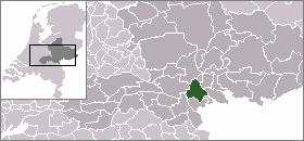

mapsize = 280px
subdivision_type = Country
subdivision_name = Netherlands
subdivision_type1 = Province
subdivision_name1 = Gelderland
area_footnotes = (2006)
area_total_km2 = 69.18
area_land_km2 = 62.72
area_water_km2 = 6.46
population_as_of = 1 January, 2007
population_note = Source: CBS, [http://statline.cbs.nl/ Statline] .
settlement_type = Municipality
mayor = Harry de Vries
population_total = 44363
population_density_km2 = 707
timezone = CET
utc_offset = +1
timezone_DST = CEST
utc_offset_DST = +2

. The municipality was initially named Bemmel but later renamed.

The municipality has the following population centres:

* Angeren
* Bemmel
* Doornenburg
* Gendt
* Haalderen
* Huissen
* Ressen

"Lingewaard" itself is not the name of one of them. The municipality lies in the proximity of Arnhem, Nijmegen and Elst, where most inhabitants work. The largest of the population centres is the town of Huissen.

External links

* [http://www.lingewaard.nl Official website]
* [http://www.bemmel.com alternative website]
* [http://geodata.prv.gelderland.nl/scripts/esrimap.dll?Name=Zakgeld2&Scherm=Gemeente&Frames=Yes&Cmd=Thema&Gemeente=Lingewaard Map and data]


Wikimedia Foundation. 2010.

Игры ⚽ Поможем написать курсовую

Look at other dictionaries:

  • Lingewaard — Héraldique …   Wikipédia en Français

  • Lingewaard — Gemeinde Lingewaard Flagge Wappen Provinz …   Deutsch Wikipedia

  • Gemeente Lingewaard — Admin ASC 2 Code Orig. name Gemeente Lingewaard Country and Admin Code NL.03.1705 NL …   World countries Adminstrative division ASC I-II

  • Bemmel (Pays-Bas) — 51°53′30″N 5°53′43″E / 51.89167, 5.89528 …   Wikipédia en Français

  • Gendt — 51°52′37″N 5°58′21″E / 51.87694, 5.9725 Pour la ville belge, voir Gand …   Wikipédia en Français

  • Huissen — 51°56′12″N 5°56′28″E / 51.93667, 5.94111 …   Wikipédia en Français

  • Liste der ehemaligen Gemeinden in der Provinz Gelderland — Hierunter folgt eine Liste der ehemaligen gelderschen Gemeinden. Wenn das Gebiet einer aufgehobenen Gemeinde über mehrere Gemeinden verteilt worden ist, ist das Großteil der erstgenannten Gemeinde hinzugefügt. Grenzkorrekturen zwischen erhaltenen …   Deutsch Wikipedia

  • Angeren — 51°54′56″N 5°57′29″E / 51.91556, 5.95806 …   Wikipédia en Français

  • Doornenburg — 51°53′18″N 5°59′57″E / 51.88833, 5.99917 …   Wikipédia en Français

  • Haalderen — 51°53′12″N 5°55′48″E / 51.88667, 5.93 …   Wikipédia en Français

Share the article and excerpts

Direct link
Do a right-click on the link above
and select “Copy Link”