- Groesbeek
Infobox Settlement
official_name = Groesbeek
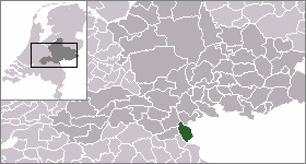
mapsize = 280px
subdivision_type = Country
subdivision_name =Netherlands
subdivision_type1 = Province
subdivision_name1 =Gelderland
area_footnotes = (2006)
area_total_km2 = 44.12
area_land_km2 = 44.12
area_water_km2 = 0.00
population_as_of =1 January ,2007
population_note = Source: CBS, [http://statline.cbs.nl/ Statline] .
settlement_type = Municipality
population_total = 18929
population_density_km2 = 429
timezone = CET
utc_offset = +1
timezone_DST = CEST
utc_offset_DST = +2.
Description
Groesbeek is named after a small stream called the Groesbeek, (beek means stream or burn in Dutch) which in it's original form doesn't exist anymore. Hills and forests surround the town, and, because of this, Groesbeek was isolated in the past, with a close community and a strong dialect.
Geography
Groesbeek and
Kranenburg are situated on the banks of the Groesbeek, a small stream in the Groesbeek valley, a large valley between theNijmeegse heuvelrug andReichswald . The Groesbeek valley was carved out by glaciers during the Saale glacial, marking the southernmost expansion of ice-age glaciers in the Netherlands. The hills surrounding the valley in which Groesbeek lies are technically the terminal moraines of those glaciers, but in contrast to the hills in the central and eastern Netherlands, these hills are rising by 0.5-0.8 mm/year due totectonic uplift .Due to this, the topography is much more varied here than in other higher grounds with similar origins in the Netherlands.Finally, during theYounger Dryas stadial, large amounts ofloess were deposited in the valley, making it extremely fertile, while the hills around it are composed to this day of sandy loam unsuitable for intensive agriculture, so that the area has been covered with thick forests to this day. This contributed to the isolation of the area, especially considering the extent of the forests in the middle ages was much larger than today. The isolation of the valley was only alleviated by the arrival of the railway in 1865 and finally lifted in theinterbellum by the contruction of a high capacity paved road to nearbyNijmegen .World War Two
During
Operation Market Garden the82nd Airborne Division landed near Groesbeek. In the subsequent fighting the town was nearly completely destroyed and inhabitants were evacuated. The National Liberation museum is based in Groesbeek on one of the landing sites of operation Market Garden, and there is also a Canadian war cemetery.Modern Groesbeek
Because of much better infrastructure and a generally increased amount of mobility among the Dutch after WW2, modern Groesbeek has transformed from a small village dependent on agriculture and forestry into a sprawling commuter town of nearby Nijmegen. The town itself is surrounded by hills and forests, including a three-kilometre wide band of woodlands,
Dekkerswald , separating it fromHeilig Landstichting and Nijmegen proper. In the last decade aviniculture industry has sprung up in Groesbeek, making the area the northernmost vinicultural centre in Europe, and the only such area in the Netherlands, owing to the highly fertile loess soil, generally warmer summers, and new variations of grapes which do better in the humid climate. Because of continued urban sprawl into the agricultural valley of Groesbeek, leaving less and less land available for traditional agriculture, viniculture could very well be the future for agriculture among the edges of the Groesbeek valley.Groesbeek is also well known in the Netherlands for its soccer teams, and despite having under 20,000 inhabitants, had three clubs playing at the highest amateur level (
De Treffers , "Germania" and "Achilles'29") for 2 seasons. There are also 3 other football teams named: D.V.S.G., Groesbeekse boys and Rood-Wit, and this is apparently so exceptional it has been featured both on Dutch national television (NOS) and in a big Dutch magazine (Panorama).In Groesbeek there is also a dirtbike circuit called den Hoek. This circuit is in use by the motor and moped club named MBC de Zevenheuvelen (the seven hills). In the year 2007 there are more than 200 active members. Through the past years a several national stars had rised from the Groesbeek dirtbike soil.
The town is also well known as the setting of the third day of the Nijmeegse Vierdaagse when walkers participating in this international event have to pass through the town and the surrounding hills.
Another thing Groesbeek is famous for is that it has one of the biggest parade in the Netherlands on the Sunday of the Catholic carnival. Because of its huge success places are now going to be limited as the parade is getting too big.
In the area
The town has three notable museums: the
Africa Museum , theNational Liberation Museum and theBible Open Air Museum . The Groesbeek Canadian War Cemetery and Memorial is located about two kilometers north of the town.Population centres
*
Berg en Dal - Partly inUbbergen municipality
*Breedeweg
*De Horst
*Groesbeek
*Heilig Landstichting -De facto neighbourhood ofNijmegen
*Wyler - Mostly inKranenburg municipality
*Grafwegen - Mostly inKranenburg municipalityExternal links
* [http://www.groesbeek.nl Official Website]
* [http://www.vvv-groesbeek.info Groesbeek a beautiful small tourist village- Website made by Michel Janssen]

Wikimedia Foundation. 2010.