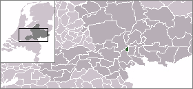
Westervoort

Westervoort

Infobox Settlement
official_name = Westervoort


mapsize = 280px
subdivision_type = Country
subdivision_name = Netherlands
subdivision_type1 = Province
subdivision_name1 = Gelderland
area_footnotes = (2006)
area_total_km2 = 7.84
area_land_km2 = 7.11
area_water_km2 = 0.74
population_as_of = 1 January, 2007
population_note = Source: CBS, [http://statline.cbs.nl/ Statline] .
settlement_type = Municipality
population_total = 15605
population_density_km2 = 2195
timezone = CET
utc_offset = +1
timezone_DST = CEST
utc_offset_DST = +2

river, the east bank being occupied by Westervoort.

Transport

While a railroad runs straight through the town, there is no railway station in Westervoort. There used to be a station in Westervoort from February 15, 1856 to October 4, 1936. There are plans to build a new one though, which would significantly reduce travel times for those travelling with the public transport. The new station will probably open in 2009. For now, public buses run through Westervoort, with direct connections to Arnhem, Duiven and Zevenaar. The A12 highway runs north of Westervoort and has an exit serving both Westervoort and the western parts of Duiven.

People born in Westervoort

* Theo Snelders (born 1963), football goalkeeper

External links

* [http://www.westervoort.nl Official website]
* [http://www.westervoortplaza.nl Westervoort Portal]


Wikimedia Foundation. 2010.

Игры ⚽ Поможем сделать НИР

Look at other dictionaries:

  • Westervoort — Héraldique …   Wikipédia en Français

  • Westervoort — Gemeinde Westervoort Flagge Wappen Provinz …   Deutsch Wikipedia

  • Westervoort — Original name in latin Westervoort Name in other language State code NL Continent/City Europe/Amsterdam longitude 51.95583 latitude 5.97222 altitude 11 Population 15976 Date 2007 06 03 …   Cities with a population over 1000 database

  • Westervoort — Sp Vèstervortas Ap Westervoort L Nyderlandai …   Pasaulio vietovardžiai. Internetinė duomenų bazė

  • Brücke bei Westervoort — 51.9691665.958611 Koordinaten: 51° 58′ 9″ N, 5° 57′ 31″ O f1 …   Deutsch Wikipedia

  • Gemeente Westervoort — Admin ASC 2 Code Orig. name Gemeente Westervoort Country and Admin Code NL.03.0293 NL …   World countries Adminstrative division ASC I-II

  • Geldersche Issel — Vorlage:Infobox Fluss/DGWK fehltVorlage:Infobox Fluss/QUELLHÖHE fehltKoordinaten fehlen! Hilf mit.Vorlage:Infobox Fluss/MÜNDUNGSHÖHE fehltVorlage:Infobox Fluss/HÖHENUNTERSCHIED fehltVorlage:Infobox Fluss/EINZUGSGEBIET fehltVorlage:Infobox… …   Deutsch Wikipedia

  • Ijssel — Vorlage:Infobox Fluss/DGWK fehltVorlage:Infobox Fluss/QUELLHÖHE fehltKoordinaten fehlen! Hilf mit.Vorlage:Infobox Fluss/MÜNDUNGSHÖHE fehltVorlage:Infobox Fluss/HÖHENUNTERSCHIED fehltVorlage:Infobox Fluss/EINZUGSGEBIET fehltVorlage:Infobox… …   Deutsch Wikipedia

  • Yssel — Vorlage:Infobox Fluss/DGWK fehltVorlage:Infobox Fluss/QUELLHÖHE fehltKoordinaten fehlen! Hilf mit.Vorlage:Infobox Fluss/MÜNDUNGSHÖHE fehltVorlage:Infobox Fluss/HÖHENUNTERSCHIED fehltVorlage:Infobox Fluss/EINZUGSGEBIET fehltVorlage:Infobox… …   Deutsch Wikipedia

  • IJssel — Vorlage:Infobox Fluss/DGWK fehltVorlage:Infobox Fluss/QUELLHÖHE fehltKoordinaten fehlen! Hilf mit.Vorlage:Infobox Fluss/MÜNDUNGSHÖHE fehltVorlage:Infobox Fluss/HÖHENUNTERSCHIED fehltVorlage:Infobox Fluss/EINZUGSGEBIET fehltVorlage:Infobox… …   Deutsch Wikipedia

Share the article and excerpts

Direct link
Do a right-click on the link above
and select “Copy Link”