- Oberroßbach
-
The title of this article contains the character ß. Where it is unavailable or not desired, the name may be represented as Oberrossbach.
Oberroßbach 

 OberroßbachLocation of Oberroßbach within Westerwaldkreis district
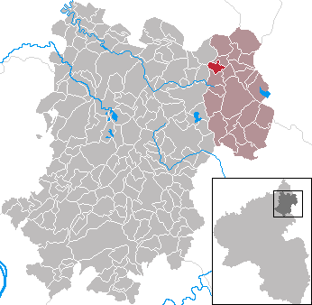
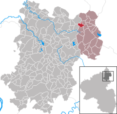
Coordinates 50°39′16″N 8°2′23″E / 50.65444°N 8.03972°ECoordinates: 50°39′16″N 8°2′23″E / 50.65444°N 8.03972°E Administration Country Germany State Rhineland-Palatinate District Westerwaldkreis Municipal assoc. Rennerod Mayor Jürgen Kramer Basic statistics Area 2.81 km2 (1.08 sq mi) Elevation 528 m (1732 ft) Population 335 (31 December 2010)[1] - Density 119 /km2 (309 /sq mi) Other information Time zone CET/CEST (UTC+1/+2) Licence plate WW Postal code 56479 Area code 02667 Website www.rennerod.de Oberroßbach is an Ortsgemeinde – a community belonging to a Verbandsgemeinde – in the Westerwaldkreis in Rhineland-Palatinate, Germany.
Contents
Geography
Location
The community lies in the High Westerwald between Siegen and Limburg an der Lahn. Through the community flows the Dorfbach. Near the community, and indeed at its original location, flows the actual Roßbach. Oberroßbach belongs to the Verbandsgemeinde of Rennerod, a kind of collective municipality. Its seat is in the like-named town.
Greater towns in the area are Siegen and Koblenz. The community’s highest point is Löh, also known as Hiesel.
Geology
In the 20th century, basalt was quarried in Oberroßbach. Until about 1970, the roadway was cobbled.
Neighbouring communities
Oberroßbach borders on Fehl-Ritzhausen, Zehnhausen, Niederroßbach, Hof and Salzburg.
Population
Almost all inhabitants follow the Evangelical faith. There are, however, also atheists, Catholics and members of the New Apostolic Church.
In 1819 there were 70 children (24% of the population) in school in Oberroßbach. In 1900, it was only 45, and after World War II, 36. When the school was dissolved in 1970, however, there were 61 children.
In 2007 and 2008, there was a great growth in population of 8.18%, due especially to the newly built housing estate.
Population development
Year 1643 1665 1741 1807 1819 1900 1945 2007 2008 6 65 92 175 283 183 256 342 356 History
In 1440, both places had their first documentary mention as Obern Rospach.
Politics
Community council
The council is made up of 8 council members who were elected in a majority vote in a municipal election on 13 June 2004.
Coat of arms
The blue bend in the community’s arms stands for the Roßbach, and the hexagonal columns refer to basalt quarrying’s former importance.
Culture and sightseeing
The continuation of Goethe’s tragic play Die natürliche Tochter was to have played in Oberroßbach, but this never came about.
Buildings
In Oberroßbach there are a village community house and a well out of which flows undrinkable water. There is the Ältsch Haus, and there are also a gliderport and a fire brigade equipment building.
Sport
In the village is a playing ground with a small sport ground. The clubs offer their respective sports.
Regular events
Clubs offer regular events. Each year there are festivals, among them the Battle Festival and the newly introduced Oktoberfest.
Clubs
In Oberroßbach there are a few clubs. Among them are the following:
- The Haareweißleu, a kind of tradition club that takes part in village festivals.
- The Oberroßbach Volunteer Fire Brigade, which likewise takes part in village festivals. Also belonging to it is the Oberroßbach Youth Volunteer Fire Brigade.
- The Gemeinschaft Oberroßbach e. V. , which was founded through a citizens’ initiative in 2005 (it is to be dissolved in 2008).
Economy and infrastructure
Transport
East of the community runs Bundesstraße 54, leading from Limburg an der Lahn to Siegen. The nearest Autobahn interchange is Haiger/Burbach on the A 45 (Dortmund–Aschaffenburg), some 15 km away. The nearest InterCityExpress stop is the train station at Montabaur on the Cologne–Frankfurt high-speed rail line.
Established businesses
There is in Oberroßbach Spedition Sahm, a rather large shipping business. There is also the Töpferei Höller, a ceramics works. As well, there is the Sahm galvanizing plant.
References
- ^ "Bevölkerung der Gemeinden am 31.12.2010" (in German). Statistisches Landesamt Rheinland-Pfalz. 31 December 2010. http://www.statistik.rlp.de/fileadmin/dokumente/berichte/A1033_201022_hj_G.pdf.
External links
- This article incorporates information from the German Wikipedia.
Categories:- Municipalities in Rhineland-Palatinate


Wikimedia Foundation. 2010.