- Mörlen
-
Mörlen 
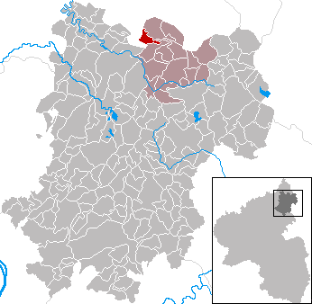
 MörlenLocation of Mörlen within Westerwaldkreis district
Coordinates 50°41′53″N 7°53′4″E / 50.69806°N 7.88444°ECoordinates: 50°41′53″N 7°53′4″E / 50.69806°N 7.88444°E Administration Country Germany State Rhineland-Palatinate District Westerwaldkreis Municipal assoc. Bad Marienberg (Westerwald) Mayor Thomas Ax Basic statistics Area 3.07 km2 (1.19 sq mi) Elevation 416 m (1365 ft) Population 565 (31 December 2010)[1] - Density 184 /km2 (477 /sq mi) Other information Time zone CET/CEST (UTC+1/+2) Licence plate WW Postal code 57583 Area code 02661 Website www.bad-marienberg.de Mörlen is an Ortsgemeinde – a community belonging to a Verbandsgemeinde – in the Westerwaldkreis in Rhineland-Palatinate, Germany.
Contents
Geography
Location
The community lies in the Westerwald between Limburg and Siegen on the boundary with North Rhine-Westphalia. The community lies in a hollow on a south slope on the course of the Kleine Nister, and is one of the richest communities in woodlands in the Westerwaldkreis. Mörlen belongs to the Verbandsgemeinde of Bad Marienberg, a kind of collective municipality. Its seat is in the like-named town.
History
Mörlen is among the oldest settled centres in the Upper Westerwald. While the brook name Nigra Morlaha had already been mentioned in writings from 914 and 1048, the actual community had its first documentary mention on 13 November 1262 in a document from the Marienstatt Abbey.
Politics
Community council
The council is made up of 12 council members who were elected in a majority vote in a municipal election on 13 June 2004.
Culture and sightseeing
Buildings
The community’s centrepiece is the Catholic parish church, Maria Empfängnis (“Immaculate Conception”). It was built in 1866 and expanded in 1882 and 1949. In 2003, it was fundamentally renovated.
Regular events
The first weekend in July is when the traditional kermis is always held.
Economy and infrastructure
Transport
South of the community runs Bundesstraße 414, leading from Hohenroth to Hachenburg. The nearest Autobahn interchange is Haiger-Burbach on the A 45 (Dortmund–Gießen), some 27 km away. The nearest InterCityExpress stop is the railway station at Montabaur on the Cologne-Frankfurt high-speed rail line.
References
- ^ "Bevölkerung der Gemeinden am 31.12.2010" (in German). Statistisches Landesamt Rheinland-Pfalz. 31 December 2010. http://www.statistik.rlp.de/fileadmin/dokumente/berichte/A1033_201022_hj_G.pdf.
External links
- This article incorporates information from the German Wikipedia.
Categories:- Municipalities in Rhineland-Palatinate
- Koblenz region geography stubs

Wikimedia Foundation. 2010.