- Deesen
-
Deesen 

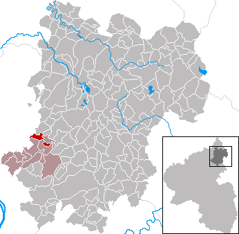
 DeesenLocation of Deesen within Westerwaldkreis district
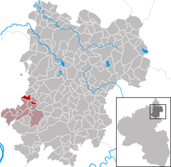
Coordinates 50°30′39″N 7°42′0″E / 50.51083°N 7.7°ECoordinates: 50°30′39″N 7°42′0″E / 50.51083°N 7.7°E Administration Country Germany State Rhineland-Palatinate District Westerwaldkreis Municipal assoc. Ransbach-Baumbach Mayor Franz Bendel Basic statistics Area 3.40 km2 (1.31 sq mi) Elevation 220 m (722 ft) Population 679 (31 December 2010)[1] - Density 200 /km2 (517 /sq mi) Other information Time zone CET/CEST (UTC+1/+2) Licence plate WW Postal code 56237 Area code 02626 Website www.deesen.de Deesen is an Ortsgemeinde – a community belonging to a Verbandsgemeinde – in the Westerwaldkreis in Rhineland-Palatinate, Germany.
Contents
Geography
Location
The community lies in the Westerwald between Koblenz and Siegen on the edge of the Rhein-Westerwald Nature Park. The Saynbach, part of the Rhine’s drainage basin, flows through the community. Deesen belongs to the Verbandsgemeinde of Ransbach-Baumbach, a kind of collective municipality.
History
In 1218, Deesen had its first documentary mention as Desene when Burgrave Heinrich von Isenburg donated a Lichterzins to the Rommersdorf Abbey. The village itself is a few hundred years older. In 1271, the Rommersdorf Monastery sold Hermann von Desene various goods in Deesen. In 1531 the Mant family of Limbach had an estate in Deesen. Until 1664, it was Isenburg domain, and thereafter Electorate of Trier domain until 1803 when it became part of the Duchy of Nassau. In 1866, the village passed to Prussia. The customs house and lordly inn in Deesen’s municipal area is mentioned in 1667 and 1723. The old school is under protection as a monument.
Politics
Community council
The council is made up of 13 council members, including the extraofficial mayor (Bürgermeister), who were elected in a municipal election on 7 June 2009.
WG Bendel Total 2004 12 12 Seats Economy and infrastructure
Transport
The A 3 with its Mogendorf interchange (AS 38) lies 7 km away. The nearest InterCityExpress stop is the railway station at Montabaur on the Cologne-Frankfurt high-speed rail line, which runs straight through the community.
References
- ^ "Bevölkerung der Gemeinden am 31.12.2010" (in German). Statistisches Landesamt Rheinland-Pfalz. 31 December 2010. http://www.statistik.rlp.de/fileadmin/dokumente/berichte/A1033_201022_hj_G.pdf.
External links
- Deesen (German)
- This article incorporates information from the German Wikipedia.
Categories:- Municipalities in Rhineland-Palatinate
- Koblenz region geography stubs


Wikimedia Foundation. 2010.