- Mündersbach
-
Mündersbach 

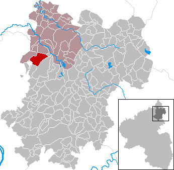
 MündersbachLocation of Mündersbach within Westerwaldkreis district
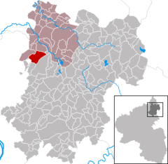
Coordinates 50°36′23″N 7°44′3″E / 50.60639°N 7.73417°ECoordinates: 50°36′23″N 7°44′3″E / 50.60639°N 7.73417°E Administration Country Germany State Rhineland-Palatinate District Westerwaldkreis Municipal assoc. Hachenburg Mayor Winfried Himmerich Basic statistics Area 9.27 km2 (3.58 sq mi) Elevation 310 m (1017 ft) Population 764 (31 December 2010)[1] - Density 82 /km2 (213 /sq mi) Other information Time zone CET/CEST (UTC+1/+2) Licence plate WW Postal code 56271 Area code 02680 Website www.muendersbach.de Mündersbach is an Ortsgemeinde – a community belonging to a Verbandsgemeinde – in the Westerwaldkreis in Rhineland-Palatinate, Germany.
Contents
Geography
Location
The community lies between Hachenburg and Herschbach. The residential community of Mündersbach belongs to the Verbandsgemeinde of Hachenburg, a kind of collective municipality. Its seat is in the like-named town.
History
In 1247, Mündersbach had its first documentary mention.
Politics
Community council
The council is made up of 13 council members, including the extraofficial mayor (Bürgermeister), who were elected in a majority vote in a municipal election on 13 June 2004.
Economy and infrastructure
Transport
The community lies directly on Bundesstraße 413 from Bendorf to Hachenburg. The nearest Autobahn interchanges are in Dierdorf, Neuwied and Ransbach-Baumbach on the A 3 (Cologne–Frankfurt), each some 15 km away. The nearest InterCityExpress stop is the railway station at Montabaur on the Cologne-Frankfurt high-speed rail line. Trains reach both cities in 30 to 40 minutes.
Public institutions
The community has at its disposal a floodlit sporting ground and a tennis court with three places. The village’s children can enjoy themselves at public playing fields and playgrounds. There is also a community house (multipurpose hall) in Mündersbach with a modern kindergarten as well as a community bakehouse with a long baking tradition.
References
- ^ "Bevölkerung der Gemeinden am 31.12.2010" (in German). Statistisches Landesamt Rheinland-Pfalz. 31 December 2010. http://www.statistik.rlp.de/fileadmin/dokumente/berichte/A1033_201022_hj_G.pdf.
External links
- This article incorporates information from the German Wikipedia.
Categories:- Municipalities in Rhineland-Palatinate
- Koblenz region geography stubs

Wikimedia Foundation. 2010.