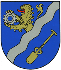
- Niederahr
-
Niederahr 

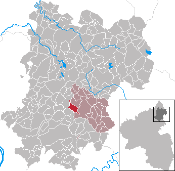
 NiederahrLocation of Niederahr within Westerwaldkreis district
Coordinates 50°29′31″N 7°51′40″E / 50.49194°N 7.86111°ECoordinates: 50°29′31″N 7°51′40″E / 50.49194°N 7.86111°E Administration Country Germany State Rhineland-Palatinate District Westerwaldkreis Municipal assoc. Wallmerod Mayor Hermann Girhard Basic statistics Area 4.03 km2 (1.56 sq mi) Elevation 300 m (984 ft) Population 840 (31 December 2010)[1] - Density 208 /km2 (540 /sq mi) Other information Time zone CET/CEST (UTC+1/+2) Licence plate WW Postal code 56414 Area code 02602 Website www.wallmerod.de Niederahr is an Ortsgemeinde – a community belonging to a Verbandsgemeinde – in the Westerwaldkreis in Rhineland-Palatinate, Germany.
Contents
Geography
Location
The community lies in the Westerwald between Montabaur and Hachenburg. Through the community flows the Ahrbach. The community belongs to the Verbandsgemeinde of Wallmerod, a kind of collective municipality. Its seat is in the like-named town.
History
In 959, Niederahr had its first documentary mention.
Politics
Community council
The council is made up of 12 council members who were elected in a majority vote in a municipal election on 13 June 2004.
Economy and infrastructure
Transport
Right through the community runs Bundesstraße 255, linking Montabaur and Rennerod. The nearest Autobahn interchange is Montabaur on the A 3 (Cologne–Frankfurt), some 5 km away. The nearest InterCityExpress stop is the railway station at Montabaur on the Cologne-Frankfurt high-speed rail line.
Established businesses
Westfalia Separator makes decanters at its Niederahr works.
References
- ^ "Bevölkerung der Gemeinden am 31.12.2010" (in German). Statistisches Landesamt Rheinland-Pfalz. 31 December 2010. http://www.statistik.rlp.de/fileadmin/dokumente/berichte/A1033_201022_hj_G.pdf.
External links
- Niederahr (German)
- This article incorporates information from the German Wikipedia.
Categories:- Municipalities in Rhineland-Palatinate
- Koblenz region geography stubs

Wikimedia Foundation. 2010.