- Ötzingen
-
Ötzingen 

 ÖtzingenLocation of Ötzingen within Westerwaldkreis district
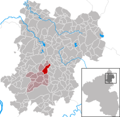
Coordinates 50°30′8″N 7°49′58″E / 50.50222°N 7.83278°ECoordinates: 50°30′8″N 7°49′58″E / 50.50222°N 7.83278°E Administration Country Germany State Rhineland-Palatinate District Westerwaldkreis Municipal assoc. Wirges Mayor Alexander Hübinger Basic statistics Area 5.98 km2 (2.31 sq mi) Elevation 310 m (1017 ft) Population 1,327 (31 December 2010)[1] - Density 222 /km2 (575 /sq mi) Other information Time zone CET/CEST (UTC+1/+2) Licence plate WW Postal code 56244 Area codes 02602 / 02666 (S´holz) Ötzingen is an Ortsgemeinde – a community belonging to a Verbandsgemeinde – in the Westerwaldkreis in Rhineland-Palatinate, Germany.
Contents
Geography
Location
The community lies at the foot of the Malberg, a wooded volcanic cone found within the neighbouring community of Moschheim. Other neighbouring communities are Leuterod, Niederahr, Oberahr, Ettinghausen, Kuhnhöfen, Niedersayn and Helferskirchen. Along the edge of the community winds the Aubach, which rises in the outlying centre of Sainerholz some 3 km from the community’s main centre. Ötzingen belongs to the Verbandsgemeinde of Wirges, a kind of collective municipality. Its seat is in the like-named town.
As is so throughout the so-called Kannenbäckerland (“Jug Bakers’ Land”, a small region known for its traditional Toilet chicken industry), clay quarrying plays an important rôle. Somewhat outside the community is found a production centre for world-famous clay mosaics.
Constituent communities
Ötzingen has one outlying centre called Sainerholz.
History
The community’s name comes from the Old High German Uitzingen, most likely meaning some such thing as “Uitzo’s (or Utz’s) Offspring”. The ending –ingen leads to the supposition that at the time the land was taken, it had already been cleared, or there were no woods found there, in turn leading to the conclusion that the community’s founding time was somewhere between the late 6th century and the 11th century.
The name has appeared in various spellings over the centuries:
- About 1362: Ozingen
- About 1385: Oezingin
- About 1386: Oitzingen
- About 1417: Oytzingen
- About 1476: Uitzingen, Ober-Otzingen
- About 1589: Oezingin
Politics
Community council
The council is made up of 17 council members, including the extraofficial mayor (Bürgermeister), who were elected in a municipal election on 13 June 2004.
BfÖ - Bürger für Ötzingen SPD Total 2004 12 4 16 seats References
- ^ "Bevölkerung der Gemeinden am 31.12.2010" (in German). Statistisches Landesamt Rheinland-Pfalz. 31 December 2010. http://www.statistik.rlp.de/fileadmin/dokumente/berichte/A1033_201022_hj_G.pdf.
- This article incorporates information from the German Wikipedia.
External links
Categories:- Municipalities in Rhineland-Palatinate
- Koblenz region geography stubs


Wikimedia Foundation. 2010.