- Marienrachdorf
-
Marienrachdorf 

 MarienrachdorfLocation of Marienrachdorf within Westerwaldkreis district
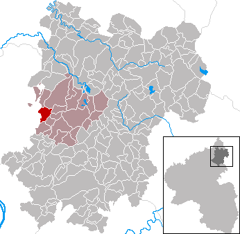
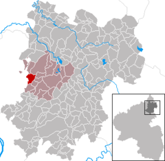
Coordinates 50°33′8″N 7°42′52″E / 50.55222°N 7.71444°ECoordinates: 50°33′8″N 7°42′52″E / 50.55222°N 7.71444°E Administration Country Germany State Rhineland-Palatinate District Westerwaldkreis Municipal assoc. Selters (Westerwald) Mayor Marianne Herkenroth Basic statistics Area 5.04 km2 (1.95 sq mi) Elevation 273 m (896 ft) Population 1,025 (31 December 2010)[1] - Density 203 /km2 (527 /sq mi) Other information Time zone CET/CEST (UTC+1/+2) Licence plate WW Postal code 56242 Area code 02626 Website www.marienrachdorf.de Marienrachdorf is an Ortsgemeinde – a community belonging to a Verbandsgemeinde – in the Westerwaldkreis in Rhineland-Palatinate, Germany.
Contents
Geography
Location
Marienrachdorf lies 4 km northwest of Selters. The community belongs to the Verbandsgemeinde of Selters, a kind of collective municipality.
History
In 1190, Marienrachdorf had its first documentary mention as Rachdorf. In 1972, in the course of municipal restructuring, the Verbandsgemeinde of Selters was founded, to which Marienrachdorf belongs.
Politics
Community council
The council is made up of 12 council members, as well as the honorary and presiding mayor (Ortsbürgermeisterin), who were elected in a majority vote in a municipal election on 13 June 2004. Apportionment of seats on Council:
WG Herkenroth WG Klöckner WG Haubrich Total 2004 5 6 1 12 seats Clubs
- Kirchenchor Cäcilia (church choir)
- Musikverein 1977 Marienrachdorf e.V. (music)
- Angelsportverein Marienrachdorf (angling)
- Gymnastikverein (women’s gymnastics)
- Sportverein Marienrachdorf e.V. 1921 (sport)
- Dartclub Florida
Economy and infrastructure
Transport
Northwest of the community runs Bundesstraße 413, leading from Bendorf to Hachenburg. The nearest Autobahn interchange is Dierdorf on the A 3 (Cologne–Frankfurt). The nearest InterCityExpress stop is the railway station at Montabaur on the Cologne-Frankfurt high-speed rail line.
References
- ^ "Bevölkerung der Gemeinden am 31.12.2010" (in German). Statistisches Landesamt Rheinland-Pfalz. 31 December 2010. http://www.statistik.rlp.de/fileadmin/dokumente/berichte/A1033_201022_hj_G.pdf.
External links
- Marienrachdorf (German)
- Verbandsgemeinde of Selters (German)
- This article incorporates information from the German Wikipedia.
Categories:- Municipalities in Rhineland-Palatinate
- Koblenz region geography stubs

Wikimedia Foundation. 2010.