- Nathu La
-
Nathu La 
Stairs leading to the border on the Indian sideElevation 4,310 m (14,140 ft) Traversed by Old Silk Route Location Location  India (Sikkim) –
  China (Tibet Autonomous Region)
Range Himalaya Coordinates 27°23′11″N 88°49′52″E / 27.386448°N 88.831190°ECoordinates: 27°23′11″N 88°49′52″E / 27.386448°N 88.831190°E 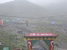 Nathu La
 Nathu La - Pass of listening ears
Nathu La
 listen (help·info) (Tibetan: རྣ་ཐོས་ལ་, Nepali: नाथू ला, Hindi: नाथूला दर्रा; IAST: Nāthū Lā, Chinese: 乃堆拉山口 Nǎiduīlā Shānkǒu) is a mountain pass in the Himalayas. It connects the Indian state of Sikkim with China's Tibet Autonomous Region. The pass, at 4,310 m (14,140 ft) above mean sea level, forms a part of an offshoot of the ancient Silk Road. Nathu means "listening ears" and La means "pass" in Tibetan.[1] It is also spelled Ntula, Natu La, Nathula, or Natula.
Nathu La is one of the three trading border posts between China and India; the other two are Shipkila in Himachal Pradesh and Lipulekh (or Lipulech) in Uttarakhand.[2] Sealed by India after the 1962 Sino-Indian War, Nathu La was re-opened in 2006 following numerous bilateral trade agreements. The opening of the pass is expected to bolster the economy of the region and play a key role in the growing Sino-Indian trade. Currently, agreements between the two nations limit trade across the pass to 29 types of goods from India and 15 from the Chinese side. The opening also shortens the travel distance to important Hindu and Buddhist pilgrimage sites in the region.
Contents
History
Nathu La is located on the 563 km (333 mi) Old Silk Route, an offshoot of the historic Silk Road. The Old Silk Route connects Lhasa in Tibet to the plains of Bengal to the south. In 1815, trade volumes increased after the British annexed territories belonging to the Sikkimese, Nepalese, and Bhutanese. The potential of Nathu La was realised in 1873, after the Darjeeling Deputy Commissioner published a report on the strategic importance of mountain passes between Sikkim and Tibet. In December 1893, the Sikkimese monarchy and Tibetan rulers signed an agreement to increase trade between the two nations.[1] The agreement culminated in 1894 when the trade pass was opened.[3]
 The British expeditionary force led by Major Younghusband (seated centre)
Nathu La played a key role in the 1903–1904 British expedition to Tibet, which sought to prevent the Russian Empire from interfering in Tibetan affairs and thus gaining a foothold in the region. In 1904, Major Francis Younghusband, serving as the British Commissioner to Tibet, led a successful mission through Nathu La to capture Lhasa. This led to the setting up of trading posts at Gyantse and Gartok in Tibet, and gave control of the surrounding Chumbi Valley to the British. The following November, China and Great Britain ratified an agreement approving trade between Sikkim and Tibet.[4][5]
In 1947 and 1948, a popular vote for Sikkim to join newly independent India failed and Indian Prime Minister Jawaharlal Nehru agreed to a special protectorate status for Sikkim. Sikkim agreed to be a protectorate nation and Indian troops were allowed to man its borders, including Nathu La. During this period, more than 1,000 mules and 700 people were involved in cross-border trade through Nathu La.[3] In 1949, when the Tibetan government expelled the Chinese living there, most of the displaced Chinese returned home through the Nathu La–Sikkim–Kolkata route.[6]
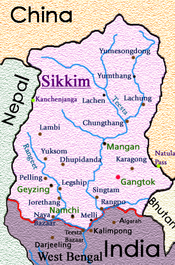
 Location of Nathu La in Sikkim
With the absence of air or rail facilities in the region in the 1950s, Nathu La was used by several dignitaries to cross the international boundary between Tibet and Sikkim. The current Dalai Lama, Tenzin Gyatso, used this pass to travel to India for the 2,500th birthday celebration of Gautama Buddha, which was held between November 1956 and February 1957.[7] Later, on 1 September 1958, Nehru, his daughter Indira Gandhi, and Palden Thondup Namgyal (son of—and internal affairs adviser to—Tashi Namgyal, the Chogyal of Sikkim) used this pass to travel to nearby Bhutan.
After the People's Republic of China took control of Tibet in 1950 and suppressed a Tibetan uprising in 1959, the passes into Sikkim became a conduit for refugees from Tibet. During the 1962 Sino-Indian War, Nathu La witnessed skirmishes between soldiers of the two countries. Shortly thereafter, the passage was sealed and remained closed for more than four decades.[8] Between 7 and 13 September 1967, China's People's Liberation Army and the Indian Army had six-day "border skirmishes", including the exchange of heavy artillery fire.[9] In 1975, Sikkim acceded to India and Nathu La became part of Indian territory. China, however, refused to acknowledge the accession.
In 1988, India's Prime Minister Rajiv Gandhi visited Beijing, where he recognised China's suzerainty over Tibet.[5] In 1993, Jyoti Basu, the then Chief Minister of the Indian state of West Bengal, initiated a campaign to reopen the Lhasa–Kalimpong route which ran through Jelep La, to no avail.[10] The following year, Prime Minister P. V. Narasimha Rao's visit to China led to further talks on the opening of the pass. The talks were unsuccessful due to security concerns raised by the Indian army.[11]
During the 1990s, bilateral trade agreements were signed by India and China that paved the way for opening of the pass. In December 1991, India and China signed the Memorandum on the Resumption of Border Trade; subsequently, in July 1992, the Protocol on Entry and Exit Procedures for Border Trade was signed. These two documents contained provisions for border trade through Nathu La. On 23 June 2003, India and China signed the Memorandum on Expanding Border Trade that provided for the use of Nathu La in border trade between India and China.[12]
 When you go home, Tell them of us, For your tomorrow, We gave our today - Indian War memorial at Nathu La
In 2003, with the thawing of Sino-Indian relations, Indian Prime Minister Atal Bihari Vajpayee's visit to China led to the resumption of talks on opening the border. Later in 2004, the Indian Defence Minister's visit to China led to the formal opening of the pass. The opening, originally scheduled for 2 October 2005, was postponed due to last-minute infrastructure problems on the Chinese side. Finally, after a decade of talks, Nathu La was opened on 6 July 2006.[13] The date of the re-opening coincided with the birthday of the reigning Dalai Lama, and is widely seen as a snub to the International Tibet Independence Movement.[5] In the years before the re-opening, the only person permitted to cross the barbed-wire frontier was a Chinese postman with an Indian military escort, who would hand over mail to his Indian counterpart in a building at the border. The event also formally recognises Tibet as part of China by India and Sikkim's accession to India.[5]
The opening of the pass was marked by a ceremony on the Indian side that was attended by officials from both countries, including Sikkim Chief Minister Pawan Kumar Chamling (the chief guest), the Chinese ambassador to India, and the Tibetan Autonomous Region Chairman, Champa Phuntsok. A delegation of 100 traders from India and 100 Tibetans crossed the border to respective trading towns. Despite heavy rain and chilly winds, the ceremony was marked by attendance of many officials, locals, and international and local media.[13] The barbed wire fence between India and China was replaced by a 10 m (30 ft) wide stone-walled passageway.[14] It was also decided to mark the year 2006 as the year of Sino-Indian friendship.[14][15]
Geography
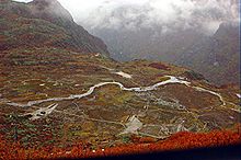 Geography of the region
 This stretch of road is observed by Chinese Military Posts - Don't make unwanted moves
The pass is 54 km (34 mi) east of the Sikkimese capital, Gangtok, and 430 km (270 mi) from the capital of the Tibetan Autonomous Region, Lhasa.[16][17] In the winter, the pass is blocked by heavy snowfall. Because there is no meteorological centre in Nathu La, systematic measurements of meteorological data (such as temperature and rainfall) are not available for the region.[18] However, it is known that in the higher reaches of the Himalayas around the region, summer temperature never exceeds 15 °C (59 °F).[19]
Nathu La has moderately shallow, excessively drained, coarse and loamy soil on a steep slope (30–50%) with gravelly loamy surface, moderate erosion, and moderate stoniness.[16] It has several sinking zones and parts of it are prone to landslides.[20] To preserve the fragile environment of Nathu La on the Indian side, the government of India regulates the flow of tourists. Road maintenance is entrusted to Border Roads Organisation, a wing of the Indian Army.[21] On the Chinese side the pass leads to the Chumbi Valley of the Tibetan Plateau.[22]
Flora and fauna
 Vegetation of the region
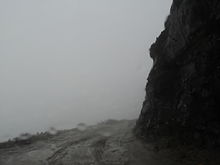 Nathu La is prone to massive land slides
Because of the steep elevation increase around the pass, the vegetation graduates from sub-tropical forest at its base, to a temperate region, to a wet and dry alpine climate, and finally to cold tundra desert devoid of vegetation. Around Nathu La and the Tibetan side, the region has little vegetation besides scattered shrubs. Major species found in the region include dwarf rhododendrons (Rhododendron anthopogon, R. setosum) and junipers. The meadows include the genera Poa, Meconopsis, Pedicularis, Primula, and Aconitum. The region has a four-month growing season during which grasses, sedges and medicinal herbs grow abundantly and support a host of insects, wild and domestic herbivores, larks, and finches. The nearby Kyongnosla Alpine Sanctuary has rare, endangered ground orchida and rhododendrons interspersed among tall junipers and silver firs.[23]
There are no permanent human settlements in the region, though it has a large number of defence personnel who man the borders on both sides. A small number of nomadic Tibetan graziers or Dokpas herd yak, sheep and pashmina-type goats in the region. There has been intense grazing pressure due to domestic and wild herbivores on the land. Yaks are found in these parts, and in many hamlets they serve as beasts of burden.[24] The region around Nathu La contains many endangered species, including Tibetan gazelle, snow leopard, Tibetan wolf, Tibetan snowcock, lammergeier, raven, golden eagle, and ruddy shelduck. Feral dogs are considered a major hazard in this region. The presence of landmines in the area causes casualties among yak, nayan, kiang, and Tibetan wolf.[25]
The avifauna consists of various types of laughing thrushes, which live in shrubs and on the forest floor. The Blue Whistling-thrush, redstarts, and forktails are found near waterfalls and hill-streams. The mixed hunting species present in the region include warblers, tit-babblers, treecreepers, white-eyes, wrens, and rose finches. Raptors such as black eagle, black-winged kite and kestrels; and pheasants such as monals and blood pheasant are also found.[25]
Economy
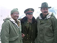 Indian and Chinese officers at Nathu La
 Trade Channel Crossing at Nathu La
 Flag on Chinese side
 A traveller at Nathu La, just in front of the barbed Chinese border
Up until 1962, before the pass was sealed, goods such as pens, watches, cereals, cotton cloth, edible oils, soaps, building materials, and dismantled scooters and four-wheelers were exported to Tibet through the pass on mule-back. Two hundred mules, each carrying about 80 kg (175 lb) of load were used to ferry goods from Gangtok to Lhasa, which used to take 20–25 days. Upon return, silk, raw wool, musk pods, medicinal plants, country liquor, precious stones, gold and silverware were imported into India.[26] Most of the trade in those days was carried out by the Marwari community, which owned 95% of the 200 authorised firms.[5]
To facilitate cross-border trade, the two countries have set up trading marts at Sherathang in Sikkim (6 km (4 mi) from Nathu La) and Rinqingang in Tibet (10 km (6 mi) from Nathu La) for the purposes of customs and checking. Trading is open Mondays through Thursdays from 07:30/11:00 to 15:30/19:00 IST/Beijing Time (03:00 to 13:00 UTC). The trading season starts on 1 June and continues through 30 September, when snowfall and extreme weather render the pass unfit for travel. A total of 100 traders and 60 trucks carrying goods are allowed to operate from either side of the border.[citation needed]
While China has not placed any restrictions on cross-border trade, India has done so, placing heavy restrictions on the commodities that are to be exported and imported. Exports from India include agricultural implements, blankets, copper products, clothes, cycles, coffee, tea, barley, rice, flour, dry fruits, vegetables, vegetable oil, molasses and candy, tobacco, snuff, spices, shoes, kerosene oil, stationery, utensils, wheat, liquor, milk processed product, canned food, cigarettes, local herb, palm oil and hardware. Chinese exports to India include goat skin, sheep skin, wool, raw silk, yak tail, yak hair, china clay, borax, butter, common salt, horses, goats, and sheep.[2][27] Restrictions are also placed on traders, with permits only given to those who were Sikkimese citizens before the kingdom merged with India in 1975.
The re-opening of the pass is expected to stimulate the economy of the region and bolster Indo-Chinese trade, which amounted to US$7 billion in 2004. Before the pass was opened, almost all the Indo-China trade went through the port of Tianjin more than 4,000 km (2,500 mi) away. With the opening, this distance has been shortened to 1,200 km (745 mi).[28] Figures released by the Tibet Autonomous Regional Bureau of Commerce show that in the 51 days of trading in 2006, US$ 186,250 worth of trade passed through Nathu La.[29] It is estimated that Sino-Indian trade would increase by nearly 15–20% within two years of Nathu La's opening.[8] Trade volumes through the pass are projected to grow to Rs. 206 crore (US$ 44.6 million) by 2007, and Rs. 12,203 crore (US$ 2.6 billion) by 2015.[5] This slowed in later years due to deteriorating relations, primarily due to lingering land disputes over Sikkim and South Tibet. The pass offers Chinese companies access to the port of Kolkata (Calcutta), situated about 1,100 km (700 mi) from Lhasa, for transshipments to and from Tibet.
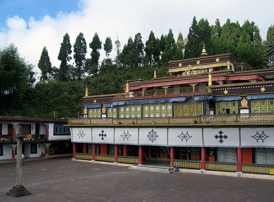
 Pilgrims from Tibet may be able to make a pilgrimage to the Rumtek monastery, one of Buddhism's holiest shrines.
On the Chinese side, 7,000 tourists visited Yadong County in 2006 and brought in 1.67 million yuan (US$ 216,000) in revenue.[29] On the Indian side, only citizens of India can visit the pass on Wednesdays, Thursdays, Saturdays and Sundays,[16] after obtaining permits one day in advance in Gangtok.[30] The pass would be particularly useful for pilgrims visiting monasteries in Sikkim such as Rumtek, one of the holiest shrines in Buddhism. For Hindus, the pass reduces the journey time to Mansarovar Lake from fifteen to two days.[31]
There are fears among some traders in India that Indian goods will find a limited outlet in Tibet, while China will have access to a ready market in Sikkim and West Bengal.[32] A major concern of the Indian government is the trafficking of wildlife products such as tiger and leopard skins and bones, bear gall bladders, otter pelts, and shahtoosh wool into India. The Indian government has undertaken a program to sensitise the police and other law enforcement agencies in the area. Most of such illicit trade currently takes place via Nepal.[33]
Transport
 Journey to Nathu La is sometimes terrifying, like this during June 2011
On the Tibetan side, two highways—from Kangmar to Yadong, and from Yadong to Nathu La—have been listed in the 2006 construction plans of the Ministry of Transportation and the Development and Reform Commission of the People's Republic of China. Plans are also underway to start a bus service from Gangtok to Lhasa, and to extend the Qinghai-Tibet Railway to Yadong over the next decade.[8][34] However, in later years the annual trade during the merchant periods was poor, especially a lack of Chinese imports. The government had to cajole the locals to trade, who cited that it was not worth it to pay the license given poor revenue. Border tensions have also deterred trade.[citation needed]
India is in the process of extending its railway to Sikkim, leading many to promote the idea of connecting it with the Qinghai-Tibet Railway to achieve rail transport between the two nations. A petition was set up to promote this idea. As of 26 Aug 2011, the petition had 77 members.[35]
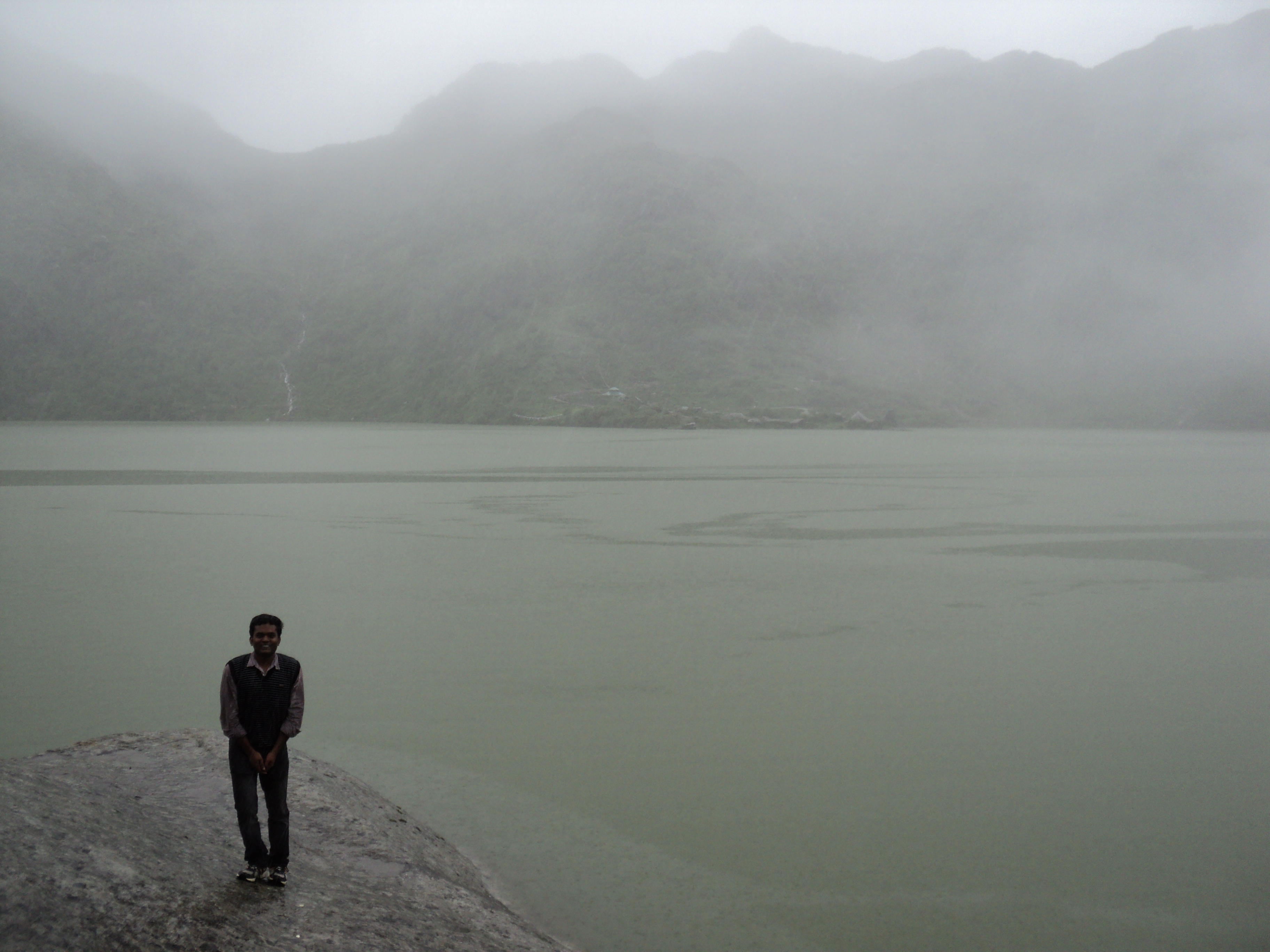
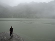 Tsongmo Lake, Near Nathu La
See also
 Babha Harbhajan Singh Shrine, Nathu La
- Baba Harbhajan Singh
- Dongkha La
- Lake Tsongmo
- Khunjerab Pass (the only other major border pass to China open in South Asia)
- Nathu La incident
References
- ^ a b Pradhan, Keshav (2006-07-06). "In the good ol' days of Nathu-la". Times of India, Mumbai (Bennett, Coleman & Co. Ltd.): p. 10.
- ^ a b "Nathula reopens for trade after 44 years". "Zee News". 2006-07-06. http://www.zeenews.com/articles.asp?aid=307263&sid=NAT. Retrieved 2006-07-06.
- ^ a b "Historical Review". China Tibet Information Center. 2006-07-05. http://en.tibet.cn/newfeature/cknduila/ckndl_qt/t20060705_130884.htm. Retrieved 2006-12-01.
- ^ Carrington, Michael: "Officers Gentlemen and Thieves: The Looting of Monasteries during the 1903/4 Younghusband Mission to Tibet", Modern Asian Studies 37, 1 (2003), pp. 81–109.
- ^ a b c d e f Pradhan, Keshav (2006-07-06). "Trading Heights". Times of India, Mumbai (Bennett, Coleman & Co. Ltd.): p. 10. http://timesofindia.indiatimes.com/articleshow/1709103.cms.
- ^ "Nathu La: 'Sweetness and light'". Rediff.com. 2006-07-06. http://specials.rediff.com/news/2006/jul/06sld03.htm. Retrieved 2006-12-01.
- ^ Datta Ray, Sunanda K (2006-07-10). "Nathu La: It's more than revival of a trade route". Phayul.com. http://www.phayul.com/news/article.aspx?id=13200&t=1&c=1. Retrieved 2006-12-02.
- ^ a b c Xinhua (2006-07-07). "Roundup: "Silk Road" rejoins at Nathu La Pass after 44 years". People's Daily Online. http://english.people.com.cn/200607/07/eng20060707_280785.html. Retrieved 2006-11-26.
- ^ Sreedhar (1998). "China Becoming A Superpower and India's Options". Across the Himalayan Gap: An Indian Quest for Understanding China (Ed. Tan Chung). Indira Gandhi National Centre for the Arts, New Delhi. http://ignca.nic.in/ks_41065.htm. Retrieved 2006-12-01.
- ^ Choudhury, Kalyan (2003-07-04). "Routes of promise". Volume 20 - Issue 14 (Frontline Magazine). http://www.hinduonnet.com/fline/fl2014/stories/20030718005201800.htm. Retrieved 2006-12-02.
- ^ Shahin, Sultan (2003-06-28). "India and China to be brothers again". Asia Times. http://www.atimes.com/atimes/South_Asia/EF28Df07.html. Retrieved 2006-12-02.
- ^ "On the inaugural function for the resumption of border trade between India and China held at Nathu La". Ministry of External Affairs, New Delhi. 2006-07-06. Archived from the original on 2007-02-19. http://web.archive.org/web/20070219175501/http://meaindia.nic.in/pressrelease/2006/07/06pr01.htm. Retrieved 2006-12-01.
- ^ a b "Historic India-China link opens". BBC News. 2006-07-06. http://news.bbc.co.uk/2/hi/south_asia/5150682.stm. Retrieved 2006-07-06.
- ^ a b Hong'e, Mo (2006-07-06). "China, India raise national flags at border pass to restart business". China View. http://news.xinhuanet.com/english/2006-07/06/content_4800709.htm. Retrieved 2006-11-26.
- ^ "Activities planned for India-China Friendship Year - 2006". Ministry of External Affairs, Government of India. 2006-01-23. Archived from the original on 2007-10-20. http://web.archive.org/web/20071020114246/http://meaindia.nic.in/pressrelease/2006/01/23pr01.htm. Retrieved 2007-02-16.
- ^ a b c Envis Team (2006-06-04). "Ecodestination of India-Sikkim Chapter" (PDF). Eco-destinations of India. The Environmental Information System (ENVIS), Ministry of Environment and Forest, Government of India. pp. 43. http://www.scstsenvis.nic.in/Sikkim%20chapter.pdf. Retrieved 2006-12-01.
- ^ Saha, Sambit (2003-09-08). "Trading post: Prospects of Nathu-La". Rediff.com. http://www.rediff.com/money/2003/sep/08trading.htm. Retrieved 2006-12-04.
- ^ Envis Team (2006-06-30). "Vol-IV Water Environment" (PDF). Carrying Capacity Study of Teesta Basin in Sikkim. The Environmental Information System (ENVIS), Ministry of Environment and Forest, Government of India. pp. 30–31. http://www.sikenvis.nic.in/CCSOTB/Vol-IV_Water%20Environment.pdf. Retrieved 2007-02-16.
- ^ Envis Team (2006-06-04). "Ecodestination of India-Sikkim Chapter" (PDF). Eco-destinations of India. The Environmental Information System (ENVIS), Ministry of Environment and Forest, Government of India. pp. 33. http://www.scstsenvis.nic.in/Sikkim%20chapter.pdf. Retrieved 2006-12-01.
- ^ Kaur, Naunidhi (2003-08-02). "A route of hope". Volume 20 - Issue 16 (Frontline Magazine). http://www.hinduonnet.com/fline/fl2016/stories/20030815001505100.htm. Retrieved 2006-12-02.
- ^ Dutta, Sujan (2006-11-20). "Nathu-la wider road reply to Beijing". The Telegraph. http://www.telegraphindia.com/1061121/asp/nation/story_7029464.asp. Retrieved 2006-12-02.
- ^ "The legend of Nathu La". Rediff.com. 2006-07-06. http://specials.rediff.com/news/2006/jul/06sld01.htm. Retrieved 2006-12-02.
- ^ Envis Team (2006-06-04). "Ecodestination of India-Sikkim Chapter" (PDF). Eco-destinations of India. The Environmental Information System (ENVIS), Ministry of Environment and Forest, Government of India. pp. 114. http://www.scstsenvis.nic.in/Sikkim%20chapter.pdf. Retrieved 2006-12-01.
- ^ Envis Team (2006-06-04). "Ecodestination of India-Sikkim Chapter" (PDF). Eco-destinations of India. The Environmental Information System (ENVIS), Ministry of Environment and Forest, Government of India. http://www.scstsenvis.nic.in/Sikkim%20chapter.pdf. Retrieved 2006-12-01.
- ^ a b Envis Team (2006-06-04). "Ecodestination of India-Sikkim Chapter" (PDF). Eco-destinations of India. The Environmental Information System (ENVIS), Ministry of Environment and Forest, Government of India. pp. 44. http://www.scstsenvis.nic.in/Sikkim%20chapter.pdf. Retrieved 2006-12-01.
- ^ Roy, Ambar Singh (2003-11-25). "Nathula 'Pass'port to better trade prospects with China". Hindu Business Line. The Hindu. http://www.blonnet.com/2003/11/25/stories/2003112502160200.htm. Retrieved 2006-07-06.
- ^ Ministry of Commerce & Industry, Government of India (2006-08-23). "Trade Between India And China Through Nathu La Pass". Press Information Bureau: Press releases. NIC. http://pib.nic.in/release/release.asp?relid=20154. Retrieved 2007-02-16.
- ^ "What border markets can bring?". China Tibet Information Center. 2006-07-05. http://en.tibet.cn/newfeature/cknduila/ckndl_qt/t20060705_130888.htm. Retrieved 2006-12-03.
- ^ a b "Nathu La Pass on Sino-Indian border closes". China Daily. 2006-10-15. http://www.chinadaily.com.cn/china/2006-10/15/content_708347.htm. Retrieved 2007-02-19.
- ^ Envis Team (2006-06-04). "Ecodestination of India-Sikkim Chapter" (PDF). Eco-destinations of India. The Environmental Information System (ENVIS), Ministry of Environment and Forest, Government of India. pp. 45. http://www.scstsenvis.nic.in/Sikkim%20chapter.pdf. Retrieved 2006-12-01.
- ^ Vinayak, G (2004-07-28). "Nathu La: closed for review". The Rediff Special (Rediff.com). http://www.rediff.com/news/2004/jul/28spec2.htm. Retrieved 2006-11-26.
- ^ "Nathu-la shows the way: It opens a new route to amity". The Tribune. 2006-08-08. http://www.tribuneindia.com/2006/20060708/edit.htm#2. Retrieved 2006-12-02.
- ^ Perappadan, Bindu Shajan (2006-06-23). "Doubts over traffickers using re-opened Nathula Pass". The Hindu. http://www.hindu.com/2006/06/23/stories/2006062322050300.htm. Retrieved 2006-07-06.
- ^ "China to build three railways in Tibet". China Daily. 2006-06-29. http://www.chinadaily.com.cn/bizchina/2006-06/29/content_629162.htm. Retrieved 2008-05-22.
- ^ http://www.facebook.com/pages/Petition-for-a-railway-between-China-and-India/112702522143508
Further reading
- Envis Team (2006-06-04). "Ecodestination of India-Sikkim Chapter" (PDF). Eco-destinations of India. The Environmental Information System (ENVIS), Ministry of Environment and Forest, Government of India. http://www.scstsenvis.nic.in/Sikkim%20chapter.pdf. Retrieved 2006-12-01.
- Pradhan, Keshav (2006-07-06). "Trading Heights". Times of India, Mumbai (Bennett, Coleman & Co. Ltd.): p. 10. http://timesofindia.indiatimes.com/articleshow/1709103.cms.
- Huggler, Justin; Coonan, Clifford (2006-06-20). "China reopens a passage to India". The Independent: p. 124. http://news.independent.co.uk/world/asia/article1090865.ece.
- Bashar, Iftekharul (2006-07-14). "Indio-Chinese relations going back to Silk Route". Weekly Holiday. Archived from the original on July 16, 2007. http://web.archive.org/web/20070716114541/http://www.weeklyholiday.net/2006/140706/mis.html. Retrieved 2006-12-02.
- Carrington, Michael, "Officers Gentlemen and Thieves: The Looting of Monasteries during the 1903/4 Younghusband Mission to Tibet", Modern Asian Studies 37, 1 (2003), pp. 81–109.
External links
 The Wiktionary definition of Nathu La
  Quotations related to Nathula at Wikiquote
  Media related to Nathu La at Wikimedia Commons
 News related to India, China reopen Nathu La pass at Wikinews
Mountain passes of China Geography of China Alataw Pass • Bedel Pass • Diphu Pass • Hangu Pass • Hulao Pass • Iron Gate Pass • Jingxing Pass • Karakoram Pass • Khunjerab Pass • Kilik Pass • Kongka Pass • Kulma Pass • Kunlun Pass • Laken Pass • Lipulekh Pass • Mana Pass • Mei Pass • Mintaka Pass • Mustagh Pass • Nangpa La • Nathu La • Niangzi Pass • Pingxing Pass • Sanju Pass • Semo La • Shipki La • Tanggula Pass • Tongguan County • Torugart Pass • Wakhjir Pass • Wu Pass • Yanmenguan • Yumen PassLandforms of China • List of gaps in Hong Kong Categories:- China–India border crossings
- Mountain passes of Tibet
- Mountain passes of India
- Sites along the Silk Road
- Mountain passes of the Himalayas
- East Sikkim district


Wikimedia Foundation. 2010.