- Nangpa La
-
Nangpa La 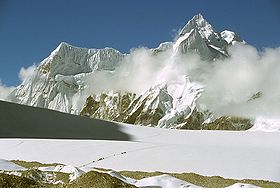
Pilgrims crossing the Nangpa LaElevation 5,806 m (19,049 ft) Location Location  Nepal /
  China
ChinaRange Himalayas Coordinates 28°06′28″N 86°35′17″E / 28.10778°N 86.58806°ECoordinates: 28°06′28″N 86°35′17″E / 28.10778°N 86.58806°E Nangpa La (el. 5,806 m or 19,050 ft) is a high mountain pass between Nepal and Tibet, a few kilometres west of Cho Oyu and some 30 km (20 mi) northwest of Mount Everest in Himalayas.[1]
It serves as the main trade route between the Tibetans and Sherpas of Khumbu.
Nangpa La was also the location of the 2006 Nangpa La shootings.
References
- ^ Encyclopædia Britannica. "Nangpa-La (pass, Asia)". http://www.britannica.com/EBchecked/topic/402581/Nangpa-La. Retrieved 2009-06-30.
China–Nepal border crossings Categories:- Geography of Tibet
- Mountain passes of China
- Mountain passes of Nepal
- Mountain passes of the Himalayas
- Tibet–Nepal border crossings
- Tibet geography stubs
- Nepal geography stubs

Wikimedia Foundation. 2010.