- Alpes-de-Haute-Provence
-
Alpes-de-Haute-Provence — Department — 
Flag
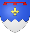
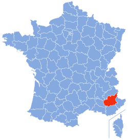
Coat of armsLocation of Alpes-de-Haute-Provence in France Coordinates: 44°0′N 6°10′E / 44°N 6.167°ECoordinates: 44°0′N 6°10′E / 44°N 6.167°E Country France Region Provence-Alpes-Côte d'Azur Prefecture Digne-les-Bains Subprefectures Barcelonnette
Castellane
ForcalquierGovernment – President of the General Council Jean-Louis Bianco (PS) Area1 – Total 6,925 km2 (2,673.8 sq mi) Population (2007) – Total 156,067 – Rank 94th – Density 22.5/km2 (58.4/sq mi) Time zone CET (UTC+1) – Summer (DST) CEST (UTC+2) Department number 04 Arrondissements 4 Cantons 30 Communes 200 ^1 French Land Register data, which exclude estuaries, and lakes, ponds, and glaciers larger than 1 km2 Alpes-de-Haute-Provence (Occitan: Aups d'Auta Provença) is a French department in the south of France, it was formerly part of the province of Provence.
Contents
History
Nord-de-Provence was one of the 83 original departments created during the French Revolution on 4 March 1790. It was renamed Haute-Provence and Basses-Alpes.
On 12 August 1793, the department of Vaucluse was created from parts of the departments of Bouches-du-Rhône, Drôme, and Basses-Alpes. Basses-Alpes lost the canton of Sault to Vaucluse at this point. Seventeen years later, in 1810, the canton of Barcillonnette was transferred over to Hautes-Alpes.
On 13 April 1970, the department of Basses-Alpes was renamed Alpes-de-Haute-Provence.
Geography
Alpes-de-Haute-Provence is a mountainous region with peaks over 10,000 feet (3,000 m) close to the Italian border. The climate is very dry and arid but irrigation allows for a prosperous fruit-growing industry.
It is surrounded by the French departments of Hautes-Alpes, Alpes-Maritimes, Var, Vaucluse, and Drôme, as well as Italy.
Rivers include: Durance, Verdon, Bléone, Ubaye, Var, Buëch, Jabron, Largue.
Arrondissements and cantons
Alpes-de-Haute-Provence is subdivided into 4 arrondissements, 30 cantons and 200 communes.
Arrondissement Canton # of communes Barcelonnette Barcelonnette 11 Le Lauzet-Ubaye 5 Castellane Allos-Colmars 6 Annot 7 Castellane 7 Entrevaux 6 Saint-André-les-Alpes 6 Digne-les-Bains Barrême 8 Digne-les-Bains-Est 4 Digne-les-Bains-Ouest 10 La Javie 6 Les Mées 6 Mézel 8 Moustiers-Sainte-Marie 3 Riez 9 Seyne 8 Valensole 4 Forcalquier Banon 9 Forcalquier 10 Manosque-Nord 3 Manosque-Sud-Est 3 Manosque-Sud-Ouest 3 La Motte-du-Caire 13 Noyers-sur-Jabron 7 Peyruis 4 Reillanne 8 Saint-Étienne-les-Orgues 8 Sisteron 5 Turriers 7 Volonne 9 See also: Communes of the Alpes-de-Haute-Provence department
Demographics
Inhabitants of this department are called Bas-Alpins.
The population was once distributed fairly evenly across the department, both in the mountainous regions and the agricultural ones. However, near the end of the 19th century it markedly decreased due to rural exodus to the cities. It fell from about 150,000 to below 100,000 after World War I. It was not until 1960, that the population began to grow again, from 84,335 in 1968 to 139,561 in 1999. However, although the population figures are about what they were before, the distribution is very different. The population is now centered around the larger towns, Manosque and Digne-les-Bains, and the mountainous regions are very sparsely populated.
The arrondissements of Barcelonette and Castellane are the two least heavily populated of France, the only ones with under 10,000 inhabitants. The town of Castellane is the smallest subprefecture of France.
Politics
The President of the General Council is the Socialist Jean-Louis Bianco.
Party seats • Socialist Party 12 • Miscellaneous Left 6 Miscellaneous Right 6 • French Communist Party 3 • Citizen and Republican Movement 1 Union for a Popular Movement 2 Tourism
The beautiful scenery provides the background to many activities and sights. Eleven villages have been classified as having special architectural character. In particular there are:
- The town of Sisteron with its ancient citadel and narrow streets
- The Gorge of Verdon (Europe's Grand Canyon)
- Digne-les-Bains Hot-spa town
- Moustiers-Sainte-Marie Pottery
- Forcalquier Cathedral
In summer many aerial sports use the surrounding mountains such as gliding, hang gliding and paragliding. In winter there is extensive skiing at eleven ski resorts.
See also
- Cantons of the Alpes-de-Haute-Provence department
- Communes of the Alpes-de-Haute-Provence department
- Arrondissements of the Alpes-de-Haute-Provence department
External links
- Alpes-de-Haute-Provence at the Open Directory Project
- (French) Conseil général website
- Abbeys in the Alps (fr. with translator)
- (French) Prefecture website
- (English) Préfecture web-site in English
- (French) Detailed information in French
- Sisteron guide
Categories:- Departments of France
- Alpes-de-Haute-Provence
- States and territories established in 1790
Wikimedia Foundation. 2010.

