- Aveyron
-
This article is about the French department. For other uses, see Aveyron (disambiguation).
Aveyron — Department — 
Flag
Coat of armsLocation of Aveyron in France
Coordinates: 44°15′N 02°42′E / 44.25°N 2.7°ECoordinates: 44°15′N 02°42′E / 44.25°N 2.7°E Country France Region Midi-Pyrénées Prefecture Rodez Subprefectures Millau
Villefranche-de-RouergueGovernment – President of the General Council Jean-Claude Luche (UMP) Area1 – Total 8,735 km2 (3,372.6 sq mi) Population (2007) – Total 274,425 – Rank 78th – Density 31.4/km2 (81.4/sq mi) Time zone CET (UTC+1) – Summer (DST) CEST (UTC+2) Department number 12 Arrondissements 3 Cantons 46 Communes 304 ^1 French Land Register data, which exclude estuaries, and lakes, ponds, and glaciers larger than 1 km2 Aveyron (French pronunciation: [avɛʁɔ̃]) (Occitan: Avairon) is a département in southern France named after the Aveyron River.
Contents
History
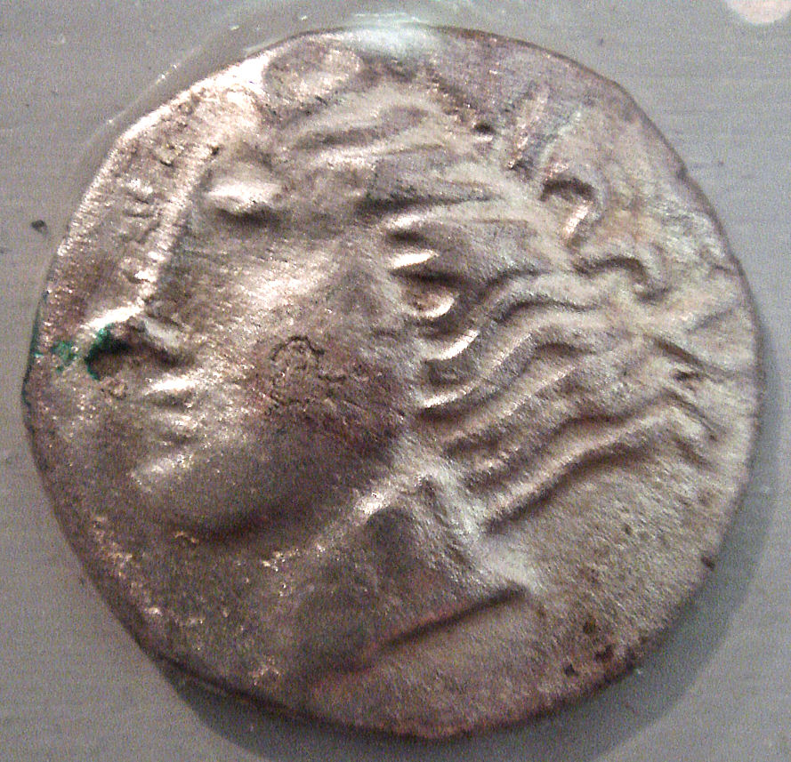
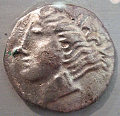 Ruteni coin, 5th–1st century BCE.
Aveyron is one of the original 83 departments created during the French Revolution on 4 March 1790.
The first known historical inhabitants of the region were the Rutenii tribe, but the area was inhabited previously to this, boasting many prehistoric ruins.
During the medieval and early modern periods, and until the 1790s, the territory covered by Aveyron was a province known as Rouergue.
In 1817, a local prosecutor Antoine Bernardin Fualdès was assassinated. The sordid circumstances of his death, following which his body was found floating in the Aveyron River, led to the matter becoming publicised as a cause célèbre. Recent studies have indicated that he met his end on the initiative of a right wing royalist organisation known as the Chevaliers de la Foi (Knights of the Faith).
Geography
The department is part of the current Midi-Pyrénées region. It is surrounded by the départements of Tarn, Tarn-et-Garonne, Lot, Hérault, Gard, Lozère, and Cantal.
The highest point in the department is the summit of Le Signal de Mailhebiau at 1469 m (Plateau of Aubrac).
Lac de Villefranche-de-Panat is used as a reservoir to provide drinking water supplies for the region.
Demographics
The inhabitants of the department are called Aveyronnais, inhabitants of Rodez are called Ruthénois, based on the first Celtic settlers, the rutenii.
Politics
The President of the General Council is Jean-Claude Luche of the Union for a Popular Movement.
Party seats Socialist Party 14 • Union for a Popular Movement 13 • Miscellaneous Right 11 Miscellaneous Left 3 Left Radical Party 2 Left Party 1 The Greens 1 Tourism
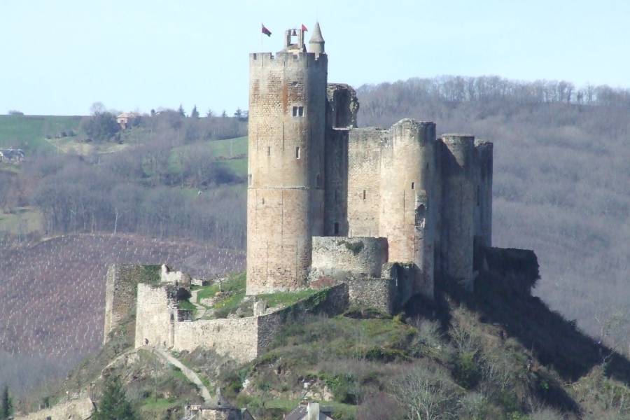
 Castle of Najac
Aveyron contains a part of the Cévennes National Park. Well-known tourist attractions are the castle of Najac, a medieval ruin perched high on a hill, and the many beautiful old castles and monasteries such as Conques Abbey, Sylvanès Abbey, Bonneval Abbey and Loc-Dieu Abbey, located near Martiel in a region with many dolmens. The small city of Millau is the site of the world's tallest bridge, the Millau viaduct, opened by President Chirac in December 2004.
Activities include horseriding, fishing, swimming in the Lacs du Lévézou and hiking/camping. The inhabitants are also very good craftsmen, and Aveyron is full of various craft objects, handmade, that can be found locally. Examples include the couteau de Laguiole, the world famous Roquefort cheese, from the village of the same name and other local produce. Markets take place every Saturday on market places around the region.
Saint-Sernin-sur-Rance is the commune where the feral child Victor of Aveyron was found in the late 18th century.
See also
- Cantons of the Aveyron department
- Communes of the Aveyron department
- Arrondissements of the Aveyron department
External links
- (French) Prefecture website
- (French) General council of Aveyron's website
- (French) Aveyron's bulletin board
 Chisholm, Hugh, ed (1911). "Aveyron". Encyclopædia Britannica (11th ed.). Cambridge University Press.
Categories:


Wikimedia Foundation. 2010.