- Bouches-du-Rhône
-
Bouches-du-Rhône — Department — 
Flag
Coat of armsLocation of Bouches-du-Rhône in France
Coordinates: 43°30′N 5°5′E / 43.5°N 5.083°ECoordinates: 43°30′N 5°5′E / 43.5°N 5.083°E Country France Region Provence-Alpes-
Côte d'AzurPrefecture Marseille Subprefectures Aix-en-Provence
Arles
IstresGovernment – President of the General Council Jean-Noël Guérini (PS) Area1 – Total 5,087 km2 (1,964.1 sq mi) Population (2007) – Total 1,958,926 – Rank 3rd – Density 385.1/km2 (997.4/sq mi) Time zone CET (UTC+1) – Summer (DST) CEST (UTC+2) Department number 13 Arrondissements 4 Cantons 57 Communes 119 ^1 French Land Register data, which exclude estuaries, and lakes, ponds, and glaciers larger than 1 km2  Istres, fourth largest town of Bouches-du-Rhône (40,000 inhabitants)
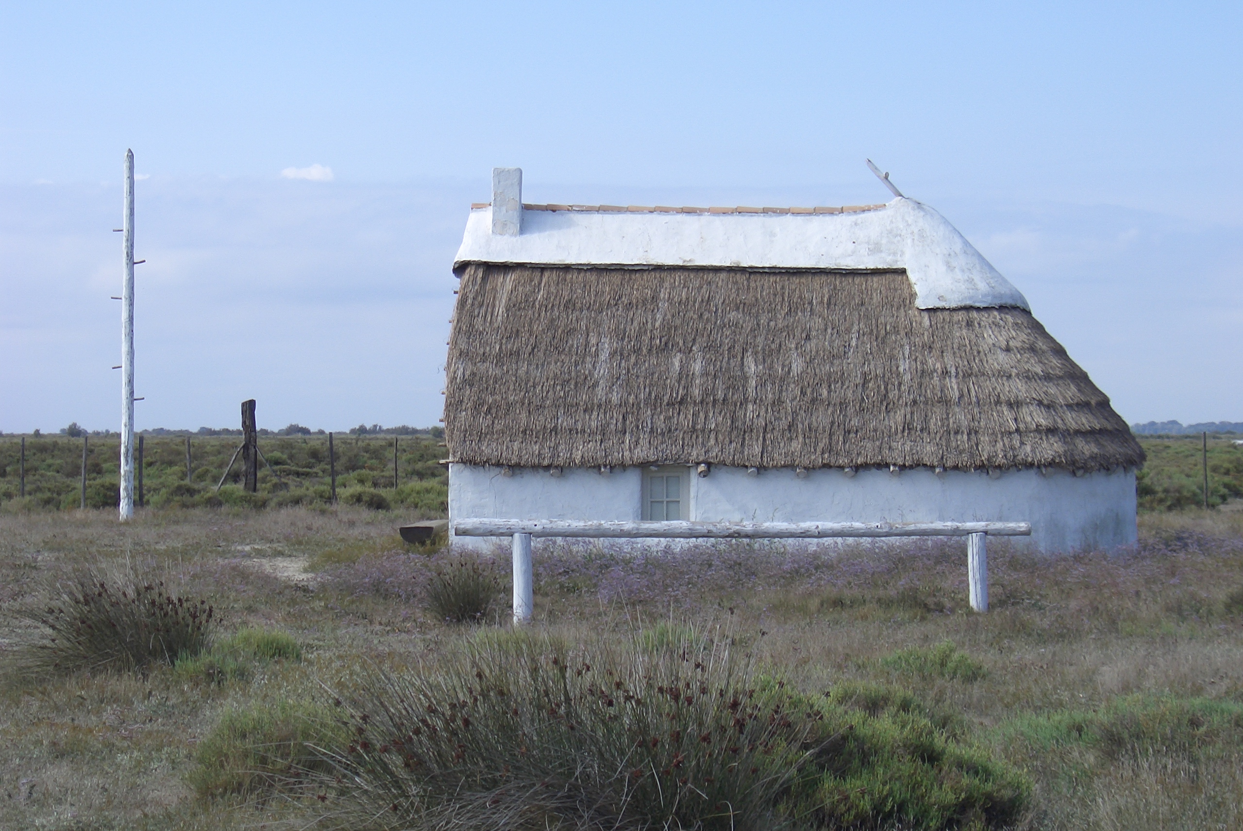
 Guardian house in Camargue
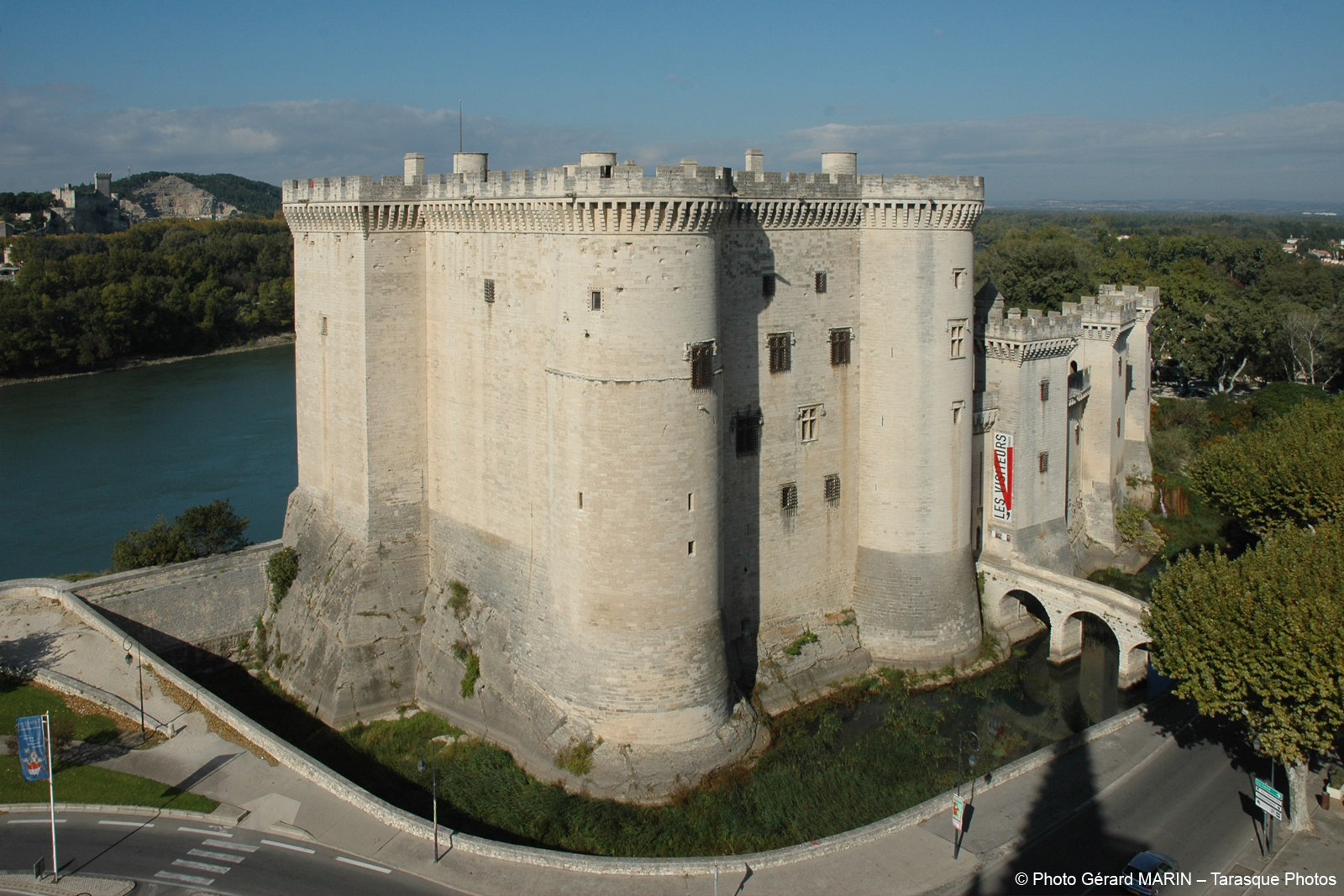
 Castle of Tarascon
Bouches-du-Rhône (French pronunciation: [buʃ.dy.ʁon]; Occitan: Bocas de Ròse, lit. "Mouths of the Rhône") is a department in the south of France named after the mouth of the Rhône River. It is the most populous department of the Provence-Alpes-Côte d'Azur region. Its INSEE and postal code is 13.
Contents
History
History of the department
Bouches-du-Rhône is one of the original 83 departments created during the French Revolution on 4 March 1790. It was created from the western part of the former province of Provence and the principalities of Orange, Martigues, and Lambesc. It lost part of its territory in 1793, including Orange and Apt, when the Vaucluse department was created.
Following its creation, the department was immediately strongly and actively supportive of the French Revolution, containing 90 "Jacobin Clubs" by 1794.[1] It was also noteworthy that more than 50% of the priests in the department accepted the Civil Constitution of the Clergy which in effect subordinated the church to the government.[2] During the ascendancy of the Communist Party in the twentieth century election results indicated that support for left-wing politics remained relatively strong in the department, and especially in the northern suburbs of Marseille.
History of the area
The history of the area is closely linked to that of Provence. Marseille has been an important harbor since before Julius Caesar's conquest of Gaul. The Roman presence has left numerous monuments across the department.
Geography
The department is part of the current region of Provence-Alpes-Côte d'Azur. It is surrounded by the departments of Gard on the west, Vaucluse on the north, and Var on the east, and by the Mediterranean Sea on the south. The Rhône River delta forms a vast swampy wetlands area called the Camargue in the southwestern part of the department.
The largest city in the department, Marseille, contains a major industrial harbor, and serves as France's largest commercial port. Bouches-du-Rhône is largely urban, with 28 towns having a population of more than 10,000 as of 2008:
- Marseille, population 851,420, departmental and regional capital (préfecture)
- Aix-en-Provence, population 142,743, sous-préfecture, a university town and seat of the regional Court of Appeals
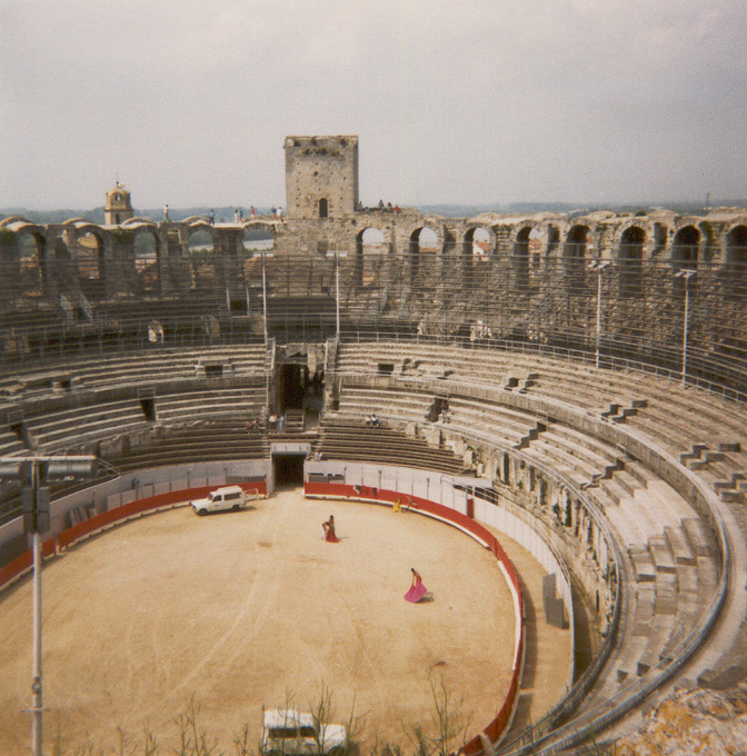
- Arles, population 52,729, sous-préfecture and site of an ancient Roman city
- Martigues, population 46,471, the leading city for the European petrochemical industry
- Aubagne, population 46,093, birthplace of Provençal author Marcel Pagnol
- Istres, population 42,603, sous-préfecture and home to a military airbase
- Salon-de-Provence, population 41,411, the home city of 16th-century soothsayer Nostradamus
- Vitrolles, population 36,610
- Marignane, population 33,909, site of the Marseille-Provence regional airport
- La Ciotat, population 33,790
- Miramas, population 25,632, regional railway hub
- Gardanne, population 21,121
- Les Pennes-Mirabeau, population 20,187
- Allauch, population 18,728
- Port-de-Bouc, population 17,207
- Fos-sur-Mer, population 15,448
- Châteaurenard, population 14,817
- Berre-l'Étang, population 13,881
- Bouc-Bel-Air, population 134,37
- Tarascon, population 13,340
- Rognac, population 12,195
- Auriol, population 11,969
- Châteauneuf-les-Martigues, population 11,564
- Plan-de-Cuques, population 11,096
- Saint-Martin-de-Crau, population 10,979
- Saint-Rémy-de-Provence, population 10,662
- Septèmes-les-Vallons, population 10,481
- Trets, population 10,239
Rivers include:
- The Rhône, which forms the border with the Gard department.
- The Durance, which forms the border with the Vaucluse department.
- The Arc
- The Huveaune
Lakes include:
- Étang de Berre
- Étang de Vaccarès, in Camargue
Mountains include:
- Alpilles mountain range
- Calanques between Marseille and La Ciotat
- Corniche des Crêtes
- Garlaban
- Mont Puget
- Montagnette hills
- Sainte-Victoire mountain
- Sainte-Baume massif
Politics
The President of the General Council is Jean-Noël Guérini of the Socialist Party. Although the department leans to the right in national elections, it remains a stronghold of the left at the local level due to the very strong PS machine in the department led today by Guérini and in the past by Gaston Defferre.
Party seats • Socialist Party 33 Union for a Popular Movement 13 • French Communist Party 6 Miscellaneous Right 5 Culture
The department is well represented in French art. Paul Cézanne painted numerous representations of the Mont Sainte-Victoire. Vincent van Gogh spent much of his life in Arles, painting many scenes in the area.
Tourism
- Cities of Marseille and Aix-en-Provence
- Roman and Romanesque monuments of Arles
- The Camargue and the town of Saintes-Maries-de-la-Mer
- Alphonse Daudet's windmill in Fontvieille
- Les Baux de Provence, medieval village
- Saint-Rémy-de-Provence and the ruins of the Roman city of Glanum
- Tarascon, medieval castle and church
- Salon, city of Nostradamus and one of the biggest citadels of Provence: Château de l'Empéri
- Calanques, between Marseille and la Ciotat
See also
- Cantons of the Bouches-du-Rhône department
- Communes of the Bouches-du-Rhône department
- Arrondissements of the Bouches-du-Rhône department
External links
Bouches-du-Rhone at the Open Directory Project
- (French) Prefecture website
- (French) General Council website
- (French) Website from the Camargue
Sources
Categories:


Wikimedia Foundation. 2010.