- Verdon Gorge
-
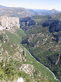 Gorges du Verdon, view from north rim
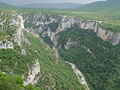
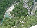
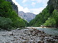
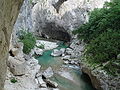
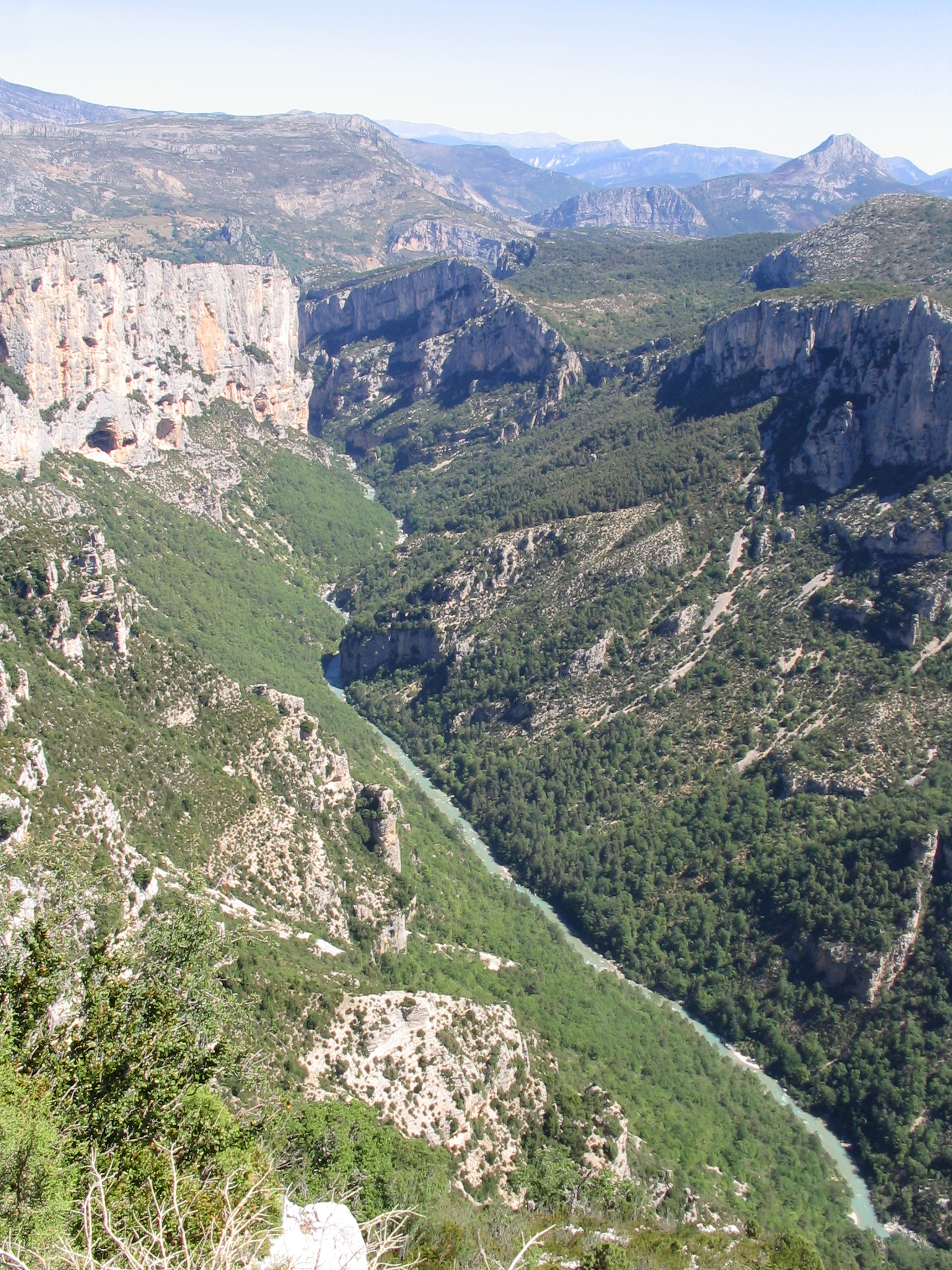
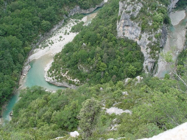
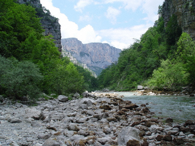
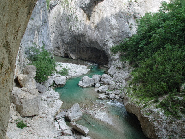
The Verdon Gorge (in French: Gorges du Verdon or Grand canyon du Verdon), in south-eastern France (Alpes-de-Haute-Provence), is a river canyon that is often considered to be one of Europe's most beautiful. It is about 25 kilometers long and up to 700 meters deep. It was formed by the Verdon River, which is named after its startling turquoise-green colour, one of the canyon's most distinguishing characteristics. The most impressive part lies between the towns of Castellane and Moustiers-Sainte-Marie, where the river has cut a ravine up to 700 metres down through the limestone mass. At the end of the canyon, the Verdon river flows into the artificial lake of Sainte-Croix-du-Verdon (in French: Lac de Sainte-Croix).
Because of its proximity to the French Riviera, the canyon is very popular with tourists, who can drive around its rim, rent kayaks or hike. The limestone walls, which are several hundreds of meters high, attract many rock climbers. It is considered an outstanding destination for multi-pitch climbing. There are routes encompassing cracks, pillars and seemingly endless walls. The climbing is generally of a technical nature, and there are over 1,500 routes, ranging from 20m to over 400m.
Contents
History
During the Triassic period, the French region of Provence subsided and was covered by the sea, leaving thick layers of various limestone deposits. Several million years later, with the arrival of the Jurassic period, the area was covered by a warm shallow sea, which allowed the growth of various Corals. The Cretaceous period saw what is now Basse Provence being raised and the sea reaching the current location of the Alps, which were themselves erected during the tertiary era. As a result of the large scale geological activity resulting from this, many of the Jurassic limestone deposits fractured, forming relief with valleys and other such features. Indeed, it is to this epoch that the origins of the Verdon Gorge can be traced. The dawn of the Quaternary period witnessed large scale glaciation, transforming water pockets and lakes into unstoppable rivers of ice, which remodeled the topography, scouring and striating the landscape. At the end of this activity, erosion by rivers continued, forming the Gorge as it is today. The Verdon’s river bed was scoured for a second time of the accumulated coral and limestone sediments, by a water delivery rate nearing 2000 to 3000 cubic metres per second.
Discovery
There are printed descriptions of the gorge from 1782 and 1804, and in tourist guides of the second half of the 19th century. According to Graham Robb's book "The Discovery of France" the gorge was unknown to the outside world until 1906.
Recent developments
On 10 July 2006, the French Conseil d'État annulled the declaration of public use of the EDF (Électricité de France; Electricity of France)’s project, relating to a high voltage line carrying 400,000 volts which would have had to pass through the Verdon Gorge. This decision ended 23 years of struggle by public groups and associations of environmental defense to preserve a site of exceptional natural interest, of which a part contains protected animal and plant species.[1]
Geography
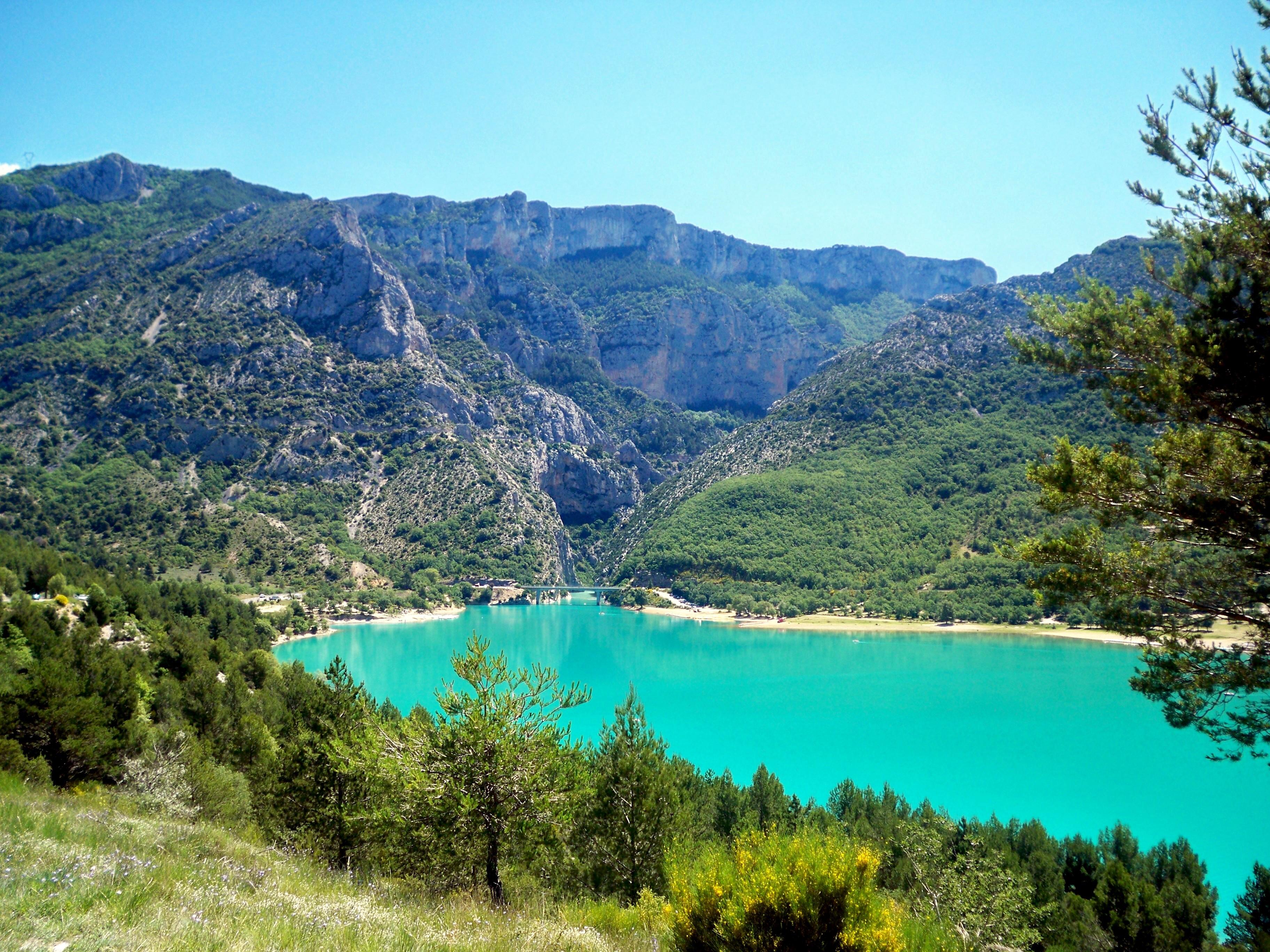
 Dam of Sainte-Croix, seen from the Low-Gorges of Baudinard
The source of the Verdon is close to the col d'Allos hill in the Trois Eveches mountain range, from where it continues, flowing into the Durance river near Vinon-sur-Verdon after traveling 175 kilometres. The most interesting part of this journey is found between Castellane and the Pont du Galetas, on the lac de Sainte-Croix. Some decades ago, this Lake used to be the large plain of Les Salles-sur-Verdon, before the construction of a reservoir created by the erecting of the Sainte-Croix dam. At the time of the raising of the water level in 1973, the old village des Salles was evacuated by force, destroyed and inundated. The church was dynamited, as was the rest of the village, which has been reconstructed higher up the valley as a more modern settlement, to the great displeasure of its inhabitants. Today, it is the youngest village in France.
For some distance the Verdon Gorge forms the border between the départements of Var to the south and Alpes-de-Haute-Provence to the north in the Provence-Alpes-Côte d'Azur région.
This region, between Castellan and the Lac de Sainte-Croix is called the ‘’’Gorges du Verdon’’’; ‘’’Verdon Gorge’’’. It is split into three distinct parts: the “Prégorges” (‘pre-gorge’) which goes from Castellane to Pont de Soleils, the Gorge itself which goes from Pont de Soleils to l'Imbut, and the Canyon which goes from l’Imbut to the Pont de Galetas.
The Verdon Gorge is narrow and deep, with depths of 250 to 700 metres and widths of 6 to 100 metres at the level of the Verdon river, and 200 to 1500 metres from one side of the Gorge to the other at the summit.
Hydro-electric dams
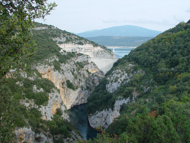
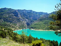 View of the entrance to the Verdon Gorge with Lac de Sainte-Croix in the foreground.
Overview
Between 1929 and 1975, five dams were erected on the course of the Verdon, between Castellane and Gréoux-les-Bains. These Dams hold back water in the following reservoirs:
- Lac de Castillon, with the engulfing of the village of the same name
- Lac de Sainte-Croix, with the engulfing of village des Salles-sur-Verdon, of the Roman bridge of pont de Garuby or pont d’Aiguines and of the “Bishop’s” spring at Bauduen. With marvellous and changing colours nearly every day, it has become a high spot for summer tourism. It is the largest reservoir in France;
- Lac d'Esparron-Gréoux, known locally as “lac d’Esparron”. It is coloured green, like the Verdon, but unlike lac de Sainte-Croix, in which the colour blue dominates.
- The reservoir at Chaudanne
- The reservoir at Quinson, sometimes improperly called the "lac de Montpezat", the name of the village over which it dominates.
Notable features
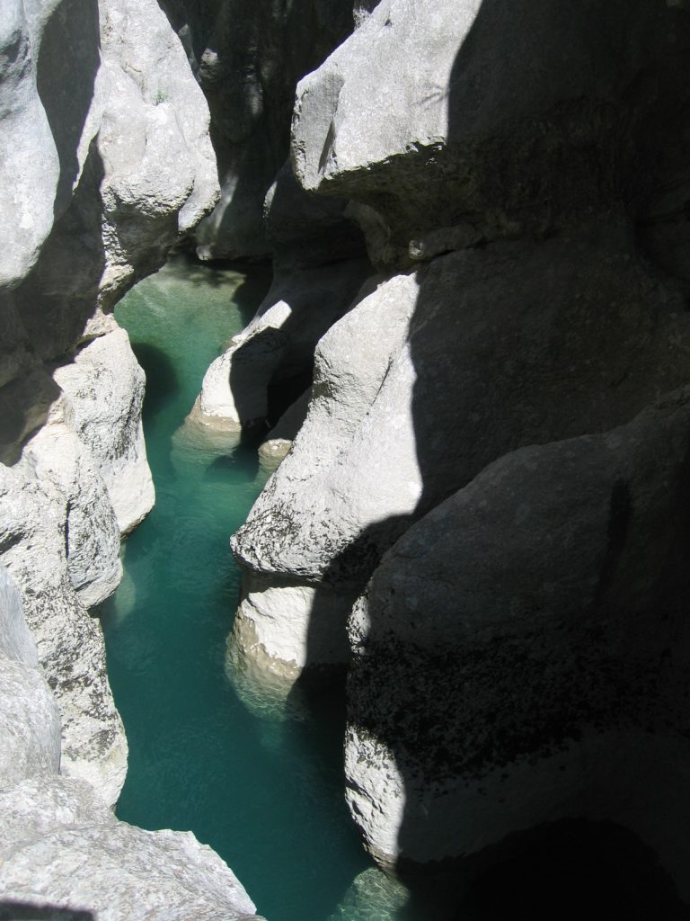
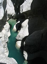 The Styx du Verdon
The Styx du Verdon, so named by reference to the river Styx of Greek mythology is like a sub-canyon within the canyon itself.
The "Imbut", also known as "Embut" or "Embucq" is a sort of funnel where the Verdon disappears underground, beneath enormous rock structures.
Tourism
The Verdon Gorge is renowned as one of the most beautiful canyons in Europe, and attracts numerous tourists, especially during the summer period. It is easily accessible on its right bank from the North (via route D952 from Castellane to Moustiers-Sainte-Marie), and on its left bank from the South (via routes D71, D90 and D995 from Aiguines to Castellane).
The southern route offers views of the Col d'Illoire, the summits of Plein Voir, le Pavillon (1624 m), la cime de Barbin (1560 m) and le Mourre de Chanier (1930 m), and the Saint-Croix reservoir. The "Sentier de l'Imbut" hike begins from this side of the gorge. When the road passes through the Tunnel du Fayet, there are openings cut into the tunnel to afford a view. The road then crosses the Artuby River over a bridge known either as Pont de l'Artuby or Pont de Chaulière; soon after, at the relais de Balcon, the Artuby flows into the Verdon. This area is also known as the "Mescla," meaning "mixture" in Provençal.
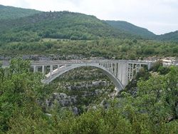 The pont de Chaulière over the river Artuby
On the D90 in the direction of Trigance, another bridge spans the Jabron river (another tributary of the Verdon) and then the Pont des Soleils. Just below Rougon there is the Couloir Samson (Samson's Corridor), the entrance to the part of the fluvial landscape designated as "gorge." From there one can hike along the Verdon and take the famous "Sentier Martel." La Palud-sur-Verdon, a village with museum and tourist bureau, is nearby; the "route des Crêtes" (Crest Route, linking various panoramic viewpoints) proceeds from here. The Sentier Martel also is accessible from this route, beginning at the French Alpine Club or "châlet de La Maline." This path covers over 100 km of not always easy roads.
Sport
The Verdon Gorge is an appreciated destination for rock climbers, since it includes more than 1,500 climbing routes on good limestone rock. The Verdon and its Gorge is also a favoured destination for fishermen, particularly for fly fishing. Hiking, Canoeing, paragliding, rafting, climbing and of course Canyoning are some of the numerous sports practiced in the region.
Hiking and scenic walks
The most famous and beautiful hikes in the gorge include:
- Le sentier (pathway) de Martel
- Le sentier de l'Imbut
- Le sentier du Bastidon
- Le belvédère de Rancoumas par le pont de Tusset (the Rancoumas panoramic viewpoint near the Tusset Bridge)
The most famous of these, the Sentier Martel, was laid out in 1928 by the Touring Club de France, and given its present name in 1930 to honor the explorer Édouard-Alfred Martel (1859–1938). Martel had visited the Verdon in 1905 as an employee of the Southeast Electricity Company, carrying out precise geological surveys of the river. On 11 August, he and his team (explorer Armand Janet, schoolmaster Isidore Blanc, geographer Cuvelier, plaus Baptistin Flory, Fernand Honorat, Prosper Marcel, and Tessier Zurcher) began an expedition of the region by boat and foot (especially when one of the boats became unusable). They discovered a narrow corridor which Martel named "Styx." When they arrived at Imbut (meaning "narrow" or "funnel" in Provençal) Martel wished to abandon the expedition, but his comrades encouraged him to continue. They entered the canyon proper and discovered more passages and rock formations; their successful arrival at the Pas de Galetas marked the completion of the first expedition of the Verdon Canyon.
Other expeditions to the Verdon included Martel's team the following year; Robert de Joly who in 1928 was the first to completely cross the Verdon Gorge, passing over the Imbut; explorer and filmmaker Albert Mahuzier in 1938 and 1939; a group of Scouts in 1945 and the Canoe Club of France in 1946; and Roger Verdegen, who made several expeditions in a boat made from animal hides and natural rubber, and became an authority on the Verdon.
The hiking route
From the chalet de la Maline to the Point Sublime, passing through Martel’s pathway with a detour via the Mescla.
The present-day Sentier Martel travels 15 kilometres (9.3 mi) along the right bank of the river Verdon from its entrance into the Canyon (Point Sublime) to the Châlet de la Maline. Some experienced hikers can do the round trip by foot in 12 to 13 hours; for those going one way, this section of the hike takes 7 to 8 hours with the detour via La Mescla.
Beginning at La Maline and going toward the canyon, the route descends in hairpins to join the water at the Estellié ford. Notable sights along this section include the Ravin de Charençon, the Pas d'Issabe, the Pré d'Issane (a small pebble beach along the Verdon), the Étroit des Cavaliers (a narrow passage between cliffs), the Guèges scree, and the large cave of Baume-aux-Boefus.
A detour allows one to visit la Mescla, where the Artuby river joins the Verdon, and where the Abbot Pascal, one of the Verdon's pioneers, drowned in 1928.
The main path towards the Point Sublime quickly ascends and comes to the Brèche Embert and its 6 stairways, totaling 252 steps (descending). Thereafter, the route climbs again along the Verdon, first very high above the riverbanks, then very close, to arrive at a pebble beach by the Baumes-Fères stream, near the cliff of l'Escalès.
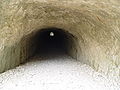
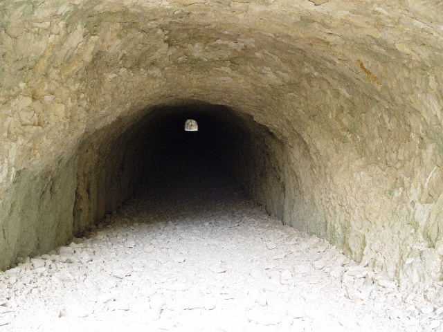
The hike continues along the river bed, passing the Tours de Trescaïre on the other bank: two impressive monolithic pyramids. Then comes three tunnels: the Tunnel des Baumes, the Tunnel de Trescaïre, and the Tunnel du Baou, which were originally built for hydroelectric projects that were abandoned after World War II. Hikers wishing to explore these need pocket lamps and warm clothing; they range in length from 110 metres (360 ft) to 670 metres (2,200 ft).
At the end of the Tunnel de Trescaïre is a view of the narrowness of the Gorge, with the cliff walls of l'Escalès to the left and the rock face of l'Encastel to the right. Partway through the Tunnel du Baou there is a window hollowed through the rock that allows access to the Baume aux Pigeons, with a steep metal staircase leading to the river and its rock formations. After this last tunnel, the route goes beside the Verdon once more, then over the Baou to a new footbridge, leading back to the parking lots.
Gallery
-
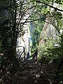
Le Martel, from the departure at la Maline. Opposite the cliff of les Cavaliers. below, the Verdon at the Pré (meadow) d’Issane.
-
The Artuby mixes with the Verdon, at the Mescla.
-
Entrance of tunnel de Trescaïre
-
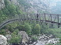
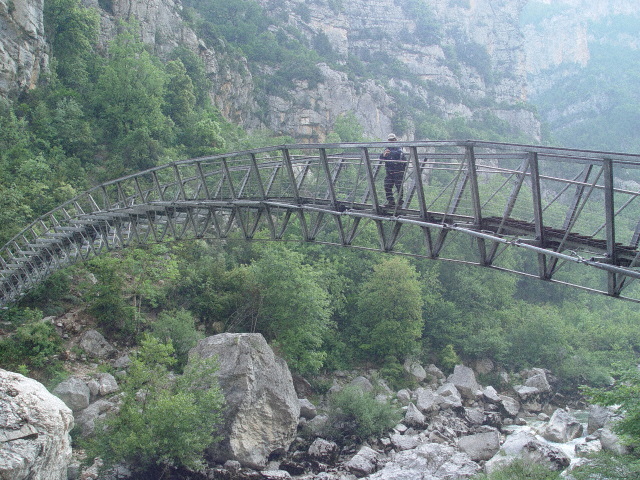
The new footbridge at l’Estellé.
-
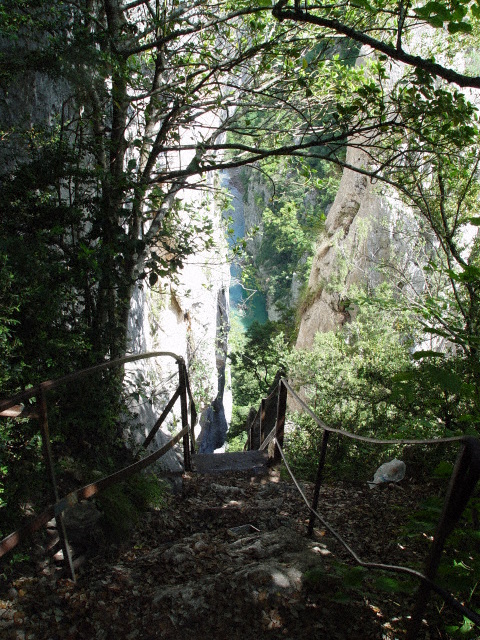
The Imbert stairway, 6 stairways and 252 steps.
-
Beach of Baumes-Fères, below, the cliff of l’Escales
-
The Baume-aux-Pigeons
References
- ^ Patriarca, Eliane. "Le Verdon sauvé des volts" (in French). libération.fr. http://www.liberation.fr/actualite/terre/198160.FR.php. Retrieved 17 March 2007.
External links
Categories:- Landforms of France
- Canyons and gorges of France
- Alpes-de-Haute-Provence


Wikimedia Foundation. 2010.