- Col d'Allos
-
Col d'Allos 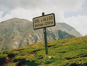
Sign at the summitElevation 2,250 m (7,382 ft) Location Location of Col d'Allos
 Col d'Allos
Location  France
Range Alps Coordinates 44°17′50″N 06°35′39″E / 44.29722°N 6.59417°ECoordinates: 44°17′50″N 06°35′39″E / 44.29722°N 6.59417°E Col d'Allos (el. 2250 m.) is a high mountain pass in the Alps in the department of Alpes-de-Haute-Provence in France.
It connects Barcelonnette in the Ubaye Valley and Colmars and goes on to the Col des Champs.
It lies parallel to the Col de la Cayolle and Col de la Bonette in the Parc National du Mercantour. The source of the Verdon River is near the pass.
Between 1911 and 1939, this pass was always in the Tour de France. Altogether, it has been part of the route 33 times, one of the most popular cols. It was last part of the Tour in 2000, when it was part of the 13th stage.
See also
- List of highest paved roads in Europe
- List of mountain passes
- Allos
References
- This article incorporates information from the German Wikipedia.
Categories:- Mountain passes of France
- Mountain passes of the Alps
- Alpes-de-Haute-Provence
- Provence-Alpes-Côte d'Azur geography stubs


Wikimedia Foundation. 2010.