Oakmere

Oakmere
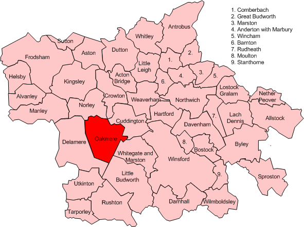
Map of civil parish of Oakmere within the former borough of Vale Royal

Oakmere is a village and civil parish in the unitary authority of Cheshire West and Chester and the ceremonial county of Cheshire, England.

Oakmere is situated on the A556 road, approximately 7 miles (11 km) west of Frodsham. It has three pubs, The Abbey Arms (named after the nearby Vale Royal Abbey), the Fishpool Inn (named after a now dried up fish pond used by the monks from Vale Royal abbey) and The Fourways, a former country club.[citation needed] There is also a car-sales business[1] and a caravan sales company.[2] The adjoining village of Delamere has a post-office, church and railway station on the Chester to Manchester line.

The area is mainly agricultural, and has a number of large sand quarries nearby, some of which are wet-workings.[citation needed] The lake from which the village takes its name is a Site of Special Scientific Interest.[3][4]

Notes

  1. ^ Nick Tomlin Cars Retrieval date: 1 May 2009.
  2. ^ Caravan sales company. Retrieval date: 12 July 2007.
  3. ^ Natural England: Oak Mere (accessed 16 April 2010)
  4. ^ Natural England: Nature on the Map: Oak Mere SSSI (accessed 16 April 2010)

External links

Media related to Oakmere at Wikimedia Commons

Coordinates: 53°13′N 2°38′W / 53.217°N 2.633°W / 53.217; -2.633


Wikimedia Foundation. 2010.

Игры ⚽ Поможем решить контрольную работу

Look at other dictionaries:

  • Oakmere — Original name in latin Oakmere Name in other language State code GB Continent/City Europe/London longitude 53.21996 latitude 2.64054 altitude 81 Population 0 Date 2011 07 31 …   Cities with a population over 1000 database

  • Oakmere hill fort — Oakmere hill fort …   Wikipedia

  • Oakmere Hall — Coordinates: 53°13′47″N 2°36′53″W / 53.2296°N 2.6148°W / 53.2296; 2.6148 …   Wikipedia

  • List of Scheduled Monuments in Cheshire dated to before 1066 — Sandbach Crosses There are over 200 Scheduled Monuments in Cheshire, a county in North West England, which date from the Neolithic period to the middle of the 20th century. This list includes the Scheduled Monuments in Cheshire up to the year… …   Wikipedia

  • Cuddington, Eddisbury — Coordinates: 53°14′24″N 2°36′01″W / 53.240°N 2.600297°W / 53.240; 2.600297 …   Wikipedia

  • John Douglas (architect) — For other people of the same name, see John Douglas (disambiguation). John Douglas John Douglas, photograph published in 1890 Born 11 April 1830(1830 04 11) Sandiway …   Wikipedia

  • Civil parishes in Cheshire — A map of Cheshire, showing the Boroughs : (1) Cheshire West and Chester; (2) Cheshire East; (3) Warrington; and (4) Halton. A civil parish is a subnational entity, forming the lowest unit of local government in England. There are 332 civil… …   Wikipedia

  • John Douglas (Architekt) — John Douglas in seinen mittleren Jahren John Douglas (* 11. April 1830 in Sandiway, Cheshire, England; † 23. Mai 1911 in Walmoor Hill, Dee Banks, Chester, England) war ein englischer Architekt, der rund 500 Bauwerke in Cheshire, im Norden vo …   Deutsch Wikipedia

  • List of historic houses in England — Historic houses in England is a link page for any stately home, country house or other historic house in England.Bedfordshire*Ampthill Park *Battlesden House *Chicksands Priory *Eggington House *Hinwick House *Houghton House *Luton Hoo *Milton… …   Wikipedia

  • Chester — For the larger local government district, see Cheshire West and Chester. For other uses, see Chester (disambiguation). Coordinates: 53°11′33″N 2°53′30″W / 53.192 …   Wikipedia

Share the article and excerpts

Direct link
Do a right-click on the link above
and select “Copy Link”