- List of Scheduled Monuments in Cheshire dated to before 1066
-
There are over 200 Scheduled Monuments in Cheshire, a county in North West England, which date from the Neolithic period to the middle of the 20th century. This list includes the Scheduled Monuments in Cheshire up to the year 1066, the year accepted by Revealing Cheshire's Past[1] as the start of the Medieval period.
A Scheduled Monument is a nationally important archaeological site or monument which is given legal protection by being placed on a list (or "schedule") by the Secretary of State for Culture, Media and Sport; English Heritage takes the leading role in identifying such sites. The current legislation supporting this is the Ancient Monuments and Archaeological Areas Act 1979. The term "monument" can apply to the whole range of archaeological sites, and they are not always visible above ground. Such sites have to have been deliberately constructed by human activity. They range from prehistoric standing stones and burial sites, through Roman remains and Medieval structures such as castles and monasteries, to later structures such as industrial sites and buildings constructed for the World Wars.[2]
At least 84 monuments dating from before 1066 have been scheduled in Cheshire, the oldest probably being The Bridestones, a Neolithic long cairn. The monument at Somerford is also thought to have been a long cairn and there is evidence of a Neolithic settlement at Tatton. The Bronze Age is the period most strongly represented before 1066 with 44 monuments, almost all of which are round barrows. Eleven Iron Age hillforts or promontory forts are scheduled. The period of Roman rule left a variety of scheduled monuments, including the remains of settlements at Heronbridge and Wilderspool, and parts of Chester city walls. Definite or possible Roman military camps have been revealed by aerial photography showing cropmarks and parchmarks. The monuments remaining from the Dark Age and the Saxon period consist mainly of portions of crosses, and there is evidence of Saxon occupation of villages, now deserted, at Tatton and Baddiley.
Name Remains Location Date SM No [A] Notes Ref Abbey Green cultivation marks Excavation Chester
53°11′36″N 2°53′28″W / 53.1933°N 2.8910°WIron Age CH103 Excavations in 1975–77 revealed striations in the sandstone bedrock indicating pre-Roman cultivation of the area. [3] Baddiley village Foundations Baddiley
53°02′59″N 2°35′11″W / 53.0497°N 2.5863°WLate Saxon and Medieval 30389 There is evidence of house platforms and enclosures which indicate a deserted village. [4] Bartomley mound Mound Wincle
53°11′18″N 2°03′17″W / 53.1882°N 2.0546°WBronze Age 33882 A round barrow which consists of a mound which is partly bedrock. The edges of it have been ploughed and two pits dug into it. [6] Bearhurst barrow Earthworks Henbury
53°14′44″N 2°11′28″W / 53.2455°N 2.1912°WBronze Age 22583 A round barrow 50 feet (15 m) across and 6 feet (2 m) high. An excavation in 1965–66 revealed flints, pottery sherds and two urns, one of which contained a cremation. [7] Beeston Castle hillfort Earthworks Beeston
53°07′41″N 2°41′31″W / 53.1280°N 2.6919°WLate Bronze Age to late Iron Age 23641 A hillfort on a prominent rocky outcrop. The site is now occupied by a ruined medieval castle which has obliterated the signs of earlier occupation. [9] Bent Farm Roman Camp Earthworks Newbold Astbury
53°09′18″N 2°14′39″W / 53.1549°N 2.2442°WRoman 25716 Earthworks were identified in 1725 as a Roman temporary camp but largely destroyed in 1744. Further investigations carried out in 1967. [11] Birch Hill Cropmarks Manley
53°15′36″N 2°42′46″W / 53.2600°N 2.7129°WRoman 25714 A temporary Roman camp which was identified from cropmarks in 1994 by aerial reconnaissance; no upstanding remains. [13] Birtles Hall barrow Earthworks Over Alderley
53°16′05″N 2°13′08″W / 53.2680°N 2.2190°WBronze Age 22577 A slightly oval (20m x 19m) round barrow consisting of a mound on top of a natural rise. [15] Blackrock Farm barrow Earthwork Ginclough, Rainow
53°17′11″N 2°03′49″W / 53.2865°N 2.0635°WBronze Age 22568 A turf-covered round barrow 22.5m in diameter and 1.6m high. [17] Blue Boar Farm barrow Earthworks Rainow
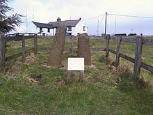
53°17′04″N 2°02′43″W / 53.2844°N 2.0453°WBronze Age 22569 A round barrow, described in 1878 as a conical tumulus. It is now an oval (31.5m x 29m) mound of earth and stones up to 2m high. [19] Bowstones Standing stones Lyme Handley
53°19′43″N 2°02′26″W / 53.3287°N 2.0406°WLate Saxon 22589 Two cross staffs set in a massive stone base. Each has traces of carved interlaced ornament. Carved initials have been added, probably in the Medieval period. [21] Bradley Hillfort Earthworks Kingsley
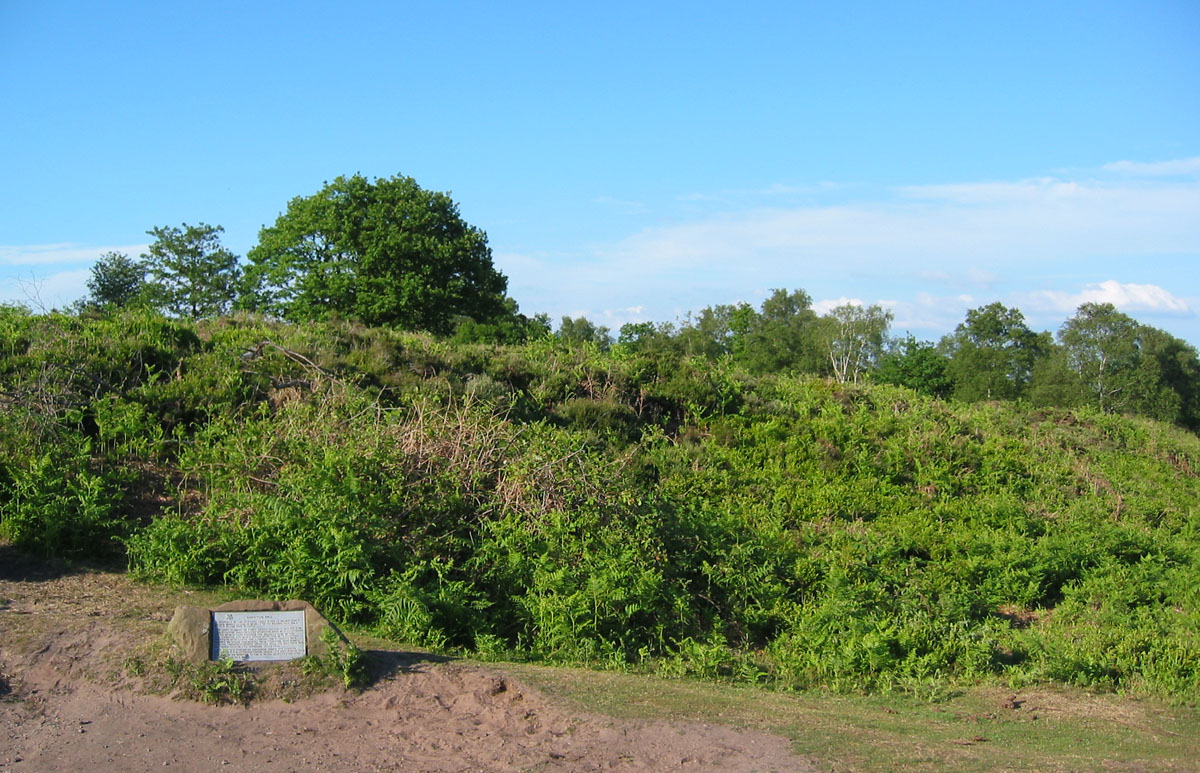
53°17′10″N 2°41′33″W / 53.2861°N 2.6926°WIron Age 25693 The smallest promontory hillfort in the county. It has natural defences only to the north; the other defences have been damaged by ploughing. [23] The Bridestones Stone structure Congleton
53°09′23″N 2°08′23″W / 53.1565°N 2.1398°WNeolithic 13500 The only known Neolithic tomb in the county, formerly a chambered long cairn. Much of its fabric was removed in the mid-18th century to build a road. It now consists of a chamber enclosed by large stone slabs. [25] Brink Farm barrow Earthworks Rainow
53°18′32″N 2°02′40″W / 53.3089°N 2.0445°WBronze Age 22570 A bowl-shaped round barrow consisting of a mound near the top of a knoll. [27] Bullstones Earthwork with upright stone Wincle
53°12′19″N 2°04′24″W / 53.2052°N 2.0732°WBronze Age 22584 A cremation burial site in which the bones of a child or young person were found 3 feet (1 m) below the surface surrounded by a stone circle 20 feet (6 m) in diameter. Inside the circle was an upright stone slab, which is still present. [28] Burton Point Earthworks Neston
53°15′17″N 3°02′46″W / 53.2548°N 3.0460°WIron Age 25695 A promontory fort consisting of earthworks in an arc protecting a former headland overlooking the River Dee [30] Capesthorne Hall barrow (south) Earthworks Siddington
53°14′58″N 2°14′01″W / 53.2495°N 2.2336°WBronze Age 22575 A round barrow on a high point in woodland. [33] Capesthorne Hall barrow (north) Earthworks Siddington
53°15′10″N 2°14′11″W / 53.2529°N 2.2365°WBronze Age 22576 A round barrow on the summit of a knoll. (The ornamental stone pedestal on its top is not part of the schedule.) [35] Carden Park barrow Earthworks Carden
53°04′31″N 2°48′03″W / 53.0753°N 2.8007°WBronze Age 23635 An oval (32m x 25m) bowl barrow of sand and earth on a saddle of higher ground (now in a golf course). [37] Charles Head barrow Earthworks Rainow
53°18′18″N 2°02′12″W / 53.3051°N 2.0367°WBronze Age 23613 A round barrow on the crest of a ridge, now crossed by a drystone wall. [39] Chester Roman Amphitheatre Earthworks Chester
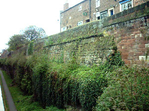
53°11′21″N 2°53′14″W / 53.1893°N 2.8871°WRoman CH 85 Originally in wood, later in stone. The northern half has been excavated [41] Chester city walls City walls Chester
53°11′32″N 2°53′21″W / 53.1923°N 2.8891°WRoman and Medieval CH7 An almost complete circuit of red sandstone walls round the city. The north and east walls follow Roman foundations and contain fabric from that era. [42] Cleulow cross Standing stone Wincle
53°12′14″N 2°04′25″W / 53.2038°N 2.0735°WEarly Medieval/ Dark Age 25645 A gritstone pillar in a socket stone on a mound. The shaft is round and has the remains of a small wheelhead cross on the top. [45] Coddington barrow Earthworks Coddington
53°05′31″N 2°49′07″W / 53.0919°N 2.8187°WBronze Age 22588 A tree-covered mound of red sand with a surrounding ditch, scheduled as a bowl barrow. [47] Disley churchyard cross Stone Disley
53°21′27″N 2°02′23″W / 53.3575°N 2.0398°WEarly Medieval/ Dark Age 25631 A socket stone for two crosses in St Mary's churchyard. It was discovered in 1958 and thought to be the setting for two Saxon crosses. [48] Eddisbury hillfort Earthworks Delamere
53°13′09″N 2°40′14″W / 53.2192°N 2.6705°WIron Age 25692 A former hillfort on a steep-sided sandstone projection on the east side of the mid-Cheshire ridge. The defences consist of two earth ramparts with a single ditch between them. [50] Edgar's Cave Former quarry Handbridge
53°11′04″N 2°53′19″W / 53.1844°N 2.8887°WRoman 27582 A quarry which included a shrine to Minerva whose image is still visible. The shrine is a Grade I listed building. [54] Elm Bank Roman Camp Cropmark Waverton
53°10′12″N 2°49′20″W / 53.1701°N 2.8222°WRoman 25715 Cropmarks show a rectangular enclosure which housed a Roman practice camp. [57] Engine Vein copper mine Trench and pits Nether Alderley
53°17′39″N 2°12′37″W / 53.2941°N 2.2104°WBronze Age and later 33859 An opencast mine for copper and other minerals in use from the early Bronze Age, in Roman and medieval times, through to the Victorian era [59] Gallowsclough Cob barrow Earthworks Oakmere
53°14′14″N 2°38′44″W / 53.2373°N 2.6455°WBronze Age 22594 A round barrow excavated in 1960 which was found to contain a cremation burial. [61] Ginclough standing stone Standing stone Ginclough
53°17′03″N 2°04′06″W / 53.2842°N 2.0683°WLate prehistoric 25702 A large stone 1m high cut away on two sides [63] Harbutt's Field Roman fort Plan of Roman fort Middlewich53°11′55″N 2°26′50″W / 53.1985°N 2.4472°W Roman 12615 The complete plan of a Roman fort has been revealed by a geophysical survey [65] Helsby Hill fort Earthworks Helsby Hill
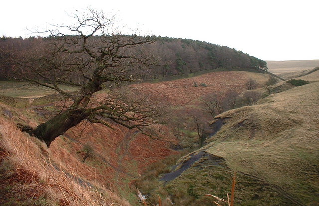
53°16′24″N 2°45′47″W / 53.2732°N 2.7630°WIron Age 25689 A promontory fort with naturally steep slopes to the west and north and an earth and stone rampart to the south. [67] Heronbridge Roman Site Earthworks Claverton
53°10′15″N 2°53′02″W / 53.1709°N 2.8839°WRoman CH25 A Roman settlement on each side of Watling Street with evidence of industrial activity in the late 1st and the 2nd century. [69] High Billinge barrow Earthworks Utkinton
53°11′28″N 2°40′04″W / 53.1911°N 2.6679°WBronze Age 23705 A round barrow 30m across and 1.8m high in woodland on a hill-top. [79] Hoole Roman Camp Parchmark Hoole
53°12′16″N 2°51′18″W / 53.2044°N 2.8551°WRoman 27596 Aerial photography in August 1995 showed a rectangular enclosure, part of which lies under the A41 road. [81] Ince Roman Fortlet Cropmarks Ince
53°17′13″N 2°49′49″W / 53.2870°N 2.8303°WRoman 27589 Aerial photography showed a double-ditched rectangular enclosure. Excavation revealed a piece of samian pottery and postholes. [83] Jodrell Bank barrow cemetery Earthworks Swettenham
53°13′27″N 2°18′13″W / 53.2243°N 2.3036°WBronze Age 23654
23655
23656
23657Four remaining round barrows from an original group of six. [85] Kelsborrow promontory fort Earthworks Delamere
53°12′10″N 2°42′09″W / 53.2027°N 2.7026°WIron Age 25691 A promontory fort with steep sides to the south and a curving bank and ditch to the north. In the 19th century a palstave and a fragment of a sword were found. [90] Knightslow barrows Earthworks Lyme Handley
53°19′55″N 2°03′17″W / 53.3319°N 2.0547°WBronze Age 22579
22580
22581
22582A group of four round barrows in woodland on a hill. [92] London Road barrow Earthworks Prestbury
53°18′06″N 2°08′23″W / 53.3017°N 2.1398°WBronze Age 22578 A slightly oval (26m x 25m) barrow up to 1.3m in height. In 1808 a number of cairns were found, one of which contained cremations. [97] Long Lane barrow Earthworks Bickerton
53°04′09″N 2°43′55″W / 53.0691°N 2.7320°WBronze Age 23636 A round barrow consisting of a low mound 24m in diameter and 0.5m high on a knoll to the east of Bickerton Hill. [99] Longley Farm field system Earthworks Kelsall
53°13′29″N 2°42′20″W / 53.2247°N 2.7056°WIron Age (or medieval/post-medieval) 30375 A system of terraces, lynchets and enclosures [101] Maiden Castle Earthworks Bickerton Hill
53°04′15″N 2°45′04″W / 53.0708°N 2.7511°WIron Age 25690 A promontory hill fort on a spur with an earthwork defending its neck and two lines of ramparts on the south and east. [103] Meadows Farm barrow Earthworks Horton-cum-Malpas
53°01′47″N 2°48′53″W / 53.0296°N 2.8146°WBronze Age 22587 A round barrow which contained an oak plank, possibly part of a coffin. [105] Moultonbank barrow Earthworks Moulton
53°13′13″N 2°31′16″W / 53.2203°N 2.5211°WBronze Age 22596 A round barrow on the top of a glacial mound 35m in diameter and 1.5m high. [107] The Murder Stone Standing stone Lyme Handley
53°19′34″N 2°01′29″W / 53.3261°N 2.0248°WBronze Age 25701 A standing stone consisting of a triangular slab of gritstone [109] Nab Head barrow Earthworks Bollington
53°18′21″N 2°05′28″W / 53.3058°N 2.0912°WBronze Age 22573 An oval (19m x 17m) barrow up to 1.8m high with a central depression, surrounded by a ditch. [111] North Cheshire Ridge Roman Road (1) Earthworks Appleton Thorn
53°20′59″N 2°32′46″W / 53.3497°N 2.5461°WRoman WG78 Much of this portion of the road is now covered by the village hall car park. [113] North Cheshire Ridge Roman Road (2) Earthworks Stretton
53°20′37″N 2°33′36″W / 53.3436°N 2.5600°WRoman WG78 Scheduled portion of the road near to Mosswood Hall [114] Oakmere hill fort Earthworks Oakmere
53°12′22″N 2°37′52″W / 53.2060°N 2.6312°WIron Age 25688 A promontory fort on a spur protruding into the mere with a rampart across the east side. [115] Peckforton Mere promontory fort Earthworks and cropmarks Peckforton
53°06′52″N 2°40′49″W / 53.1144°N 2.6803°WIron Age 25703 A defensive settlement on a ridge with the mere to the southwest and marsh to the northwest and southeast. The northeast was defended by a ditch. [117] Picton Roman camp Cropmarks Picton
53°13′27″N 2°52′04″W / 53.2243°N 2.8677°WRoman 27597 Aerial photography in July 1995 showed a rectangular enclosure which was probably a Roman practice camp. [119] Prestbury churchyard cross shaft Stone fragments Prestbury
53°17′21″N 2°09′03″W / 53.2892°N 2.1508°WEarly Medieval/ Dark Age 25632 Three Saxon stone fragments cemented together in the churchyard of St Peter's; the lower two fragments come from one cross while the top one is from a different cross. [121] Reed Hill cairn Earthworks Lyme Handley
53°18′56″N 2°02′03″W / 53.3155°N 2.0342°WBronze Age 23609 A round barrow on the apex of a natural mound. Excavation in 1911 revealed a gritstone burial chamber containing cremated human bones. [122] Robin Hood's Tump Earthworks Alpraham
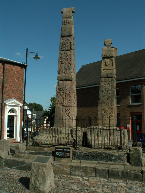
53°08′05″N 2°38′14″W / 53.1346°N 2.6371°WBronze Age 22593 A sand and turf round barrow 17m in diameter and 1.5m high. Excavation revealed worked flints but no evidence of a burial. [124] Sandbach Crosses Standing stones Sandbach
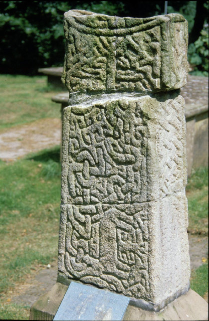
53°08′38″N 2°21′44″W / 53.1440°N 2.3621°WEarly Medieval/ Dark Age 23637 A pair of Saxon crosses decorated with carvings on all faces. They have been moved on several occasions and were erected in their present position in 1816. They are listed Grade I. [126] Sandbach cross fragments Stones Sandbach
53°08′37″N 2°21′40″W / 53.1435°N 2.3611°WEarly Medieval/ Dark Age 30396 Three fragments from the shaft of one or more Saxon crosses in St Mary's churchyard. [129] Seven Lows barrows Earthworks Delamere
53°11′55″N 2°39′18″W / 53.1987°N 2.6550°WBronze Age 23616
23617
23644
23650
23651Five barrows remaining out of an original total of seven. [130] Somerford Bridge barrow Earthwork Somerford
53°10′04″N 2°15′19″W / 53.1677°N 2.2553°WNeolithic 13499 A suspected long barrow, now a mound covered in oak trees. [133] Sponds Hill barrows Earthworks Lyme Handley
53°19′10″N 2°02′50″W / 53.3194°N 2.0471°WBronze Age 22571
22572Two round barrows, one on the summit of the hill, the other to the south. [135] St. Plegmund's well Holy well Mickle Trafford
53°13′31″N 2°49′03″W / 53.2253°N 2.8175°WEarly Medieval/ Dark Age 30374 A well, now dry, surrounded by stone slabs [138] Stamford Heath enclosure Shown on aerial photographs Christleton
53°11′50″N 2°48′31″W / 53.1972°N 2.8087°WRoman 25729 Photography in 1947 revealed a rectangular earthwork enclosure which may be a Roman camp. [140] Stamford Lodge Roman Camp Cropmarks Christleton
53°11′47″N 2°49′04″W / 53.1964°N 2.8179°WRoman 25730 Photography in 1947 revealed a rectangular earthwork enclosure which may be a Roman camp. [142] Sutton Hall cairn Earthworks Sutton, Macclesfield
53°14′20″N 2°06′50″W / 53.2388°N 2.1140°WBronze Age 22574 A round barrow 24m in diameter and up to 1.4m in height. When excavated in 1962 secondary cremations were found but no primary cremation. [144] Swettenham Hall barrow Earthworks Swettenham
53°11′50″N 2°16′48″W / 53.1971°N 2.2801°WBronze Age 23614 A probable round barrow which has been spread by ploughing [146] Tatton settlement, old hall and mill dam Earthworks Tatton Park
53°19′43″N 2°22′02″W / 53.3286°N 2.3671°WLate Neolithic, Saxon, and Medieval 30362 A former village occupied in the late Neolithic, Saxon and Medieval periods. Now deserted and only earthworks remain. The site includes the ground beneath Tatton Old Hall [148] Thieves Moss Roman road Site of road Delamere Forest
53°13′06″N 2°39′23″W / 53.2182°N 2.6563°WRoman CH30 The possible site of section of the Chester-Manchester Roman road. [156] Toot Hill barrow Mound Macclesfield Forest
53°14′43″N 2°02′38″W / 53.2454°N 2.0440°WBronze Age 23612 An oval barrow of earth and stones at the centre of which is a gritstone slab. [157] Tytherington barrow Earthworks Tytherington
53°16′16″N 2°07′51″W / 53.2712°N 2.1308°WBronze Age 22592 A round barrow, now in a housing development, which was found to contain a cremation and part of an urn. [159] Upton Heath Roman Camp Cropmark Upton Heath
53°13′12″N 2°52′28″W / 53.2201°N 2.8744°WRoman 25722 A rectangular round-cornered enclosure, possibly a Roman practice camp. [161] Upton Roman Camp Parchmarks Upton-by-Chester
53°13′11″N 2°52′13″W / 53.2196°N 2.8703°WRoman 25723 Aerial photography in August 1989 showed a rectangular enclosure; no signs of it can be seen on the ground. [163] Upton Roman camp (1) Parchmarks Upton-by-Chester
53°13′24″N 2°52′20″W / 53.2233°N 2.8721°WRoman 25724 Aerial photography in August 1990 showed a rectangular enclosure with a rounded entrance. [165] Upton Roman camp (2) Cropmarks Upton-by-Chester
53°13′00″N 2°52′10″W / 53.2168°N 2.8695°WRoman 25726 Aerial photography has shown a rectangular enclosure. Further investigations have revealed evidence of a ditch and sherds of Roman pottery. [166] West Park cross shafts Three standing stones West Park, Macclesfield
53°15′48″N 2°08′11″W / 53.2634°N 2.1365°WEarly Medieval/ Dark Age 25633 Three Saxon circular crosses with traces of ornamental sculpting, now mounted in a public park. [168] Whitley barrow Earthworks Lower Whitley
53°18′36″N 2°34′29″W / 53.3099°N 2.5747°WBronze Age 23615 A slightly oval round barrow [169] Wilderspool Roman site Excavation Wilderspool
53°22′30″N 2°35′14″W / 53.3750°N 2.5871°WRoman WG110 Excavations have shown parts of a walled town with evidence of industrial activity. [171] Winwick barrow Earthworks Highfield Lane, Winwick
53°26′03″N 2°34′58″W / 53.4342°N 2.5827°WBronze Age 22597 A round barrow, formerly part of a cemetery. Excavation in 1860 revealed a large urn containing human bones, a stone axe hammer and a bronze spear head. [174] Withington Hall barrow cemetery Earthworks Withington, Macclesfield
53°14′54″N 2°17′28″W / 53.2482°N 2.2911°WBronze Age 22585
22586Three round barrows, two of which have been excavated revealing evidence of cremations. [176] Woodhouse hillfort Stone and earth bank Frodsham
53°16′35″N 2°44′06″W / 53.2763°N 2.7350°WIron Age 25694 A promontory hillfort with steep slopes on the south and west sides and a stone and earth bank on the other sides. [181] Wybunbury church site Foundations Wybunbury
53°02′43″N 2°26′55″W / 53.0452°N 2.4486°WLate Saxon 32564 A church was present in the Domesday survey. The subsequent Medieval church of St Chads (other than the tower) has been demolished and the site is scheduled. [183] Yearn's Low barrow Earthworks Rainow
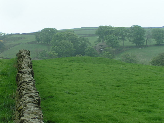
53°16′50″N 2°03′17″W / 53.2806°N 2.0548°WBronze Age 22567 A round barrow 19m in diameter in which Roman coins and other objects have been found. [185]  Blackrock Farm barrow
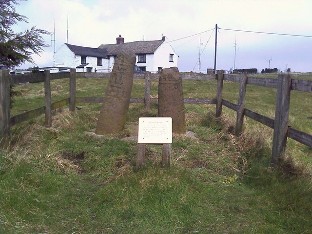
 The Bowstones
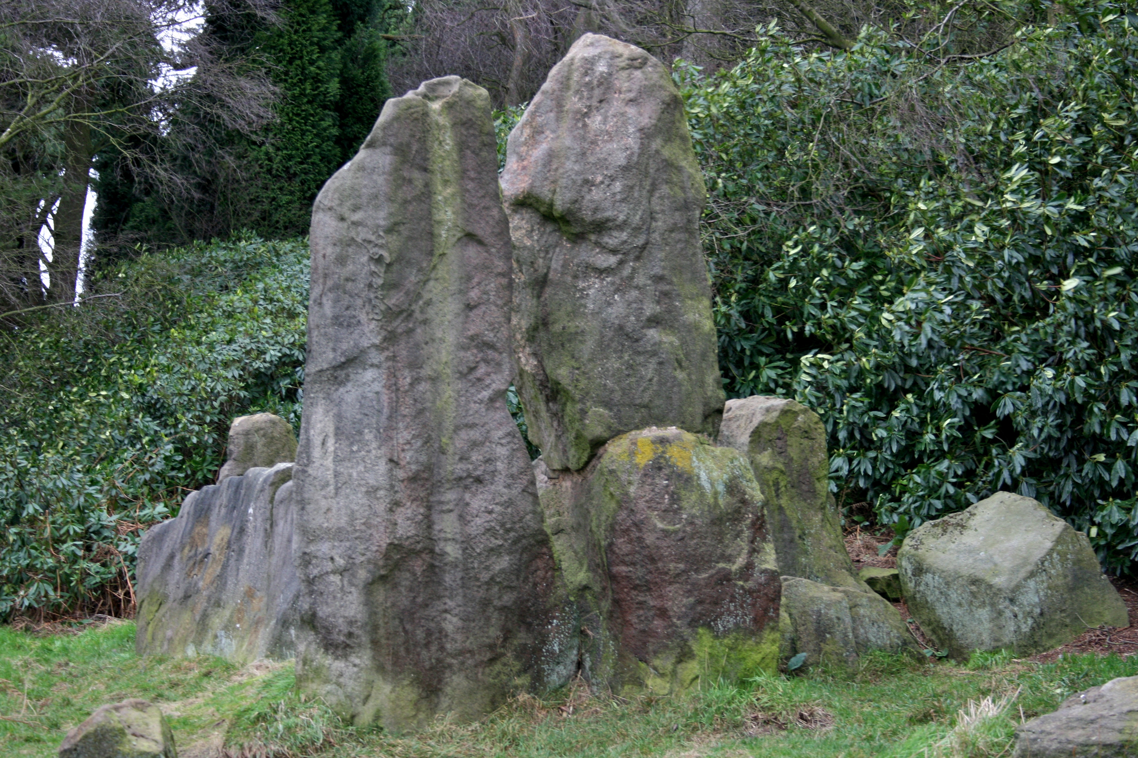
 The Bridestones
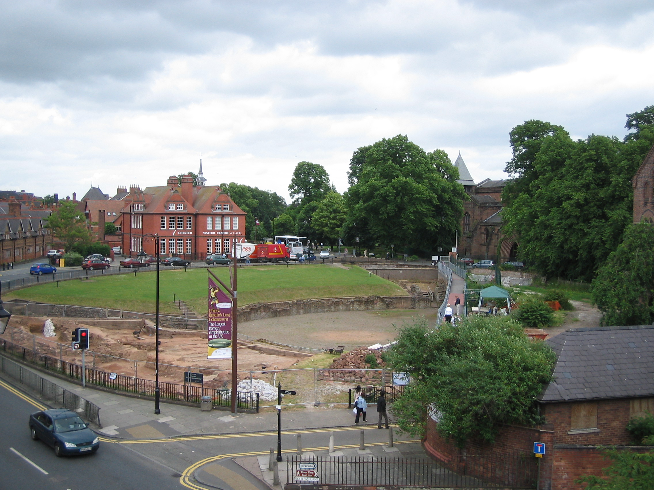
 Chester Roman amphitheatre
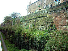 Chester City Walls
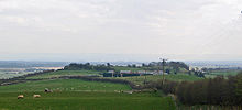 Eddisbury hill fort from the west
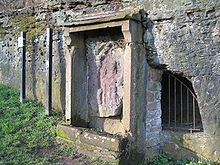 Minerva's shrine in Edgar's Field
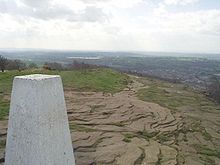 Helsby Hill
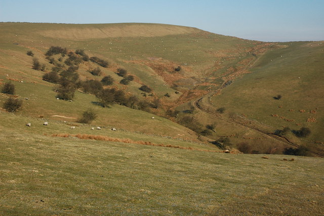
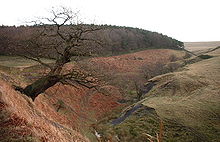 Knightslow Wood
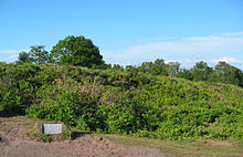 Maiden Castle rampart
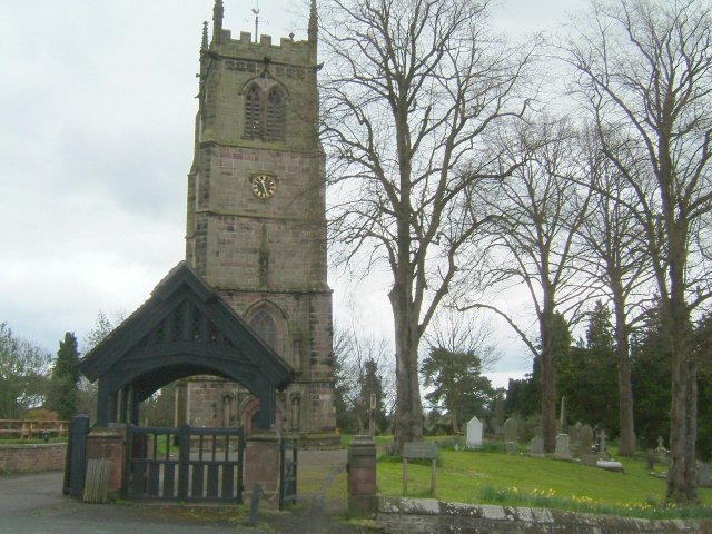
 Prestbury churchyard cross
 Sponds Hill
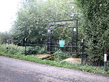 St. Plegmund's well
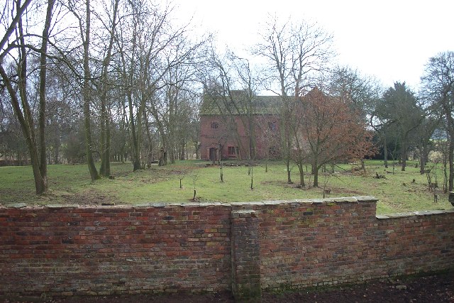
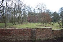 Grounds around Tatton Old Hall
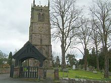 Grounds of St Chad's Church, Wybunbury
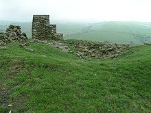 Barrow on Yearns Low
See also
- List of Scheduled Monuments in Cheshire (1066–1539)
- List of Scheduled Monuments in Cheshire (post-1539)
- Grade I listed buildings in Cheshire
Notes
- A SM No = Scheduled Monument Number
References
Pastscape and Images of England are published by English Heritage and Revealing Cheshire's Past is published by Cheshire County Council
- ^ Revealing Cheshire's Past, http://www.cheshire.gov.uk/Archaeology/RCP/RevealingCheshiresPast.htm, retrieved 7 February 2009
- ^ The Schedule of Monuments, English Heritage, http://www.english-heritage.org.uk/server/show/nav.1369, retrieved 7 February 2009
- ^ Revealing Cheshire's Past: Cultivation Marks at Abbey Green, http://rcp.cheshire.gov.uk/SingleResult.aspx?uid=MCH851, retrieved 18 January 2009
- ^ Pastscape: Baddiley, http://pastscape.english-heritage.org.uk/hob.aspx?hob_id=72830, retrieved 3 March 2009
- ^ Revealing Cheshire's Past: Medieval village remains 230m east of Baddiley Hall, http://rcp.cheshire.gov.uk/SingleResult.aspx?uid=MCH5944, retrieved 3 March 2009
- ^ Revealing Cheshire's Past: Mound SE of Bartomley, Wincle, Cheshire, http://rcp.cheshire.gov.uk/SingleResult.aspx?uid=MCH6946, retrieved 19 January 2009
- ^ Pastscape: Monument No. 76419, http://pastscape.english-heritage.org.uk/hob.aspx?hob_id=76419, retrieved 17 January 2009
- ^ Revealing Cheshire's Past: Bowl barrow 370m ESE of Bearhurst Farm, http://rcp.cheshire.gov.uk/SingleResult.aspx?uid=MCH6998, retrieved 17 January 2009
- ^ Pastscape: Beeston Castle, http://pastscape.english-heritage.org.uk/hob.aspx?hob_id=71073, retrieved 24 February 2009
- ^ Revealing Cheshire's Past: Beeston Castle Hillfort, http://rcp.cheshire.gov.uk/SingleResult.aspx?uid=MCH1415, retrieved 24 February 2009
- ^ Pastscape: Wallhill, http://pastscape.english-heritage.org.uk/hob.aspx?hob_id=76286, retrieved 17 January 2009
- ^ Revealing Cheshire's Past: Roman camp at Bent Farm, http://rcp.cheshire.gov.uk/SingleResult.aspx?uid=MCH5185, retrieved 17 January 2009
- ^ Pastscape: Monument No. 1046244, http://pastscape.english-heritage.org.uk/hob.aspx?hob_id=1046244, retrieved 17 January 2009
- ^ Revealing Cheshire's Past: Birch Hill, http://rcp.cheshire.gov.uk/SingleResult.aspx?uid=MCH8402, retrieved 17 January 2009
- ^ Pastscape: Monument No. 76413, http://pastscape.english-heritage.org.uk/hob.aspx?hob_id=76413, retrieved 19 January 2009
- ^ Revealing Cheshire's Past: Bronze Age round barrow south west of Birtles Hall, http://rcp.cheshire.gov.uk/SingleResult.aspx?uid=MCH6996, retrieved 19 January 2009
- ^ Pastscape: Monument No. 78131, http://pastscape.english-heritage.org.uk/hob.aspx?hob_id=78131, retrieved 18 January 2009
- ^ Revealing Cheshire's Past: Round Barrow W of Blackrock Farm, Ginclough, http://rcp.cheshire.gov.uk/SingleResult.aspx?uid=MCH7007, retrieved 18 January 2009
- ^ Pastscape: Monument No. 78137, http://pastscape.english-heritage.org.uk/hob.aspx?hob_id=78137, retrieved 17 January 2009
- ^ Revealing Cheshire's Past: Round Barrow South of Blue Boar Farm, http://rcp.cheshire.gov.uk/SingleResult.aspx?uid=MCH7499, retrieved 17 January 2009
- ^ Pastscape: The Bow Stones, http://pastscape.english-heritage.org.uk/hob.aspx?hob_id=78382, retrieved 24 January 2009
- ^ Revealing Cheshire's Past: Bowstones, http://rcp.cheshire.gov.uk/SingleResult.aspx?uid=MCH7128, retrieved 24 January 2009
- ^ Pastscape: Bradley Camp, http://pastscape.english-heritage.org.uk/hob.aspx?hob_id=71532, retrieved 17 January 2009
- ^ Revealing Cheshire's Past: Bradley promontory fort above Beechbrook 50m S Beechmill House, http://rcp.cheshire.gov.uk/SingleResult.aspx?uid=MCH8235, retrieved 23 January 2009
- ^ Pastscape: The Bridestones, http://pastscape.english-heritage.org.uk/hob.aspx?hob_id=78118, retrieved 5 January 2009
- ^ Revealing Cheshire's Past: The Bridestones Neolithic chambered long cairn, http://rcp.cheshire.gov.uk/SingleResult.aspx?uid=MCH5196, retrieved 21 January 2009
- ^ Revealing Cheshire's Past: Round Barrow 450m East of Brink Farm, http://rcp.cheshire.gov.uk/SingleResult.aspx?uid=MCH6990, retrieved 18 January 2009
- ^ Pastscape: The Bullstones, http://pastscape.english-heritage.org.uk/hob.aspx?hob_id=78022, retrieved 24 January 2009
- ^ Revealing Cheshire's Past: The Bullstones, http://rcp.cheshire.gov.uk/SingleResult.aspx?uid=MCH7138, retrieved 24 January 2009
- ^ Pastscape: Monument No. 67150, http://pastscape.english-heritage.org.uk/hob.aspx?hob_id=67150, retrieved 6 January 2009
- ^ Revealing Cheshire's Past: Promontory fort on Burton Point 550m SW of Burton Point Farm, http://rcp.cheshire.gov.uk/SingleResult.aspx?uid=MCH6214, retrieved 23 January 2009
- ^ Revealing Cheshire's Past: Burton Point, http://rcp.cheshire.gov.uk/SingleResult.aspx?uid=MCH6211, retrieved 23 January 2009
- ^ Pastscape: Monument No. 76436, http://pastscape.english-heritage.org.uk/hob.aspx?hob_id=76436, retrieved 19 January 2009
- ^ Revealing Cheshire's Past: Round Barrow SE of Capesthorne Hall, http://rcp.cheshire.gov.uk/SingleResult.aspx?uid=MCH6994, retrieved 19 January 2009
- ^ Pastscape: Monument No. 1043579, English Heritage, http://pastscape.english-heritage.org.uk/hob.aspx?hob_id=1043579, retrieved 19 January 2009
- ^ Revealing Cheshire's Past: Bowl barrow 200m NE of Capesthorne Hall, http://rcp.cheshire.gov.uk/SingleResult.aspx?uid=MCH6986, retrieved 19 January 2009
- ^ Pastscape: Monument No. 1043363, http://pastscape.english-heritage.org.uk/hob.aspx?hob_id=1043363, retrieved 19 January 2009
- ^ Revealing Cheshire's Past: Bowl Barrow in Carden Park, http://rcp.cheshire.gov.uk/SingleResult.aspx?uid=MCH1433, retrieved 19 January 2009
- ^ Pastscape: Monument No. 78169, http://pastscape.english-heritage.org.uk/hob.aspx?hob_id=78169, retrieved 19 January 2009
- ^ Revealing Cheshire's Past: Charles Head, http://rcp.cheshire.gov.uk/SingleResult.aspx?uid=MCH7054, retrieved 19 January 2009
- ^ Pastscape: Roman Amphitheatre, http://www.pastscape.org.uk/hob.aspx?hob_id=69224, retrieved 31 March 2009
- ^ Pastscape: Monument No. 69073, http://pastscape.english-heritage.org.uk/hob.aspx?hob_id=69073, retrieved 5 January 2009
- ^ Revealing Cheshire's Past: Chester City Walls, http://rcp.cheshire.gov.uk/SingleResult.aspx?uid=MCH746, retrieved 23 January 2009
- ^ Revealing Cheshire's Past: Chester City Walls - Northgate, http://rcp.cheshire.gov.uk/SingleResult.aspx?uid=MCH753, retrieved 23 January 2009
- ^ Pastscape: Cleulow Cross, http://pastscape.english-heritage.org.uk/hob.aspx?hob_id=78028, retrieved 24 January 2009
- ^ Revealing Cheshire's Past: Cleulow Cross, http://rcp.cheshire.gov.uk/SingleResult.aspx?uid=MCH7103, retrieved 24 January 2009
- ^ Revealing Cheshire's Past: Bowl barrow 120m NE of Rose Farm, http://rcp.cheshire.gov.uk/SingleResult.aspx?uid=MCH1426, retrieved 23 January 2009
- ^ Pastscape: Monument No. 78390, http://pastscape.english-heritage.org.uk/hob.aspx?hob_id=78390, retrieved 25 January 2009
- ^ Revealing Cheshire's Past: Cross base in the churchyard of St Mary's Church, http://rcp.cheshire.gov.uk/SingleResult.aspx?uid=MCH7154, retrieved 25 January 2009
- ^ Pastscape: Castle Ditch, http://pastscape.english-heritage.org.uk/hob.aspx?hob_id=71146, retrieved 17 January 2009
- ^ Revealing Cheshire's Past: Eddisbury Hillfort, http://rcp.cheshire.gov.uk/SingleResult.aspx?uid=MCH8266, retrieved 17 January 2009
- ^ Revealing Cheshire's Past: Burh at Castle Ditch, Eddisbury, http://rcp.cheshire.gov.uk/SingleResult.aspx?uid=MCH8444, retrieved 17 January 2009
- ^ Revealing Cheshire's Past: Castle Ditch, Eddisbury, http://rcp.cheshire.gov.uk/SingleResult.aspx?uid=MCH8268, retrieved 17 January 2009
- ^ Pastscape: Edgar's Cave, http://pastscape.english-heritage.org.uk/hob.aspx?hob_id=69101, retrieved 5 January 2009
- ^ Revealing Cheshire's Past: Roman quarry, Edgar's Cave and rock-cut figure of Minerva, Chester, http://rcp.cheshire.gov.uk/SingleResult.aspx?uid=MCH1712, retrieved 23 January 2009
- ^ Images of England: Roman Shrine to Minerva, http://www.imagesofengland.org.uk/details/default.aspx?id=469762, retrieved 3 March 2009
- ^ Pastscape: Monument No. 1046247, http://pastscape.english-heritage.org.uk/hob.aspx?hob_id=1046247, retrieved 18 January 2009
- ^ Revealing Cheshire's Past: Elm Bank Roman Camp, http://rcp.cheshire.gov.uk/SingleResult.aspx?uid=MCH1694, retrieved 18 January 2009
- ^ Pastscape: Engine Vein copper mine, http://www.pastscape.org.uk/hob.aspx?hob_id=76343, retrieved 31 March 2009
- ^ Revealing Cheshire's Past: Engine Vein copper mine, http://rcp.cheshire.gov.uk/SingleResult.aspx?uid=MCH6537, retrieved 31 March 2009
- ^ Pastscape: Gallowsclough Cob, http://pastscape.english-heritage.org.uk/hob.aspx?hob_id=71597, retrieved 17 January 2009
- ^ Revealing Cheshire's Past: Gallowsclough Cob Round Barrow, http://rcp.cheshire.gov.uk/SingleResult.aspx?uid=MCH8353, retrieved 17 January 2009
- ^ Pastscape: Monument No. 1043535, http://www.pastscape.org.uk/hob.aspx?hob_id=1043535, retrieved 31 March 2009
- ^ Revealing Cheshire's Past: Standing stone at Ginclough, http://rcp.cheshire.gov.uk/SingleResult.aspx?uid=MCH7524, retrieved 31 March 2009
- ^ Pastscape: Monument No. 1008702, http://www.pastscape.org.uk/hob.aspx?hob_id=1008702, retrieved March 30 2009
- ^ Revealing Cheshire's Past: Roman Middlewich - Harbutt's Field, http://rcp.cheshire.gov.uk/SingleResult.aspx?uid=MCH5166, retrieved March 30 2009
- ^ Pastscape: Helsby Hill Camp, http://pastscape.english-heritage.org.uk/hob.aspx?hob_id=69518, retrieved 16 January 2009
- ^ Revealing Cheshire's Past: Promontory fort on Helsby Hill 250m NW of Harmers Lake Farm, http://rcp.cheshire.gov.uk/SingleResult.aspx?uid=MCH8237, retrieved 23 January 2009
- ^ Pastscape: Heronbridge, http://pastscape.english-heritage.org.uk/hob.aspx?hob_id=69293, retrieved 6 January 2009
- ^ Revealing Cheshire's Past: Heronbridge Roman Site, http://rcp.cheshire.gov.uk/SingleResult.aspx?uid=MCH926, retrieved 17 January 2009
- ^ Revealing Cheshire's Past: Heronbridge Roman Site, http://rcp.cheshire.gov.uk/SingleResult.aspx?uid=MCH10820, retrieved 17 January 2009
- ^ Revealing Cheshire's Past: Heronbridge Roman Site, http://rcp.cheshire.gov.uk/SingleResult.aspx?uid=MCH982, retrieved 17 January 2009
- ^ Revealing Cheshire's Past: Heronbridge Roman Site, http://rcp.cheshire.gov.uk/SingleResult.aspx?uid=MCH158, retrieved 17 January 2009
- ^ Revealing Cheshire's Past: Heronbridge Roman Site, http://rcp.cheshire.gov.uk/SingleResult.aspx?uid=MCH10818, retrieved 17 January 2009
- ^ Revealing Cheshire's Past: Heronbridge, http://rcp.cheshire.gov.uk/SingleResult.aspx?uid=MCH10868, retrieved 17 January 2009
- ^ Revealing Cheshire's Past: Heronbridge Roman Site, http://rcp.cheshire.gov.uk/SingleResult.aspx?uid=MCH993, retrieved 17 January 2009
- ^ Revealing Cheshire's Past: Heronbridge Roman Site, http://rcp.cheshire.gov.uk/SingleResult.aspx?uid=MCH874, retrieved 17 January 2009
- ^ Revealing Cheshire's Past: Heronbridge Roman Site, http://rcp.cheshire.gov.uk/SingleResult.aspx?uid=MCH1266, retrieved 17 January 2009
- ^ Pastscape: Monument No. 71228, http://pastscape.english-heritage.org.uk/hob.aspx?hob_id=71228, retrieved 19 January 2009
- ^ Revealing Cheshire's Past: High Billinge Bowl Barrow, http://rcp.cheshire.gov.uk/SingleResult.aspx?uid=MCH8127, retrieved 19 January 2009
- ^ Pastscape: Monument No. 1095456, http://pastscape.english-heritage.org.uk/hob.aspx?hob_id=1095456, retrieved 17 January 2009
- ^ Revealing Cheshire's Past: Part of a Roman Camp at Hoole 200m south of Hoole Hall, http://rcp.cheshire.gov.uk/SingleResult.aspx?uid=MCH1706, retrieved 23 January 2009
- ^ Pastscape: Roman Fortlet at Ince, http://pastscape.english-heritage.org.uk/hob.aspx?hob_id=1355575, retrieved 18 January 2009
- ^ Revealing Cheshire's Past: Roman Fortlet, Ince, http://rcp.cheshire.gov.uk/SingleResult.aspx?uid=MCH6229, retrieved 18 January 2009
- ^ Pastscape: Monument No. 74825, http://pastscape.english-heritage.org.uk/hob.aspx?hob_id=74825, retrieved 17 January 2009
- ^ Revealing Cheshire's Past: Jodrell Bank Barrow Cemetery, http://rcp.cheshire.gov.uk/SingleResult.aspx?uid=MCH5066, retrieved 23 January 2009
- ^ Revealing Cheshire's Past: Jodrell Bank Barrow Cemetery, http://rcp.cheshire.gov.uk/SingleResult.aspx?uid=MCH5068, retrieved 23 January 2009
- ^ Revealing Cheshire's Past: Jodrell Bank Barrow Cemetery, http://rcp.cheshire.gov.uk/SingleResult.aspx?uid=MCH5070, retrieved 23 January 2009
- ^ Revealing Cheshire's Past: Jodrell Bank Barrow Cemetery, http://rcp.cheshire.gov.uk/SingleResult.aspx?uid=MCH5072, retrieved 23 January 2009
- ^ Pastscape: Kelsborrow Castle, http://pastscape.english-heritage.org.uk/hob.aspx?hob_id=71310, retrieved 18 January 2009
- ^ Revealing Cheshire's Past: Kelsborrow promontory fort, http://rcp.cheshire.gov.uk/SingleResult.aspx?uid=MCH8384, retrieved 18 January 2009
- ^ Pastscape: Monument No. 78402, http://pastscape.english-heritage.org.uk/hob.aspx?hob_id=78402, retrieved 19 January 2009
- ^ Revealing Cheshire's Past: Bowl barrow west of path in Knightslow wood, http://rcp.cheshire.gov.uk/SingleResult.aspx?uid=MCH7134, retrieved 19 January 2009
- ^ Revealing Cheshire's Past: Bowl barrow east of path in Knightslow wood, http://rcp.cheshire.gov.uk/SingleResult.aspx?uid=MCH7133, retrieved 19 January 2009
- ^ Revealing Cheshire's Past: Eastern bowl barrow at Knights Low, http://rcp.cheshire.gov.uk/SingleResult.aspx?uid=MCH7057, retrieved 19 January 2009
- ^ Revealing Cheshire's Past: Western bowl barrow at Knights Low, http://rcp.cheshire.gov.uk/SingleResult.aspx?uid=MCH7000, retrieved 18 January 2009
- ^ Pastscape: Monument No. 78178, http://pastscape.english-heritage.org.uk/hob.aspx?hob_id=78178, retrieved 17 January 2009
- ^ Revealing Cheshire's Past: Bowl barrow 60m N of junction of London Rd and Bonis Hall Lane, http://rcp.cheshire.gov.uk/SingleResult.aspx?uid=MCH6973, retrieved 17 January 2009
- ^ Pastscape: Monument No. 873503, http://pastscape.english-heritage.org.uk/hob.aspx?hob_id=873503, retrieved 19 January 2009
- ^ Revealing Cheshire's Past: Bowl barrow 140m east of Long Lane, http://rcp.cheshire.gov.uk/SingleResult.aspx?uid=MCH5674, retrieved 19 January 2009
- ^ Pastscape: Monument No. 71636, http://www.pastscape.org.uk/hob.aspx?hob_id=71636, retrieved 31 March 2009
- ^ Revealing Cheshire's Past: Field system 200m SE of Longley Cottage, http://rcp.cheshire.gov.uk/SingleResult.aspx?uid=MCH1709, retrieved 31 March 2009
- ^ Pastscape: Maiden Castle, http://pastscape.english-heritage.org.uk/hob.aspx?hob_id=68844, retrieved 5 January 2009
- ^ Revealing Cheshire's Past: Maiden Castle promontory fort on Bickerton Hill 700m W Hill Farm, http://rcp.cheshire.gov.uk/SingleResult.aspx?uid=MCH5717, retrieved 23 January 2009
- ^ Pastscape: Monument No. 68705, http://pastscape.english-heritage.org.uk/hob.aspx?hob_id=68705, retrieved 19 January 2009
- ^ Revealing Cheshire's Past: Bowl barrow 250m SSE of Meadows Farm, http://rcp.cheshire.gov.uk/SingleResult.aspx?uid=MCH1431, retrieved 19 January 2009
- ^ Pastscape: Monument No. 72865, http://pastscape.english-heritage.org.uk/hob.aspx?hob_id=72865, retrieved 19 January 2009
- ^ Revealing Cheshire's Past: Bowl barrow 160m NE of Moultonbank Farm, http://rcp.cheshire.gov.uk/SingleResult.aspx?uid=MCH8228, retrieved 19 January 2009
- ^ Pastscape: The Murder Stone, http://www.pastscape.org.uk/hob.aspx?hob_id=78403, retrieved 30 March 2009
- ^ Revealing Cheshire's Past: The Murder Stone, http://rcp.cheshire.gov.uk/SingleResult.aspx?uid=MCH7153, retrieved 30 March 2009
- ^ Pastscape: Monument No. 78193, http://pastscape.english-heritage.org.uk/hob.aspx?hob_id=78193, retrieved 19 January 2009
- ^ Revealing Cheshire's Past: Nab Head Round Barrow, http://rcp.cheshire.gov.uk/SingleResult.aspx?uid=MCH6985, retrieved 19 January 2009
- ^ Revealing Cheshire's Past: Roman Road between Appleton and Stretton, http://rcp.cheshire.gov.uk/SingleResult.aspx?uid=MCH8795, retrieved 3 April 2009
- ^ Revealing Cheshire's Past: Roman Road between Appleton and Stretton, http://rcp.cheshire.gov.uk/SingleResult.aspx?uid=MCH8793, retrieved 4 April 2009
- ^ Pastscape: Oakmere Camp, http://pastscape.english-heritage.org.uk/hob.aspx?hob_id=71205, retrieved 17 January 2009
- ^ Revealing Cheshire's Past: Oakmere promontory fort, http://rcp.cheshire.gov.uk/SingleResult.aspx?uid=MCH8240, retrieved 17 January 2009
- ^ Pastscape: Monument No. 71085, http://pastscape.english-heritage.org.uk/hob.aspx?hob_id=71085, retrieved 17 January 2009
- ^ Revealing Cheshire's Past: Promontory fort east of Peckforton Mere, http://rcp.cheshire.gov.uk/SingleResult.aspx?uid=MCH5784, retrieved 17 January 2009
- ^ Pastscape: Monument No. 1302525, http://pastscape.english-heritage.org.uk/hob.aspx?hob_id=1302525, retrieved 17 January 2009
- ^ Revealing Cheshire's Past: Roman Camp on Fox Covert Lane 650m north-west of Picton Gorse, http://rcp.cheshire.gov.uk/SingleResult.aspx?uid=MCH1533, retrieved 23 January 2009
- ^ Revealing Cheshire's Past: Cross shaft in the churchyard of St Peter's Church, Prestbury, http://rcp.cheshire.gov.uk/SingleResult.aspx?uid=MCH6747, retrieved 24 January 2009
- ^ Pastscape: Monument No. 78163, http://pastscape.english-heritage.org.uk/hob.aspx?hob_id=78163, retrieved 17 January 2009
- ^ Revealing Cheshire's Past: Round cairn on Reed Hill, http://rcp.cheshire.gov.uk/SingleResult.aspx?uid=MCH7056, retrieved 23 January 2009
- ^ Pastscape: Robin Hoods Tump, http://pastscape.english-heritage.org.uk/hob.aspx?hob_id=71041, retrieved 17 January 2009
- ^ Revealing Cheshire's Past: Robin Hood's Tump bowl barrow, http://rcp.cheshire.gov.uk/SingleResult.aspx?uid=MCH5925, retrieved 17 January 2009
- ^ Pastscape: Sandbach Crosses, http://pastscape.english-heritage.org.uk/hob.aspx?hob_id=74749, retrieved 24 January 2009
- ^ Revealing Cheshire's Past: Sandbach Crosses, http://rcp.cheshire.gov.uk/SingleResult.aspx?uid=MCH5157, retrieved 24 January 2009
- ^ Images of England: Sandbach Crosses, http://www.imagesofengland.org.uk/details/default.aspx?id=56244, retrieved 3 March 2009
- ^ Revealing Cheshire's Past: Saxon cross fragments in St Mary's Churchyard, http://rcp.cheshire.gov.uk/SingleResult.aspx?uid=MCH5043, retrieved 24 January 2009
- ^ Pastscape: Seven Lows, http://pastscape.english-heritage.org.uk/hob.aspx?hob_id=71169, retrieved 18 January 2009
- ^ Revealing Cheshire's Past: Seven Lows, http://rcp.cheshire.gov.uk/SingleResult.aspx?uid=MCH7827, retrieved 18 January 2009
- ^ Revealing Cheshire's Past: Seven Lows, http://rcp.cheshire.gov.uk/SingleResult.aspx?uid=MCH8117, retrieved 18 January 2009
- ^ Pastscape: Monument No. 76295, http://pastscape.english-heritage.org.uk/hob.aspx?hob_id=76295, retrieved 5 January 2009
- ^ Revealing Cheshire's Past: Long barrow 300m SE of Somerford Bridge, http://rcp.cheshire.gov.uk/SingleResult.aspx?uid=MCH5199, retrieved 21 January 2009
- ^ Pastscape: Monument No. 78404, http://pastscape.english-heritage.org.uk/hob.aspx?hob_id=78404, retrieved 19 January 2009
- ^ Revealing Cheshire's Past: Bowl barrow on summit of Sponds Hill, http://rcp.cheshire.gov.uk/SingleResult.aspx?uid=MCH7009, retrieved 19 January 2009
- ^ Revealing Cheshire's Past: Bowl barrow 50m S. of summit of Sponds Hill, http://rcp.cheshire.gov.uk/SingleResult.aspx?uid=MCH7064, retrieved 24 January 2009
- ^ Pastscape: St. Plegmund's well, http://www.pastscape.org.uk/hob.aspx?hob_id=69574, retrieved 31 March 2009
- ^ Revealing Cheshire's Past: St. Plegmund's well, http://rcp.cheshire.gov.uk/SingleResult.aspx?uid=MCH1702, retrieved 31 March 2009
- ^ Pastscape: Monument No. 1083033, http://pastscape.english-heritage.org.uk/hob.aspx?hob_id=1083033, retrieved 17 January 2009
- ^ Revealing Cheshire's Past: Enclosure at Stamford Heath, http://rcp.cheshire.gov.uk/SingleResult.aspx?uid=MCH1628, retrieved 17 January 2009
- ^ Pastscape: Monument No. 873485, http://pastscape.english-heritage.org.uk/hob.aspx?hob_id=873485, retrieved 18 January 2009
- ^ Revealing Cheshire's Past: Roman Camp at Stamford Lodge, http://rcp.cheshire.gov.uk/SingleResult.aspx?uid=MCH1670, retrieved 18 January 2009
- ^ Pastscape: Monument No. 78293, http://pastscape.english-heritage.org.uk/hob.aspx?hob_id=78293, retrieved 17 January 2009
- ^ Revealing Cheshire's Past: Round cairn 200m SW of Sutton Hall, http://rcp.cheshire.gov.uk/SingleResult.aspx?uid=MCH5190, retrieved 17 January 2009
- ^ Pastscape: Monument No. 76202, http://www.pastscape.org.uk/hob.aspx?hob_id=76202, retrieved 30 March 2009
- ^ Revealing Cheshire's Past: Bowl barrow 450m ENE of Swettenham Hall, http://rcp.cheshire.gov.uk/SingleResult.aspx?uid=MCH6992, retrieved 30 March 2009
- ^ Pastscape: Tatton, http://pastscape.english-heritage.org.uk/hob.aspx?hob_id=74924, retrieved 5 January 2009
- ^ Revealing Cheshire's Past: Tatton Old Hall Deserted Village, http://rcp.cheshire.gov.uk/SingleResult.aspx?uid=MCH6918, retrieved 19 January 2009
- ^ Revealing Cheshire's Past: Tatton Old Hall, http://rcp.cheshire.gov.uk/SingleResult.aspx?uid=MCH6625, retrieved 21 January 2009
- ^ Revealing Cheshire's Past: Tatton Medieval Mill., http://rcp.cheshire.gov.uk/SingleResult.aspx?uid=MCH6297, retrieved 21 January 2009
- ^ Revealing Cheshire's Past: Neolithic settlement at Tatton Park, http://rcp.cheshire.gov.uk/SingleResult.aspx?uid=MCH6448, retrieved 21 January 2009
- ^ Revealing Cheshire's Past: Tatton medieval settlement, prehistoric settlement, Old hall and mill dam., http://rcp.cheshire.gov.uk/SingleResult.aspx?uid=MCH6700, retrieved 21 January 2009
- ^ Revealing Cheshire's Past: Tatton Old Hall Deserted Village, http://rcp.cheshire.gov.uk/SingleResult.aspx?uid=MCH6451, retrieved 21 January 2009
- ^ Revealing Cheshire's Past: Tatton Neolithic Settlement, http://rcp.cheshire.gov.uk/SingleResult.aspx?uid=MCH6449, retrieved 21 January 2009
- ^ Revealing Cheshire's Past: Roman Road, Thieves Moss;Delamere Forest, http://rcp.cheshire.gov.uk/SingleResult.aspx?uid=MCH8224, retrieved 6 February 2009
- ^ Pastscape: Monument No. 78249, http://pastscape.english-heritage.org.uk/hob.aspx?hob_id=78249, retrieved 17 January 2009
- ^ Revealing Cheshire's Past: Bowl barrow on Toot Hill, http://rcp.cheshire.gov.uk/SingleResult.aspx?uid=MCH7135, retrieved 23 January 2009
- ^ Pastscape: Monument No. 78310, http://pastscape.english-heritage.org.uk/hob.aspx?hob_id=78310, retrieved 19 January 2009
- ^ Revealing Cheshire's Past: Bowl barrow in Lavenham Close, Tytherington, http://rcp.cheshire.gov.uk/SingleResult.aspx?uid=MCH7010, retrieved 19 January 2009
- ^ Pastscape: Monument No. 931535, http://pastscape.english-heritage.org.uk/hob.aspx?hob_id=931535, retrieved 6 January 2009
- ^ Revealing Cheshire's Past: Roman camp at Upton Heath, beside the water tower N of Long Lane, http://rcp.cheshire.gov.uk/SingleResult.aspx?uid=MCH1687, retrieved 23 January 2009
- ^ Pastscape: Monument No. 69053, http://pastscape.english-heritage.org.uk/hob.aspx?hob_id=69053&search=all&criteria=upton%20Roman&p=1, retrieved 17 January 2009
- ^ Revealing Cheshire's Past: Roman camp at Upton, http://rcp.cheshire.gov.uk/SingleResult.aspx?uid=MCH1688, retrieved 17 January 2009
- ^ Revealing Cheshire's Past: Roman camp at Upton, 350m NE of the water tower N of Long Lane, http://rcp.cheshire.gov.uk/SingleResult.aspx?uid=MCH1689, retrieved 18 January 2009
- ^ Pastscape: Monument No. 69053, http://pastscape.english-heritage.org.uk/hob.aspx?hob_id=69053, retrieved 6 January 2009
- ^ Revealing Cheshire's Past: Roman camp 300m W of Upton Grange Farm, http://rcp.cheshire.gov.uk/SingleResult.aspx?uid=MCH1690, retrieved 23 January 2009
- ^ Revealing Cheshire's Past: Three early medieval cross shafts in West Park, http://rcp.cheshire.gov.uk/SingleResult.aspx?uid=MCH7149, retrieved 24 January 2009
- ^ Pastscape: Monument No. 873562, http://pastscape.english-heritage.org.uk/hob.aspx?hob_id=873562, retrieved 6 February 2009
- ^ Revealing Cheshire's Past: Bowl barrow 120m east of Village Lane, http://rcp.cheshire.gov.uk/SingleResult.aspx?uid=MCH8111, retrieved 6 February 2009
- ^ Pastscape: Wilderspool, http://pastscape.english-heritage.org.uk/hob.aspx?hob_id=73175, retrieved 17 January 2009
- ^ Revealing Cheshire's Past: Wilderspool Roman Site, http://rcp.cheshire.gov.uk/SingleResult.aspx?uid=MCH8610, retrieved 17 January 2009
- ^ Revealing Cheshire's Past: Wilderspool Roman Site-Brewery Site, http://rcp.cheshire.gov.uk/SingleResult.aspx?uid=MCH8689, retrieved 19 January 2009
- ^ Pastscape: Monument No. 73562, http://pastscape.english-heritage.org.uk/hob.aspx?hob_id=73562, retrieved 17 January 2009
- ^ Revealing Cheshire's Past: Bowl barrow west of Highfield Lane, http://rcp.cheshire.gov.uk/SingleResult.aspx?uid=MCH8786, retrieved 17 January 2009
- ^ Pastscape: Monument No. 76433, http://pastscape.english-heritage.org.uk/hob.aspx?hob_id=76433, retrieved 6 January 2009
- ^ Revealing Cheshire's Past: Withington Hall Barrow Cemetery, http://rcp.cheshire.gov.uk/SingleResult.aspx?uid=MCH7507, retrieved 23 January 2009
- ^ Revealing Cheshire's Past: Withington Hall Barrow Cemetery, http://rcp.cheshire.gov.uk/SingleResult.aspx?uid=MCH6987, retrieved 23 January 2009
- ^ Revealing Cheshire's Past: Withington Hall Barrow Cemetery, http://rcp.cheshire.gov.uk/SingleResult.aspx?uid=MCH7089, retrieved 23 January 2009
- ^ Revealing Cheshire's Past: Withington Hall Barrow Cemetery, http://rcp.cheshire.gov.uk/SingleResult.aspx?uid=MCH7073, retrieved 23 January 2009
- ^ Pastscape: Monument No. 71527, http://pastscape.english-heritage.org.uk/hob.aspx?hob_id=71527, retrieved 17 January 2009
- ^ Revealing Cheshire's Past: Woodhouse Hillfort, http://rcp.cheshire.gov.uk/SingleResult.aspx?uid=MCH8405, retrieved 17 January 2009
- ^ Pastscape: St Chads Church, http://pastscape.english-heritage.org.uk/hob.aspx?hob_id=74461, retrieved 3 February 2009
- ^ Revealing Cheshire's Past: Site of the Church of St Chad's, http://rcp.cheshire.gov.uk/SingleResult.aspx?uid=MCH5858, retrieved 3 February 2009
- ^ Pastscape: Yearn's Low, http://pastscape.english-heritage.org.uk/hob.aspx?hob_id=78134, retrieved 18 January 2009
- ^ Revealing Cheshire's Past: Yearn's Low Round Barrow, http://rcp.cheshire.gov.uk/SingleResult.aspx?uid=MCH6983, retrieved 18 January 2009
- ^ Revealing Cheshire's Past: Yearn's bowl barrow, http://rcp.cheshire.gov.uk/SingleResult.aspx?uid=MCH6982, retrieved 18 January 2009
Ceremonial county of Cheshire Cheshire Portal Unitary authorities Major settlements Alsager • Birchwood • Bollington • Chester • Congleton • Crewe • Ellesmere Port • Frodsham • Knutsford • Macclesfield • Middlewich • Nantwich • Neston • Northwich • Poynton • Runcorn • Sandbach • Warrington • Widnes • Wilmslow • Winsford
See also: List of civil parishes in CheshireRivers Topics History • MuseumsCategories:- Archaeological sites in England
- Archaeological sites in Cheshire
- History of Cheshire
- Buildings and structures in Cheshire
- Scheduled Ancient Monuments in Cheshire


Wikimedia Foundation. 2010.