- Oakmere Hall
-
Coordinates: 53°13′47″N 2°36′53″W / 53.2296°N 2.6148°W
Oakmere Hall 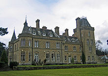 Oakmere Hall garden front
Location: Sandiway, Cheshire, England OS grid reference: SJ 590 704 Built: 1867 Built for: John & Thomas Johnson Architect: John Douglas Architectural style(s): French Gothic Listed Building – Grade II Designated: 6 January 1978 Reference #: 1313106 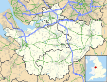
 Location in Cheshire
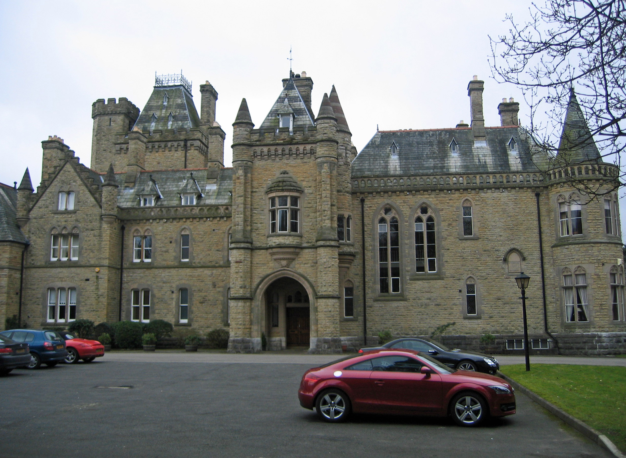
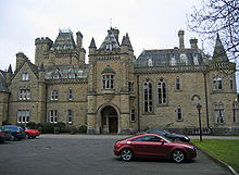 Entrance front
Oakmere Hall is a large house to the southwest of the villages of Cuddington and Sandiway, Cheshire, England, near the junction of the A49 and A556 roads. It has been designated by English Heritage as a Grade II listed building.[1] It was originally a private house and later became a rehabilitation centre and hospital. It has since been divided into residential apartments.
Contents
History
The house is dated 1867 and was designed by John Douglas.[1] It was the most ambitious of Douglas' early works and one of the largest houses he designed.[2] Douglas also designed the two entrance lodges.[3] It had been built for John & Thomas Johnson, merchants and chemical manufacturers of Runcorn.[4] However they lost all their ships in the blockade of Charleston in 1865 and subsequently became bankrupt.[5] The house was bought from them by John Higson, a Liverpool merchant, who became the house's first resident.[6][7] He was followed by John Hayes Higson and then by Captain William Higson, the head of Higson's Brewery in Liverpool.[4]
In 1943 the house was bought by the Miners’ Welfare Commission and it became a rehabilitation centre for injured miners. In 1951 it became part of the National Health Service, initially for rehabilitation for people injured in industrial accidents, and later for rehabilitation for all groups of people, including children.[8] It has been converted into flats.[9]
Architecture
Exterior
The house is built in freestone from Lancashire in French Gothic style with roofs of Westmorland slate.[4] It is in two storeys with a nine-bay west (garden) front. The entrance is behind a two-storey porte-cochère which has been finished as a gatehouse. This is flanked by octagonal pilasters which end as turrets and on the first floor there is an oriel window. At the right of the west (entrance) front is a circular projection with a tall conical roof and at the left end is an octagonal turret with a tall pyramidal roof. The east front includes a massive three-storey tower with an embattled parapet and a truncated pyramidal roof with a wrought iron balustrade. The tower has an additional octagonal turret.[1]
Interior
In the original ground-floor plan, the porte-cochère led into the entrance hall with the staircase hall on its right. To the right of these were two drawing rooms and in front of halls, overlooking the garden, was the dining room. To the left were the servants' quarters with a billiard room at the extreme left on the first floor. Considerable alterations were made in the 20th century to the interior of the house to adapt it for its later purposes.[2]
See also
- List of houses and associated buildings by John Douglas
References
- ^ a b c "Oakmere Hall", The National Heritage List for England (English Heritage), 2011, http://list.english-heritage.org.uk/resultsingle.aspx?uid=1313106, retrieved 7 May 2011
- ^ a b Hubbard, Edward (1991), The Work of John Douglas, London: The Victorian Society, pp. 50–54, ISBN 0-901657-16-6
- ^ King, Roger, John Douglas, Northwich: Northwich & District Historical Society, p. 6
- ^ a b c Bevan, R. M. (2000), Cuddington and Sandiway 2000, Cheshire Country Publishing, pp. 19–21, ISBN 978-0949001160
- ^ Starkey, H. F. (1990), Old Runcorn, Halton Borough Council, p. 154
- ^ Crewe Chronicle, 9 September 1893, p.6 in a report on the death of John Higson
- ^ Wright, Tom, Three Parishes, Chester: C. C. Publishing, p. 83, ISBN 0-949001-30-9
- ^ Oakmere Rehabilitation Centre & Hospital, National Health Service, http://www.coch.org/history/oakmerehospital.html#TOP, retrieved 2008-03-10
- ^ Hartwell, Claire; Hyde, Matthew; Hubbard, Edward; Pevsner, Nikolaus (2011) [1971], Cheshire, The Buildings of England, New Haven and London: Yale University Press, p. 582, ISBN 978-0-300-17043-6
Categories:- Country houses in Cheshire
- John Douglas buildings
- Houses completed in 1867
- Gothic Revival architecture in England
- Grade II listed buildings in Cheshire


Wikimedia Foundation. 2010.