Dutton Viaduct — Carries West Coast Main Line Crosses River Weaver Locale … Wikipedia
Dutton — may refer to: Places Dutton, Alabama, town in the United States Dutton, Cheshire, village in England Dutton, Lancashire, village in England Dutton, Montana, town in the United States Dutton/Dunwich, Ontario, town and municipality in Canada Dutton … Wikipedia
Dutton — ist der Name mehrerer Personen: Charles S. Dutton (* 1951), US amerikanischer Schauspieler Denis Dutton (1944–2010), Philosoph und Hochschullehrer Edwin Dutton (1890–1970), deutscher Fußballspieler George Dutton (1899–1977), US amerikanischer… … Deutsch Wikipedia
Dutton Park Nature Reserve — is an 18 hectare nature reserve managed by the Cheshire Wildlife Trust.[1] It lies below the Grade II listed Dutton viaduct and is looked after by the Cheshire Wildlife Trust in partnership with the Woodland Trust. The reserve’s many pools and… … Wikipedia
Cheshire West and Chester Council election, 2011 — 2008 ← 5 May 2011 → 2015 … Wikipedia
Dutton — This is an English locational name from either of the places so called in Cheshire or Lancashire. Dutton in Cheshire is first recorded as Duntune in the Domesday Book of 1086 and that in Lancashire as Dotona in 1102. They share the same… … Surnames reference
Cheshire Wildlife Trust — The Cheshire Wildlife Trust is a wildlife trust covering the county of Cheshire and parts of the counties of Greater Manchester and Merseyside, England. The trust manages 43 nature reserves totalling over 470 hectares, including:[1] Birch… … Wikipedia
Civil parishes in Cheshire — A map of Cheshire, showing the Boroughs : (1) Cheshire West and Chester; (2) Cheshire East; (3) Warrington; and (4) Halton. A civil parish is a subnational entity, forming the lowest unit of local government in England. There are 332 civil… … Wikipedia
Whitley, Cheshire — infobox UK place country = England official name= Whitley latitude= longitude= population = 540(est) shire district= Vale Royal shire county = Cheshire region= North West England constituency westminster= Tatton post town= Warrington postcode… … Wikipedia
Malpas, Cheshire — Coordinates: 53°01′08″N 2°45′50″W / 53.019°N 2.764°W / 53.019; 2.764 … Wikipedia
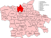 Map of civil parish of Dutton within the former borough of Vale Royal
 Media related to Dutton, Cheshire at Wikimedia Commons