Crewe by Farndon

Crewe by Farndon

Coordinates: 53°03′58″N 2°51′58″W / 53.066°N 2.866°W / 53.066; -2.866

Crewe by Farndon
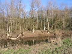
Crewe by Farndon - Bend in the River Dee.jpg
Bend in the River Dee
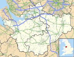
Crewe by Farndon is located in Cheshire
Crewe by Farndon

 Crewe by Farndon shown within Cheshire
Population 16 (2001)
OS grid reference SJ4252
Parish Crewe by Farndon
Unitary authority Cheshire West and Chester
Ceremonial county Cheshire
Region North West
Country England
Sovereign state United Kingdom
Post town CHESTER
Postcode district CH3
Dialling code 01829
Police Cheshire
Fire Cheshire
Ambulance North West
EU Parliament North West England
UK Parliament Eddisbury
List of places: UK • England • Cheshire

Crewe by Farndon is a civil parish in the Borough of Cheshire West and Chester and ceremonial county of Cheshire in England. It has a population of 16.[1]

See also

References

External links

Media related to Crewe by Farndon at Wikimedia Commons


Wikimedia Foundation. 2010.

Игры ⚽ Поможем написать реферат

Look at other dictionaries:

  • Crewe Hill — is a country house in the parish of Crewe by Farndon, to the southeast of the village of Farndon, Cheshire, England. It was enlarged from a farmhouse for the Barnston family of Churton Hall in the early 19th century.[1] In about 1890 it was… …   Wikipedia

  • Farndon, Cheshire — Coordinates: 53°05′07″N 2°52′41″W / 53.08519°N 2.8781°W / 53.08519; 2.8781 …   Wikipedia

  • Churton by Farndon — Coordinates: 53°05′38″N 2°52′05″W / 53.094°N 2.868°W / 53.094; 2.868 …   Wikipedia

  • St Chad's Church, Farndon — St Chad s Church, Farndon, from the northeast …   Wikipedia

  • St Michael and All Angels Church, Crewe Green — St Michael and All Angels Church, Crewe Green, from the north …   Wikipedia

  • St Barnabas' Church, Crewe — St Barnabas Church, Crewe …   Wikipedia

  • Civil parishes in Cheshire — A map of Cheshire, showing the Boroughs : (1) Cheshire West and Chester; (2) Cheshire East; (3) Warrington; and (4) Halton. A civil parish is a subnational entity, forming the lowest unit of local government in England. There are 332 civil… …   Wikipedia

  • List of civil parishes in Cheshire — This is a list of civil parishes in the ceremonial county of Cheshire, England.Chester (district)Most of the central Chester urban area is unparished.* Agden * Aldersey * Aldford * Ashton Hayes (Ashton before September 17, 2004) * Bache *… …   Wikipedia

  • Churton by Aldford — Coordinates: 53°06′07″N 2°52′19″W / 53.102°N 2.872°W / 53.102; 2.872 …   Wikipedia

  • Chester — For the larger local government district, see Cheshire West and Chester. For other uses, see Chester (disambiguation). Coordinates: 53°11′33″N 2°53′30″W / 53.192 …   Wikipedia

Share the article and excerpts

Direct link
Do a right-click on the link above
and select “Copy Link”