Claverton, Cheshire

Claverton, Cheshire

Coordinates: 53°10′08″N 2°53′20″W / 53.169°N 2.889°W / 53.169; -2.889

Claverton
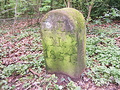
Claverton - Boundary Stone.jpg
Boundary stone
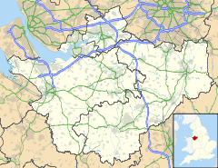
Claverton is located in Cheshire
Claverton

 Claverton shown within Cheshire
Population (2001)
OS grid reference SJ4063
Parish Claverton
Unitary authority Cheshire West and Chester
Ceremonial county Cheshire
Region North West
Country England
Sovereign state United Kingdom
Post town CHESTER
Postcode district CH4
Dialling code 01244
Police Cheshire
Fire Cheshire
Ambulance North West
EU Parliament North West England
UK Parliament City of Chester
List of places: UK • England • Cheshire

Claverton is a civil parish in the Borough of Cheshire West and Chester and ceremonial county of Cheshire in England. It has a population of 7.[1] The parish includes the site of The King's School.

References

External links

Media related to Claverton, Cheshire at Wikimedia Commons


Wikimedia Foundation. 2010.

Игры ⚽ Нужно решить контрольную?

Look at other dictionaries:

  • Claverton — may refer to: Claverton, Somerset Claverton, Cheshire This disambiguation page lists articles about distinct geographical locations with the same name. If an internal link led you here, you may wish to change …   Wikipedia

  • Civil parishes in Cheshire — A map of Cheshire, showing the Boroughs : (1) Cheshire West and Chester; (2) Cheshire East; (3) Warrington; and (4) Halton. A civil parish is a subnational entity, forming the lowest unit of local government in England. There are 332 civil… …   Wikipedia

  • List of Scheduled Monuments in Cheshire dated to before 1066 — Sandbach Crosses There are over 200 Scheduled Monuments in Cheshire, a county in North West England, which date from the Neolithic period to the middle of the 20th century. This list includes the Scheduled Monuments in Cheshire up to the year… …   Wikipedia

  • Malpas, Cheshire — Coordinates: 53°01′08″N 2°45′50″W / 53.019°N 2.764°W / 53.019; 2.764 …   Wikipedia

  • Farndon, Cheshire — Coordinates: 53°05′07″N 2°52′41″W / 53.08519°N 2.8781°W / 53.08519; 2.8781 …   Wikipedia

  • Mollington, Cheshire — Coordinates: 53°13′34″N 2°57′32″W / 53.226°N 2.959°W / 53.226; 2.959 …   Wikipedia

  • Moston, Cheshire West and Chester — Coordinates: 53°13′23″N 2°53′53″W / 53.223°N 2.898°W / 53.223; 2.898 …   Wikipedia

  • Overton, Cheshire — Coordinates: 53°01′43″N 2°47′09″W / 53.02851°N 2.78572°W / 53.02851; 2.78572 …   Wikipedia

  • No Man's Heath, Cheshire — Coordinates: 53°01′36″N 2°43′26″W / 53.0266°N 2.7238°W / 53.0266; 02.7238 …   Wikipedia

  • Ness, Cheshire — Coordinates: 53°16′30″N 3°02′46″W / 53.275°N 3.046°W / 53.275; 3.046 …   Wikipedia

Share the article and excerpts

Direct link
Do a right-click on the link above
and select “Copy Link”